


December 13, 2024 Friday Morning
Looking into next weekend for next Arctic blast, uncertainty about magnitude

Friday Headlines:
West coast of US from Bay Area of California into Oregon and Washington to see the atmospheric river from a 975 mb storm over the next 24-36 hours. Gusty winds, coastal heavy rain, and mountain snows are the typical impacts. Expect the active pattern across the Pacific Ocean storm track to continue in the next 7-10 days.
Watching Days 8-9 heading into the weekend before Christmas as the various models have a trough that ranges from weak and shallow to impressive. Hard to favor a particular outcome when the A.I. and conventional models disagree. I don’t know how to (yet) handle this inconsistency.
This is a bit lighter update, but I’ll return after the 12z models arrive later this afternoon.
Weather on Friday

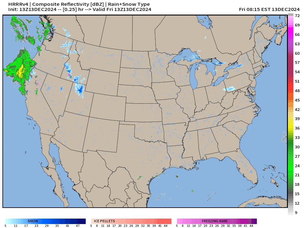
A storm system over the Plains has a warm front creeping northward across Kansas and Missouri this afternoon. Moisture running over the warm front will fall as frozen precipitation over Iowa.
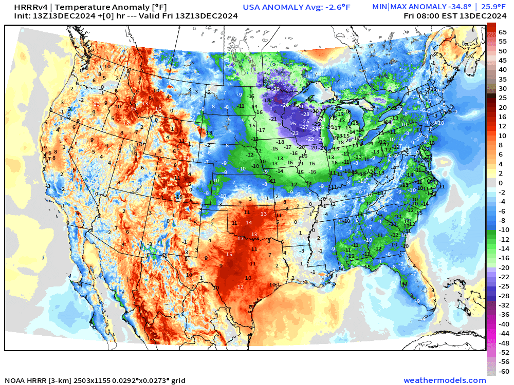
The Arctic air does moderate and erode across the Midwest and Great Lakes into the weekend. Temperature anomaly HRRR next 18-hours:
Keep reading with a 7-day free trial
Subscribe to Weather Trader to keep reading this post and get 7 days of free access to the full post archives.