


December 11, 2024 Wednesday Weather Update
Arctic air filters into Great Lakes with continued heavy snowfall

Quick late-evening update for subscribers.
Wednesday Headlines:
Arctic blast battled back by southerly (much warmer) flow out of Texas. However, bitterly cold temperatures up to 30°F below normal in the Midwest bleed eastward into the Great Lakes and Northeast with some moderation into Friday.
Notably chilly day in Florida on Thursday.
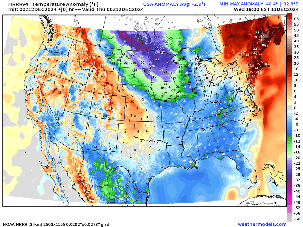
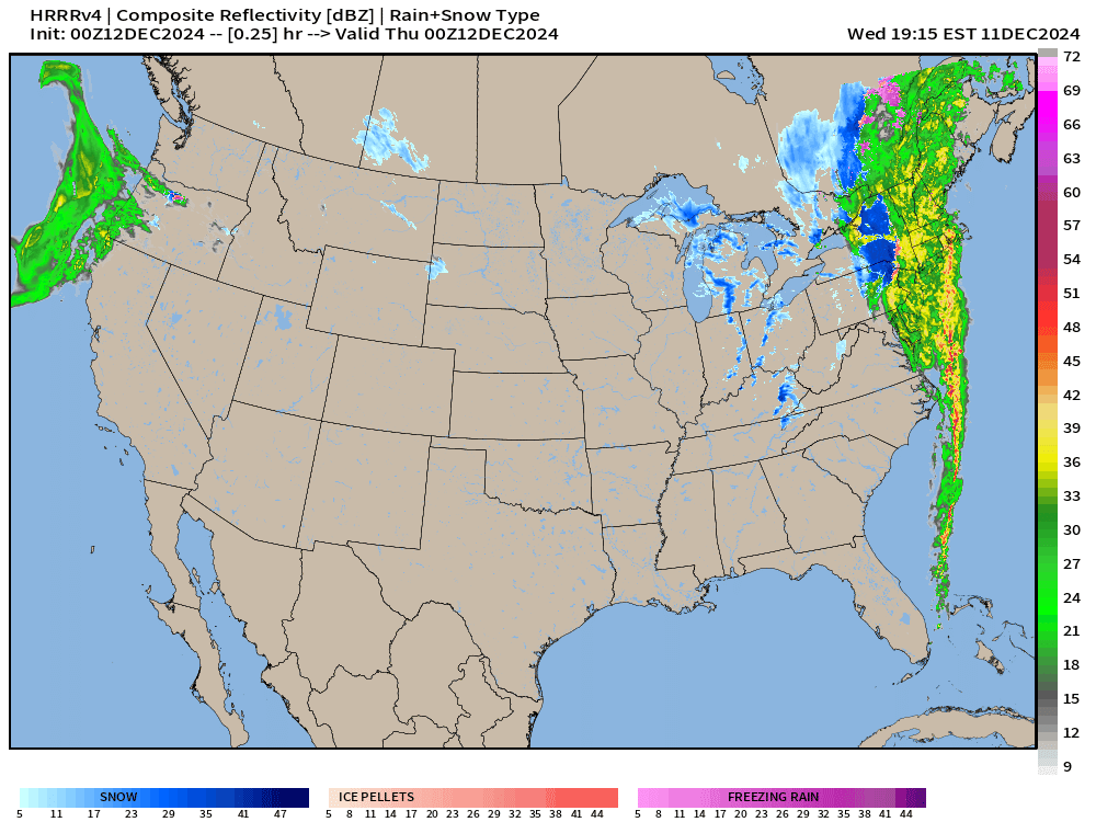
The extreme cold over the warmer Great Lakes = huge Lake Effect snow continues across Michigan, PA, and New York including Buffalo.
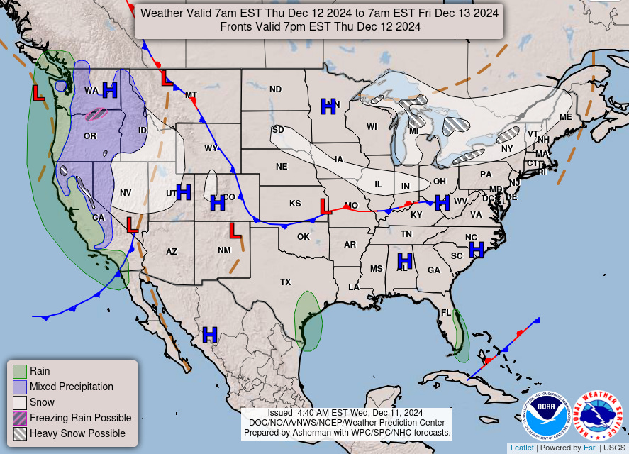
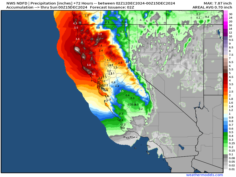
A series of storm systems move into the West Coast yielding substantial rain across Northern California, and plenty of mountain snowfall.

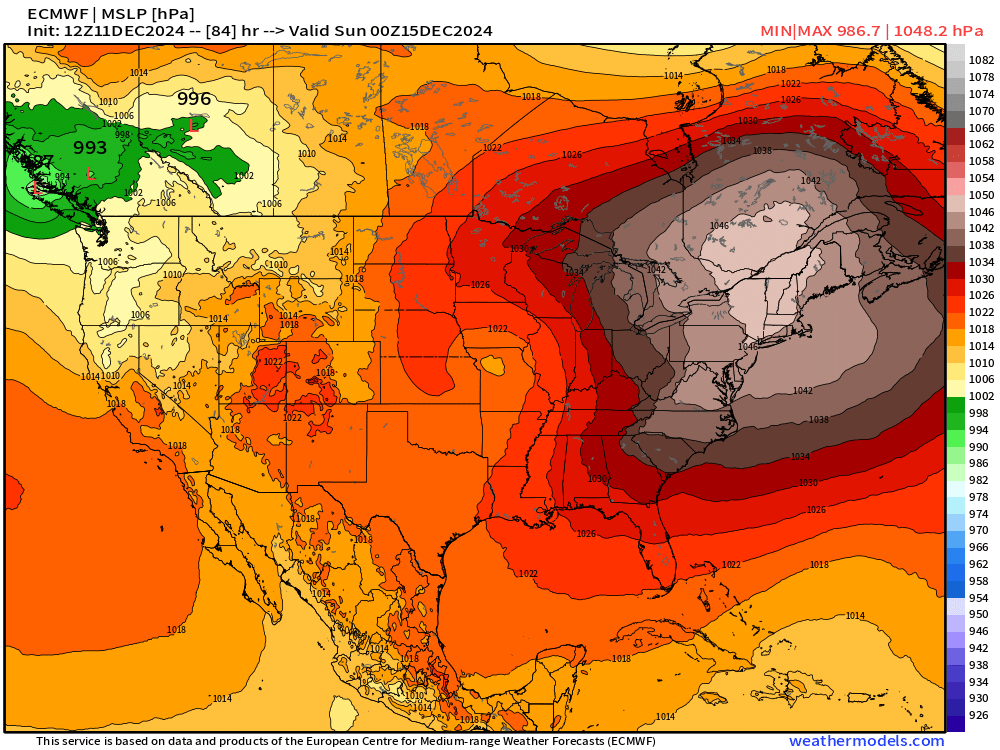
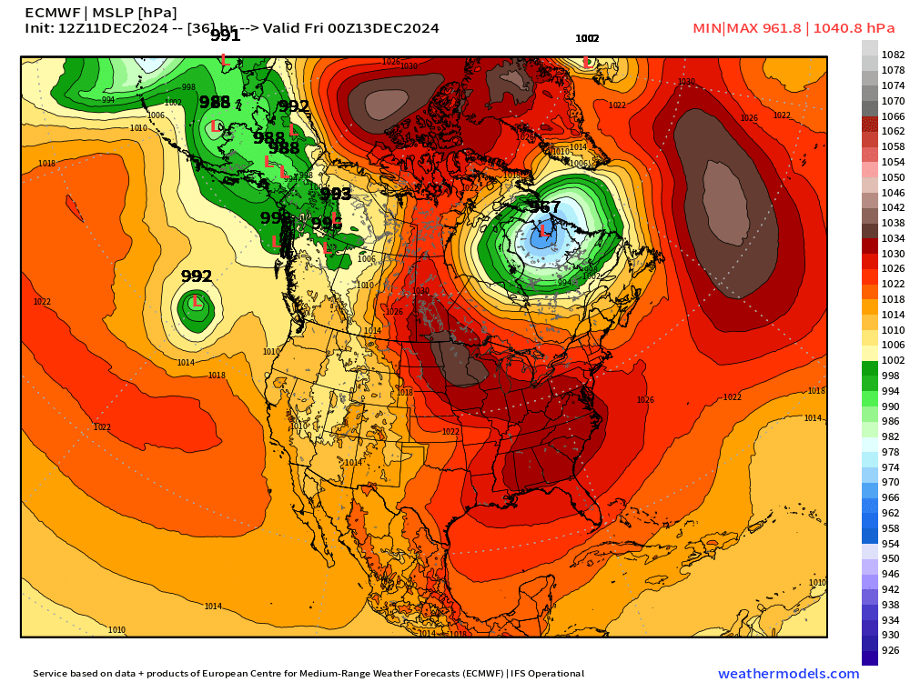
Bomb Cyclone to Bomb Anticyclone

The strong storm moving through New England tracks up into Quebec and deepens enough to be classified as a “bomb” or rapid intensifying extratropical cyclone.
Then, by late Saturday rapid pressure rises up to 1048 mb over Northeast. Whoa!
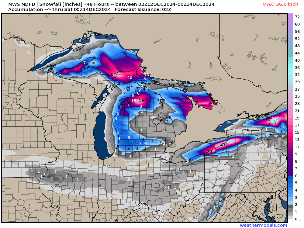
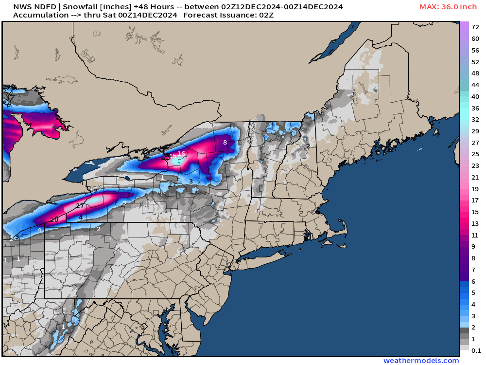
48-Hour Snowfall from NWS

LAKE EFFECT (!) measured in feet.

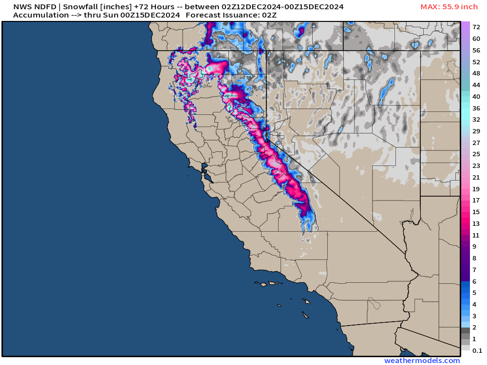
California rain and snow next 72-hours


Keep reading with a 7-day free trial
Subscribe to Weather Trader to keep reading this post and get 7 days of free access to the full post archives.