


December 10, 2024 Tuesday Weather Update
Powerful storm system across Great Lakes and Northeast

Tuesday Headlines
A frontal system is slowly developing across the eastern Great Lakes into the Northeast with boatloads of moisture in the warm sector. Later on Wednesday, the low pressure intensified and damaging wind gusts likely along Arctic front. Cooler temperature blast in behind the storm with yet more Lake Effect snow for the Great Lakes. Rainfall totals could be 2-3”+ across New England, and well over a foot of snow in Michigan by end of Wednesday.
The cold front has already plunged through South Texas, but the secondary shot in the Midwest is holding back the much colder air.

On Wednesday, the main event “polar front” dips into Arkansas and much colder air with snow showers arrive in the Great Lakes and Ohio Valley. Heavy rain in New England.

48-Hour Rainfall and Snowfall from NWS

2.5” is the popular number on the rainfall map for Philadelphia up into Maine. A moisture rich atmospheric river will deliver heavy rain for mid-December.
Snowfall along the Michigan, Superior, and Erie lakeshores could exceed a foot more more in lucky areas like NW Michigan and Buffalo!

Maximum Wind Gusts | NWS
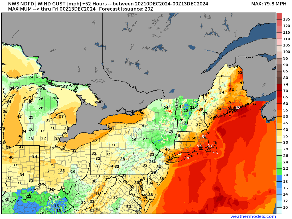
As I mentioned yesterday, the trough is quite intense but narrow — progressing quickly to the east. However, with the atmospheric river, a strong low-level jet with 700 and 850 mb winds > 70-90 knots will filter down to the surface with NWS expecting maximum wind gusts of > 55 mph including Boston, maybe NYC.

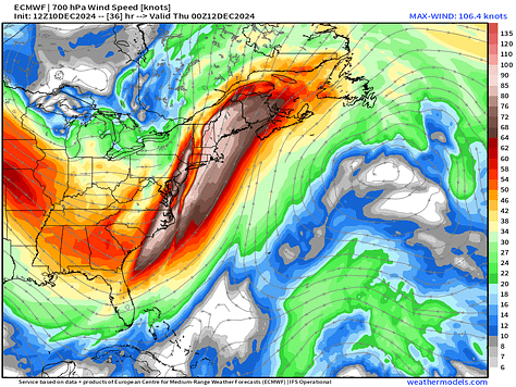

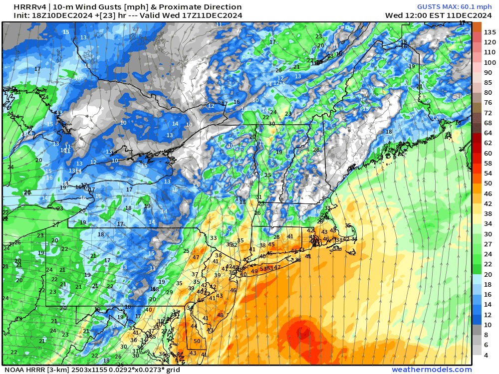
ECMWF +36 Hours Trough HRRR simulation of Wind Gusts is more robust with 60s (MPH) indicated late Wednesday.

Great Lakes HRRR depiction on Wednesday shows a winter wonderland with gusty winds > 35 mph and heavy lake effect snow. No thanks!
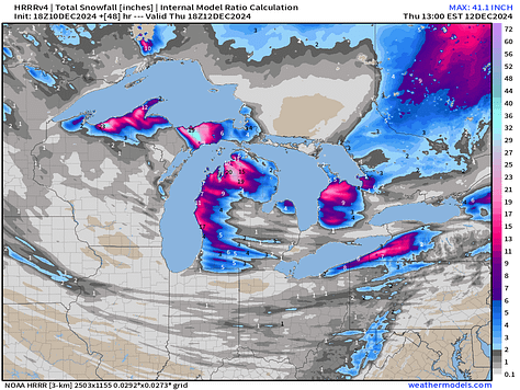


HRRR Great Lakes +36 Hours and Total Snowfall 48-hours


Keep reading with a 7-day free trial
Subscribe to Weather Trader to keep reading this post and get 7 days of free access to the full post archives.