


August 3, 2024 Saturday Tropical Storm Debby Update
Debby forecast to intensify into a hurricane before landfall in Florida

Welcome to new readers and subscribers!
Headline for Saturday evening
Tropical Storm Debby is over the VERY warm ocean waters of the Eastern Gulf of Mexico and heading northward into a favorable atmospheric environment for intensification. The only inhibitor is the large size of Debby — meaning the circulation. However, bursts of convection near the center can consolidate and spin around an eye in 12-24 hours. Rapid intensification is poorly forecast by our models, so we shall just watch and hope for the best up until landfall in Florida on Monday.
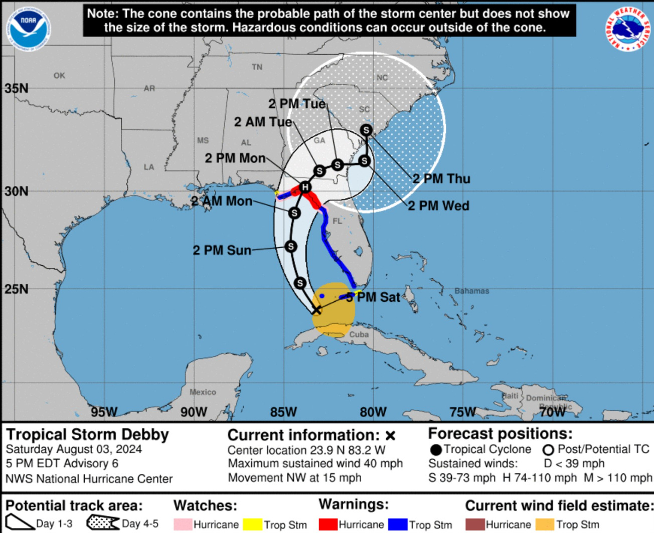
The track of Debby indicates landfall in the Big Bend of Florida just east of Tallahassee on Monday afternoon. Then the forward motion decreases to a crawl. By next Thursday, we could be looking at impacts to South Carolina — could be serious depending upon how much time Debby stays over the warm Gulf Stream waters to rejuvenate.
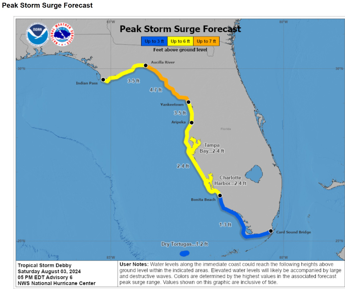
The intensity forecast is 65-knots or a minimal hurricane at landfall. There is uncertainty — and this could go higher if Debby intensifies faster or the pressure drops more than expected by our models. I’d go with 75-knots as the higher end of potential intensity in the 36-42 hours of development over the warm Gulf.
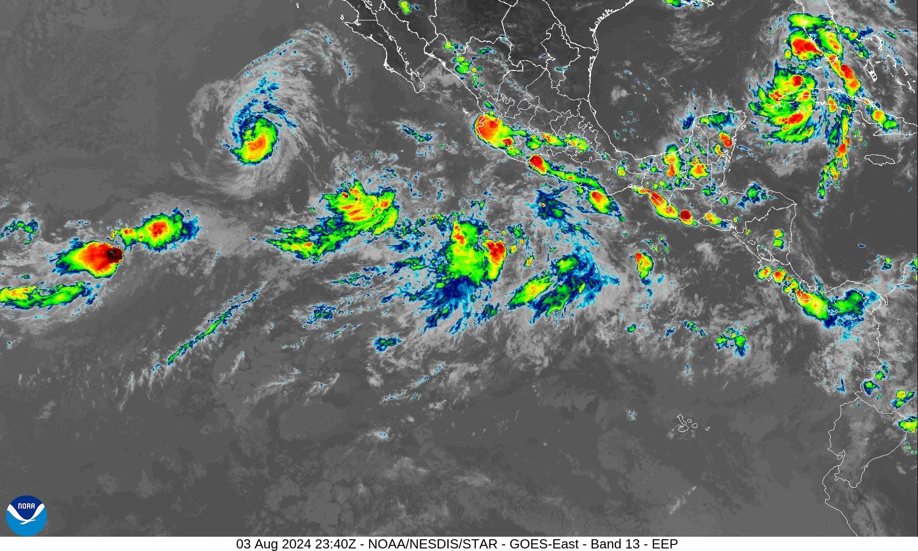
IR Satellite

The convection is bubbling up from Florida into Cuba with plenty of moisture to work with. The key for intensification will be consolidating a central core and ditching some of the outer bands.
HRRR 18z | 48 hour model simulation

The HRRR does a decent to good job with developing tropical storms in the Gulf of Mexico. This simulation does show an eyewall development just prior to landfall — with significant impacts to Leon County and Taylor County — including Tallahassee to Perry, Florida — my old haunts in the panhandle when I went to Florida State University.
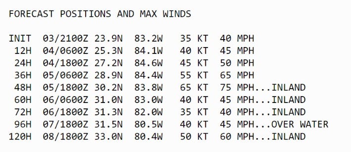
Storm Surge Impacts
The shape of the Florida coastline means the water can easily pile up as it is pushed onshore northward into the Big Bend. 4-7 feet causes issues!
NWS Rainfall | Next 72-hours
Note, this cuts off at Tuesday afternoon — and Debby will so be going for days upon days. However, this shows the potential for 6-12” of rainfall along/east of the center of Debby as it heads slowly inland.

HRRR Wind Gust potential
There will be gusts 65-90 mph around the “eye” of Debby if/when it develops.

Note that Tallahassee would be the major population center affected — but this is highly dependent upon the landfall location of Debby’s small core (eye).
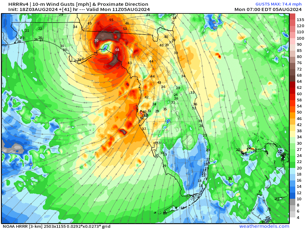
HRRR does have 6-hours of 60 to 73 mph wind gusts in Tallahassee on Monday morning — a bit faster landfall expected than NHC forecasts.

ECMWF 12z HRES Model Solution | Next 8-days
Where will Debby go next week?
Huge uncertainty remains with Debby’s interaction with an upper-level trough coming into the Eastern United States.
Worst impacts for wind / rain would require Debby to step out into the Atlantic Ocean over the warm Gulf Stream waters and reintensify. Some models have a big hurricane for the Carolinas — in that scenario.
Debby could also drift/meander over land before heading northward into the mid-Atlantic. That would limit the wind issues but continue to dump boatloads of rainfall.
NOAA WPC Rainfall | Next 7-Days

That rainfall will add up to 20-trillion gallons just across Florida, Georgia, and the Carolinas from Debby.
Storm Tracks from the EPS 12z ensembles
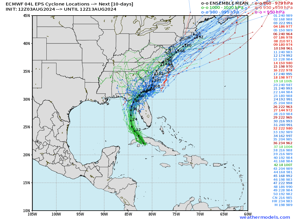
The spaghetti is quite tangled have 3-days! Sorry, we can’t really say much more about Debby’s second act into the middle of next week.
Eastern Pacific Hurricane Carlotta + Tropical Storm Daniel
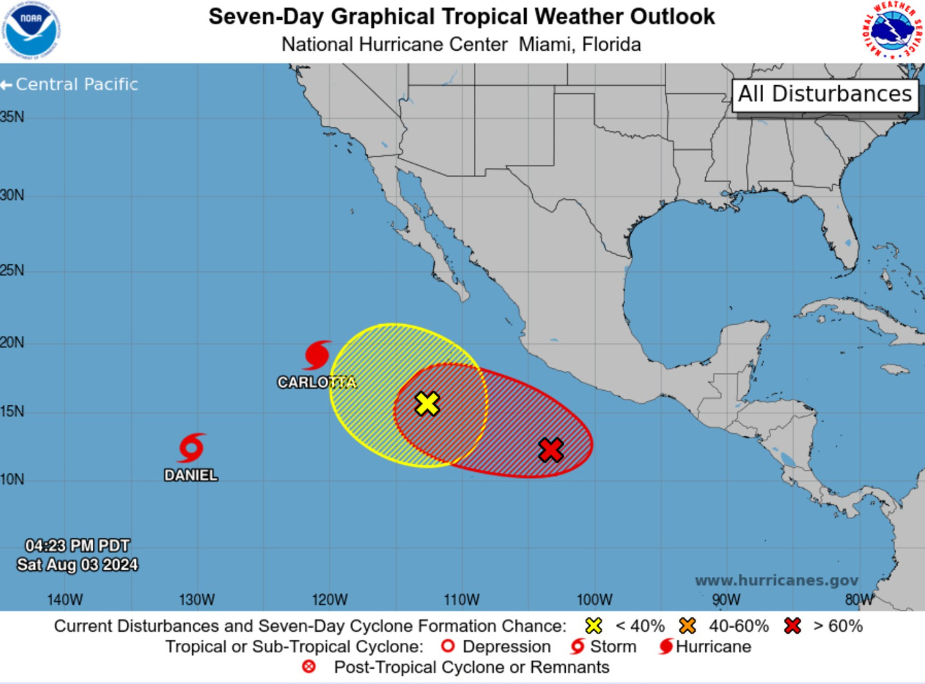
The Eastern Pacific crossed off another name: Daniel as a weak tropical storm way out at 130°W. Carlotta is spinning down as a Cat 1 hurricane.
The next system (Invest 96L) should become a much larger hurricane, and could have a dance partner!
Thank you to Subscribers and Supporters!
Maps sourced from weathermodels.com designed and innovated by yours truly! I actually create all of my content from scratch.