


August 29, 2024 Thursday Tropical Update
Atlantic development still uncertain

Thank you to Subscribers and Supporters into Year 2 of this newsletter. For my maps users, this is Year 8 of Weather Models, and 22 years since starting grad school at Florida State.
Atlantic Tropics in wait-and-see mode
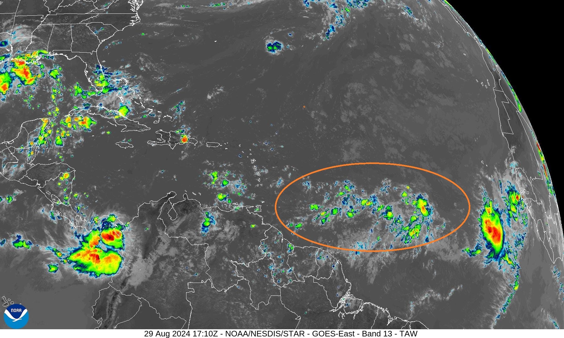
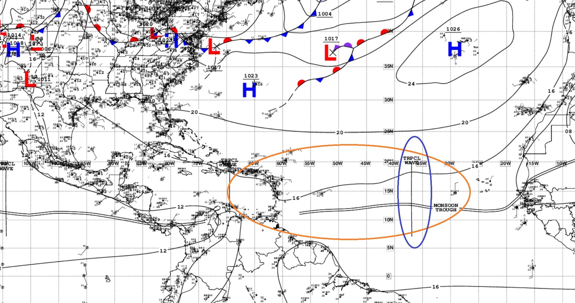
An area of storms/convection along the monsoon trough in the tropical Atlantic remains disorganized this afternoon. Another wave to the east looks more robust.
NHC has 40% chance of development in the next 7-days as the area of showers drifts westward. Models do not indicate a named storm prior to reaching the Lesser Antilles in 4-5 days (by September 3, next Tuesday).
So, we are in wait-and-see mode for signs that low pressure is forming and a circulation.
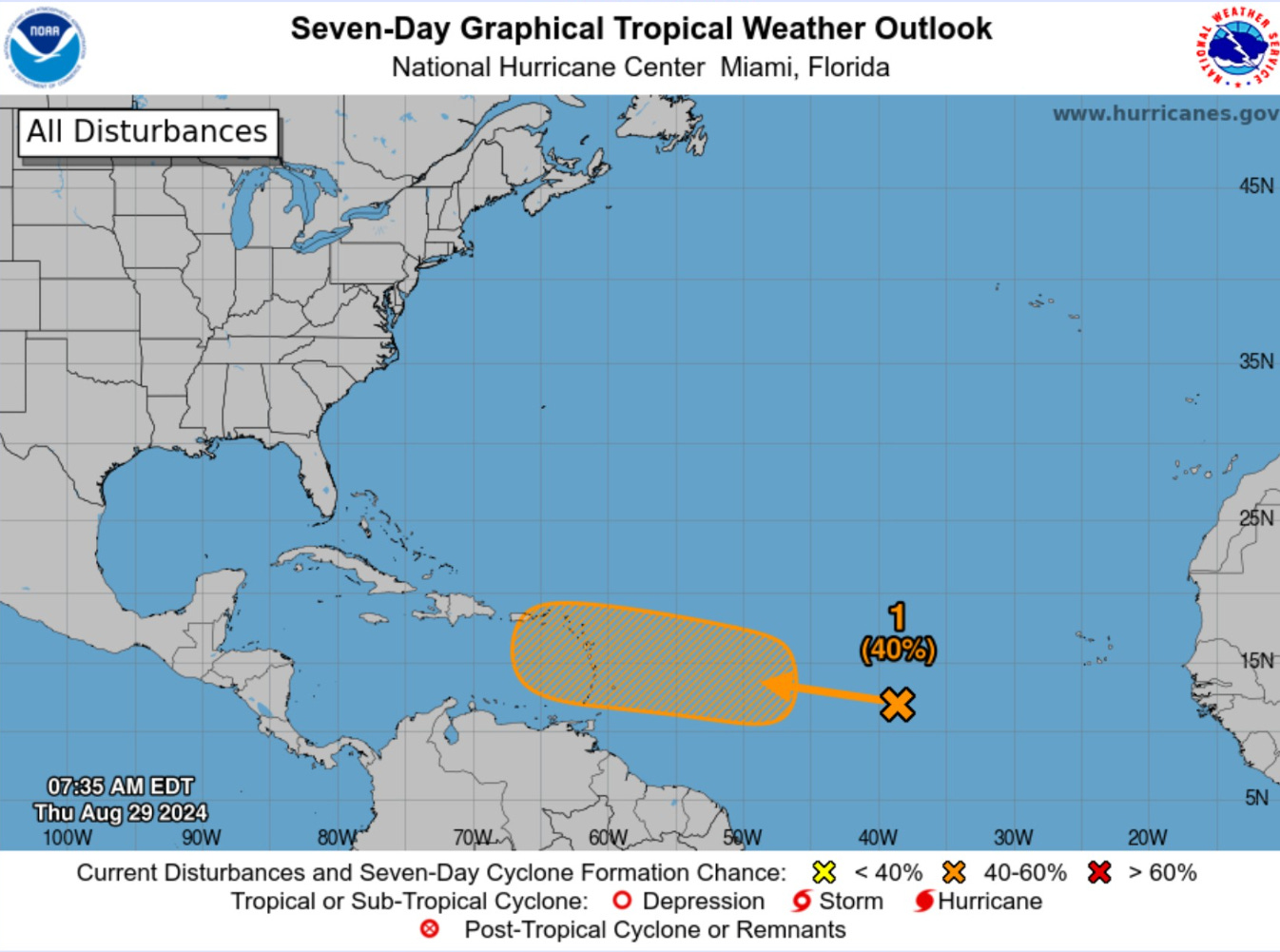
NHC analyzed the monsoon trough and one tropical wave in the central Tropical Atlantic.
Weird Things Happening in Africa

A powerful tropical wave doesn’t bother going into the Atlantic — instead heading north out of Mali into Algeria. Extreme rain over Mali along/north of the Niger River.
Maybe this resets the wave train to allow more southward moving disturbances to come off Africa at 10°N.
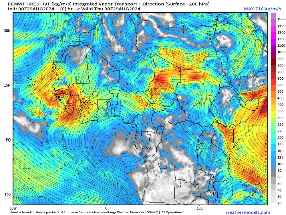
ECMWF HRES 10-Day IVT
Keep reading with a 7-day free trial
Subscribe to Weather Trader to keep reading this post and get 7 days of free access to the full post archives.