


August 26, 2024 Monday Tropical Update
Ensembles lighting up with major development

Thank you to Subscribers and Supporters into Year 2 of this newsletter.
Headlines for Monday
Major heat continues for eastern half of Lower 48 with 90s and 100s
Atlantic Tropics next opportunity for development: this weekend & early next week w/September 2-3 pegged as due date
Typhoon Shanshan intensifying on approach to southern Japan.
Atlantic Tropics remain quiet until September 2-3
I think we can finally sound an alarm that the Atlantic hurricane season will resume by September 2-3 east of the Lesser Antilles with an area of low pressure developing in the central MDR.
There is almost across the board convectional model agreement as of 18z including GFS. The A.I. trained system has not generated a system as of yet, but I suspect will will eventually see AIFS join the crowd.
The IVT through 10-days shows how the system develops around 45°W as a convergence of moisture along the ITCZ w/breakdown into a coherent circulation. Note a monster wave ready to come off Africa at Day 10.

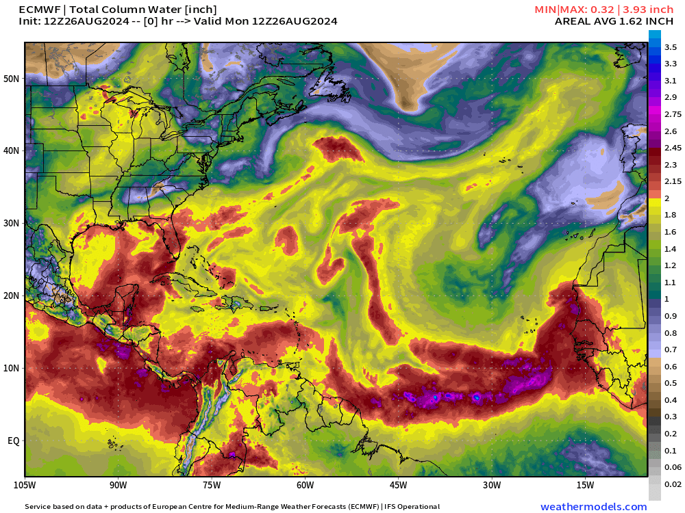
The Precipitable Water (my favorite variable) shows 3 areas of circulation or disturbance departing from the ITCZ similar to how the 3 storms developed in the Eastern Pacific.
NHC has put up 20% in the next 7-days for “Francine”

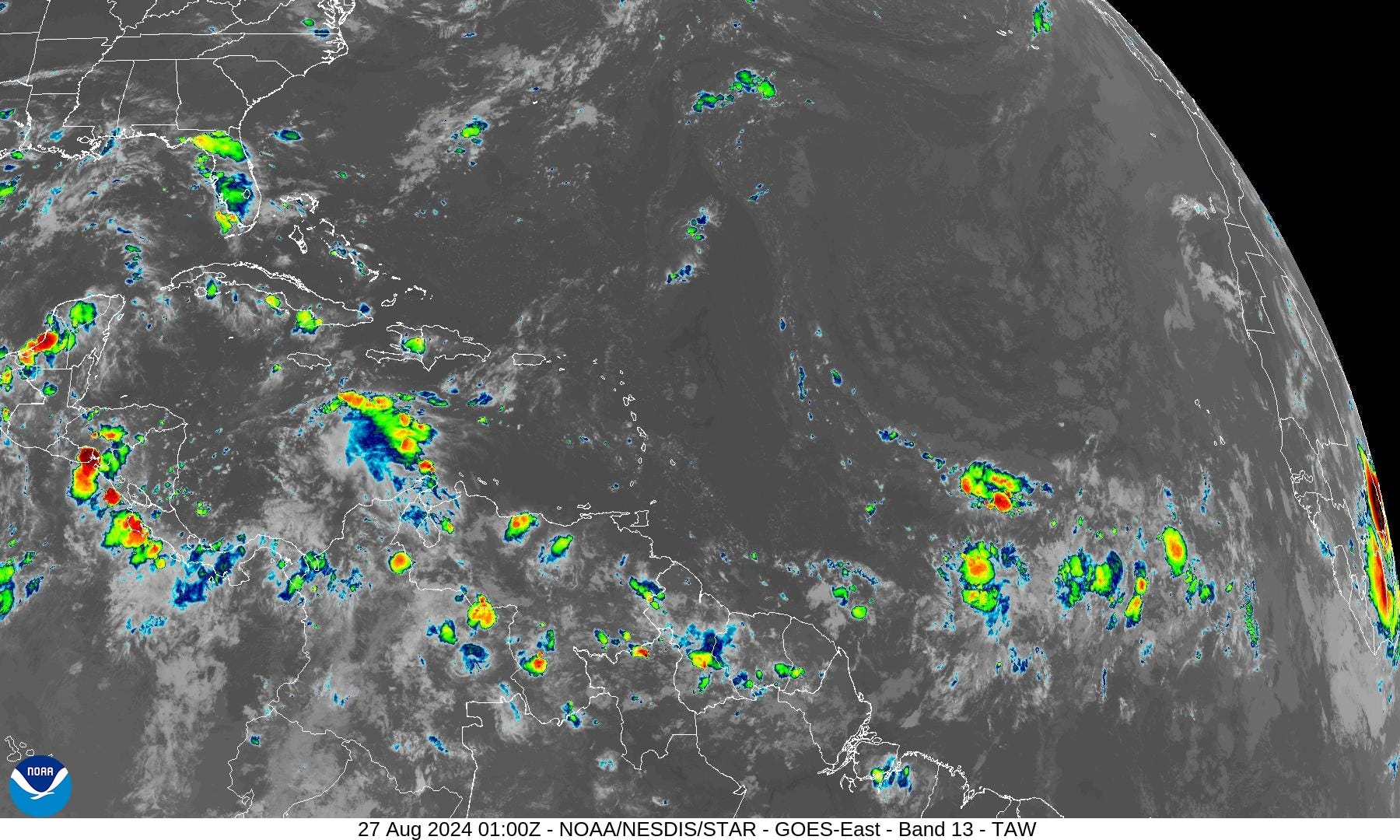
Not much to see w/satellite imagery but there are some showers and storms brewing, which is better than nothing for a tropical system to eventually develop.
Eastern Pacific and Central Pacific
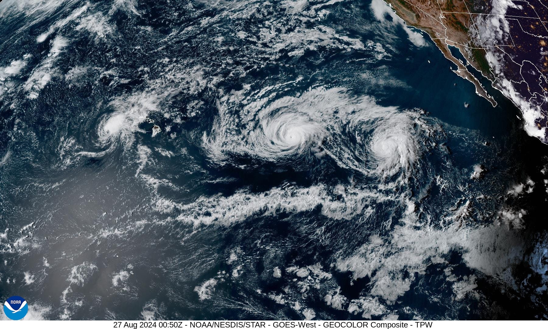
Our three systems continue along their merry way: Hone, Gilma and Hector. They are not affecting land — only mixing fish and generating waves.
Western Pacific | Typhoon Shanshan
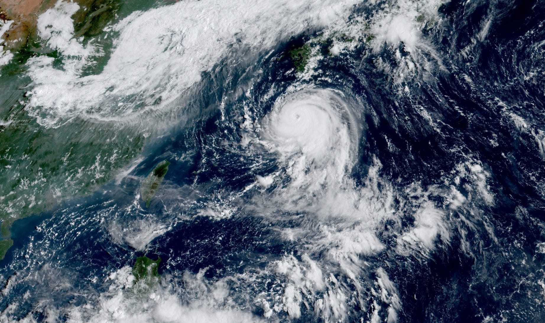
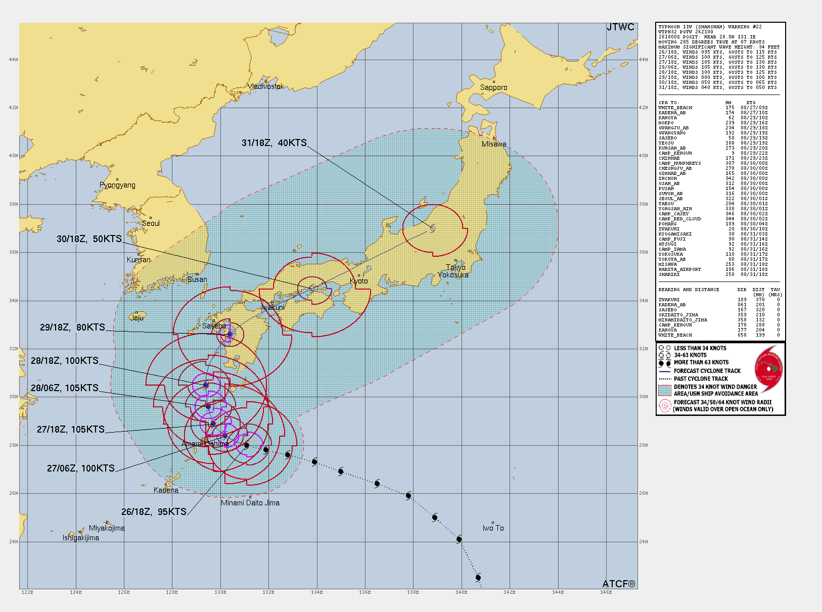
Shanshan is up to 95-100 knots and is now Major (Category 3)
The maximum intensity is expected to be around 105 knots and it may remain at major intensity prior to landfall now on the western side of Kyushu. The track keeps progressing/correcting to the left.
GFS 18z Happy Hour
Wanted to point out that GFS is also developing the system just east of the Lesser Antilles on a Ernesto like track.


Next 8-day, 12-days, and 14-day ECMWF EPS Active Tracks
Pegging September 3 as the development due date for the next tropical system according to the ensembles and HRES. Francine would be favored to become a powerful hurricane.
Keep reading with a 7-day free trial
Subscribe to Weather Trader to keep reading this post and get 7 days of free access to the full post archives.