


August 25, 2024 Sunday Tropical Update
Not sure about those signs of life

Thank you to Subscribers and Supporters into Year 2 of this newsletter.
Headlines for Sunday
Midwest and Ohio Valley Heat Up to 100°F
Atlantic Tropics next opportunity for development: who knows, but one wave to watch in 7-days
Hurricane Hone (70 knots) passing south of Hawaii
Atlantic Tropics remain very quiet into early September

Looking ahead to Labor Day:
There is a tropical wave that arrives near the Lesser Antilles in 8-9-days, into next weekend. This wave is far enough south that it could certainly catch fire (up storms) and develop further as it reaches the Caribbean / Hispaniola in 10-days. However, ensembles are not bullish, and the very excitable GFS can’t be bothered.
Again, look at the monster tropical waves that come off Africa or are poised to do so (at the end of loop). These are functionally tropical storms over land but once they reach the water go poof.
GFS 18z at Day 14: Ghost Town
And nothing develops prior to September 8. Amazing to see how quiet the GFS has become even during “Happy Hour”

Eastern Pacific and Central Pacific
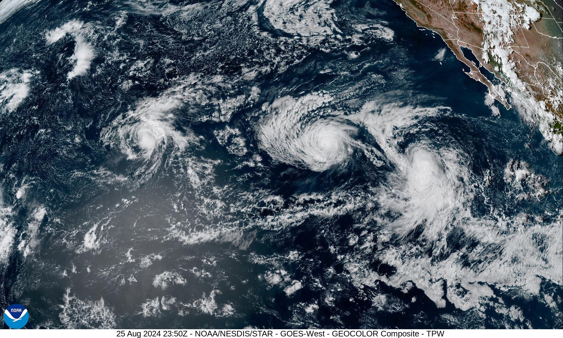
Hurricane Hone (01C) looks much better this evening south of Big Island of Hawaii. It will continue westward for the next 5-days as a tropical storm along 20°N without much fanfare.
Hurricane Gilma (Category 3) continues to persevere as it nears passage into the Central Pacific basin. It will weaken over cooler water and under effects of wind shear during next 3-4 days before becoming a remnant low devoid of convection. No threat to land.
Tropical Storm Hector (07E) was named on Sunday. It is not expected to become a hurricane and poses no threat to land.
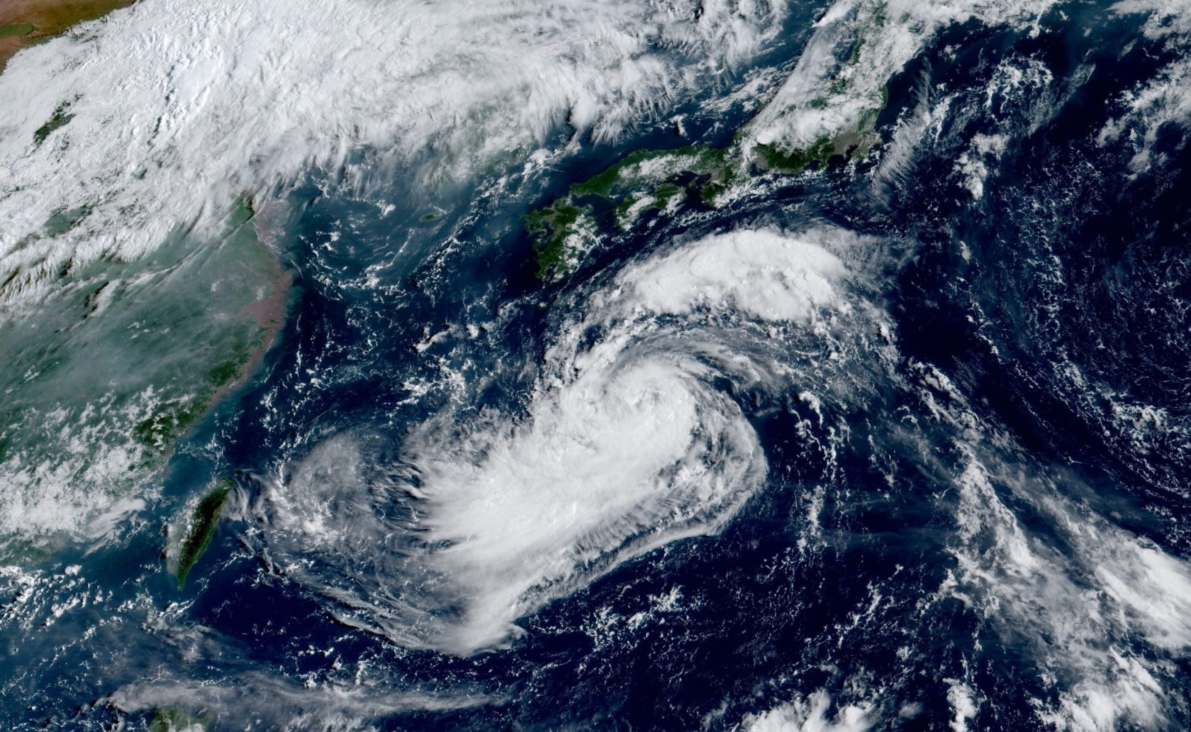
Western Pacific | Typhoon Shanshan

A major intensity [Category 3) Typhoon will strike Japan on Wednesday
Shanshan is ragged and battling dry air as it slowly intensifies. However, it expected to pick up steam to 110-knots before turning northward into Kyushu.
Next 8-day, 12-days, and 14-day ECMWF EPS Active Tracks
Stick a fork in August, but by September 6, we could see better chances of development in the SW Atlantic. Watch Gulf of Mexico for near-shore spin-up by next weekend.
Keep reading with a 7-day free trial
Subscribe to Weather Trader to keep reading this post and get 7 days of free access to the full post archives.