


August 23, 2024 Friday Weather Update
Atlantic remains quiet for next 10-days

Thank you to Subscribers and Supporters into Year 2 of this newsletter.
This is an open/unlocked post — will keep to 1 per week going forward with 2-3 posts with preview options. I am quite happy with the community here on Substack and look forward to continuing to grow with it into the Fall and Winter. Please consider upgrading to a paid subscription in order to receive every update.
Atlantic Tropics are (still) a Ghost Town
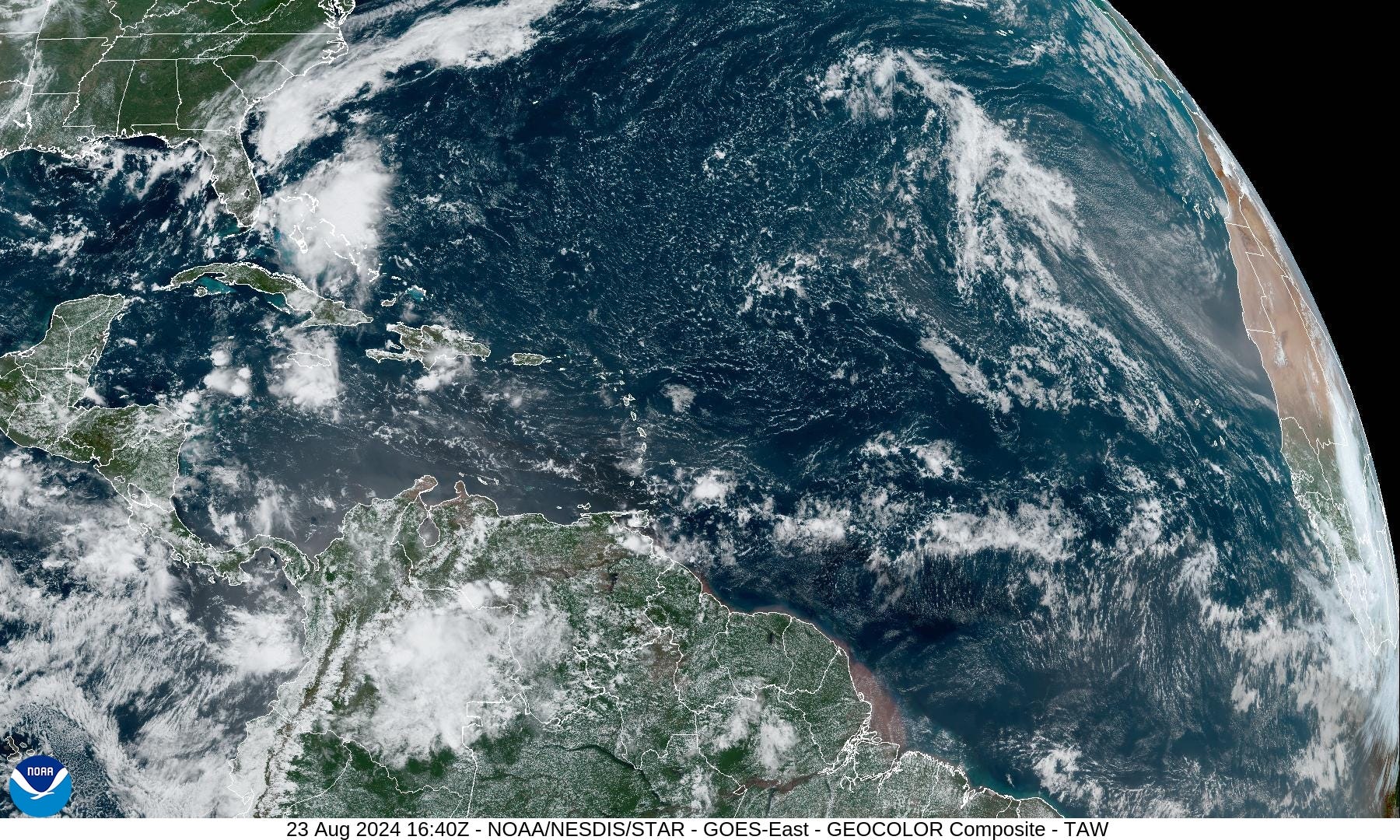
The tropical Atlantic is mostly quiet except for disturbed weather over the Bahamas drifting westward into Florida. A plume of African dust is coming off the continent at about 22°N latitude and spreading westward across the Atlantic tropics. Any tropical waves would need to be much further south in the deep tropics, but nothing doing.

There is a tropical wave about midway across the tropical Atlantic, but it is not convectively active. The overall environment across the entire Atlantic is inhospitable to tropical storm genesis for several reasons. Of course, the ocean surface is plenty warm at least away from teh col


Eastern Pacific Tropical Storm Party
3 storms in the Eastern Pacific to watch during the next 7-8 days.

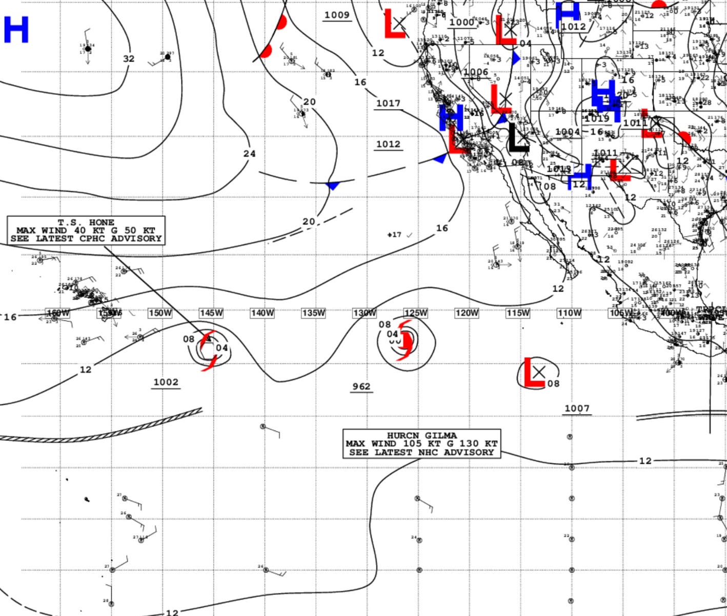
Gilma is forecast by NHC to reach Category 4 (115-knots) at maximum intensity. The track will be WNW into / over cooler water in 7-8 days and it will fizzle. The developing La Nina presents a SST gradient at about 20°N across which a tropical system can’t survive very long. That means Hawaii is mostly protected from the strongest hurricanes — greater than Category 1 — because waters are only 26.5°C.
However, Hawaii would be subject to heavy precipitation — orographically induced — more so than wind.
The system labeled as 91E will become a tropical storm in the next 24-48 hours, and either become Hector or Hone depending upon it crossing 140°W before being designated.
Next 10-day and 14-day ECMWF EPS Active Tracks

Ghost town at Day 10 — September 2, 2024. Dead. Stick a fork in August.

Count up 15/50 members at Day 14 = 30% chance of a development somewhere in the basin — largely focused north of the Greater Antilles to east of the Bahamas, but rapidly gaining latitude to Bermuda.
30% of members at Day 14 is a decent signal — and near climatology for early September. I would highlight the period from Sept 2-9 for Atlantic tropical storm development — mainly b/c something has to eventually develop, right?
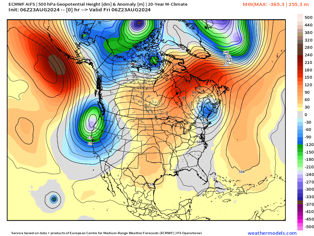
ECMWF AIFS 06z | 10-day Upper Level Pattern
Another trough from Alaska into the Midwest by Day 10 = cooler signal to finally wipe out the extreme heat.
Highs on Friday

Lows on Saturday

69 million at/above 90°F — losing more and more people.
Weather on Friday


Heaviest rain on Thursday across the 4 corners. The trough/cold front moves into northern California.
Weather on Saturday
Total Rainfall next 7-Days | NOAA WPC

More rain for the Pacific Northwest including Seattle. Florida pretty wet as well.
EPS Weekly Temperature Anomaly
Week 1: August 23-29

Week 2: August 30-September 5
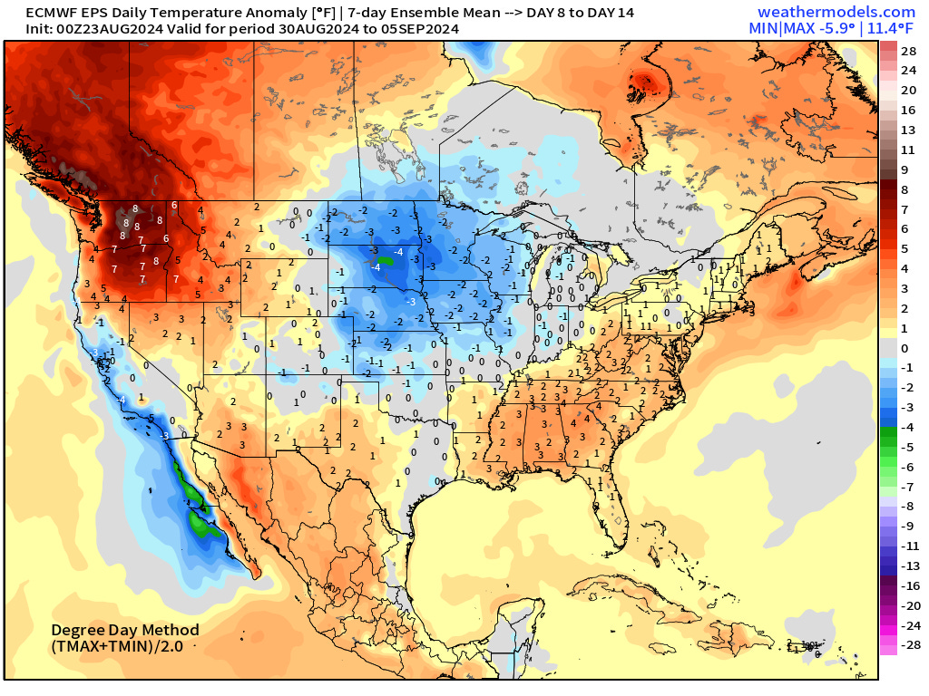
The upper-Midwest showing up as cooler than normal as a ridge builds over the Pacific Northwest — into early September.
Peak of Blazing Heat | Tuesday

Pushing 102°F in Nashville. Almost 200-million at/above 90°F to remind everyone that summer is NOT over — yet.
Thank you to Subscribers and Supporters!
Maps sourced from weathermodels.com designed and innovated by yours truly! I actually create all of my content from scratch.