


Top stories Monday morning: (1) Remnants of Hilary continue through Nevada into Idaho leading to heavy rain event for Rockies.
(2) Monster “heat dome” in the central U.S. with unbelievable 500 hPa height at 6027 m. Extreme heat > 100°F on tap for mostly everyone east of the Rockies.
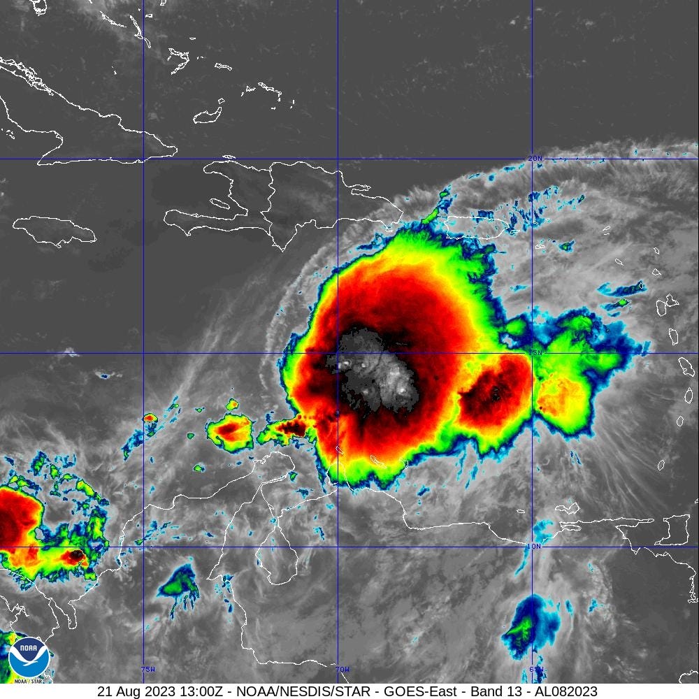
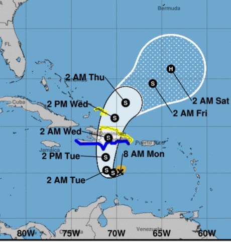
(3) Development of Tropical Storm Franklin in the Caribbean
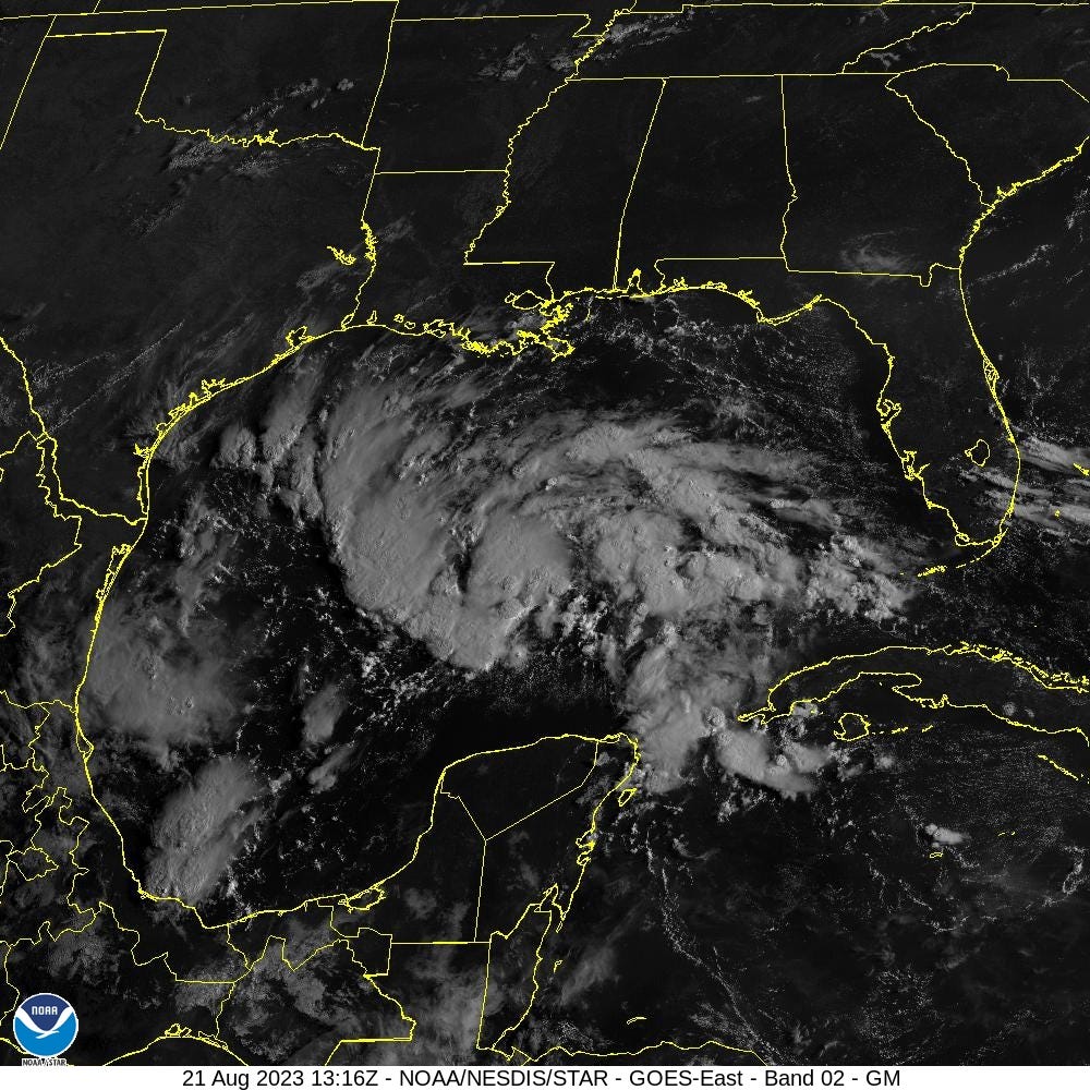
(4) Tropical Storm likely to develop and impact South Texas. Next name is Harold.

The Atlantic has blossomed from Gulf of Mexico to coast of Africa.
The system in the Gulf of Mexico will likely become a depression or named storm (Harold) by time it reaches the South Texas coast. Heavy rainfall will be welcome news for the bone dry landscape albeit with localized flood threats. On balance, the rain from a tropical system in Texas is highly beneficial to recharge reservoirs.
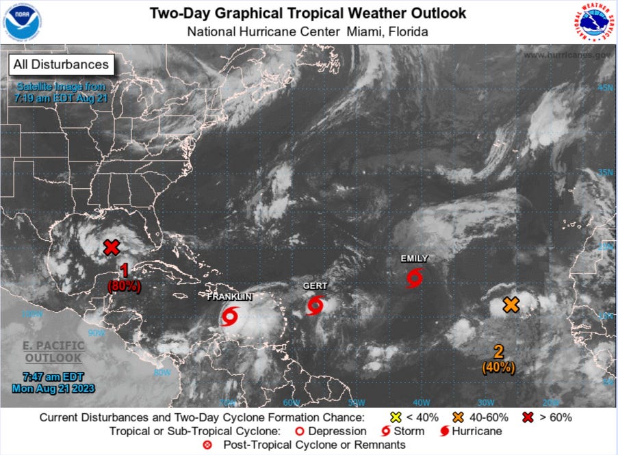
Short term Atlantic Tropics
Emily and Gert will likely be written off as remnant lows later on Monday, probably by 11 AM for the former. The environmental conditions in the Atlantic are hostile for smaller tropical systems with dry air and wind shear inhibiting sustained, vertically upright thunderstorms or convection. Franklin is in a more moist area and able to generate sustained deep convection. After watching disheveled tropical waves in the Atlantic for the past several weeks, Franklin looks significantly more healthy as it moves north into Hispaniola.
The rugged terrain of Hispaniola means the island is highly susceptible to dangerous flooding from tropical systems.
Across Hispaniola, significant and
potentially life-threatening flash flooding is possible Tuesday into
Wednesday.
Invest 91L (80% NHC) is currently disorganized over the Gulf of Mexico but only would need a small area of circulation to gain TD or TS status prior to landfall in South Texas. Rainfall amounts on the order of 3-6” are possible. Unfortunately, the rain shield is mostly south of Houston, which will see clouds that are cooling, sort of.
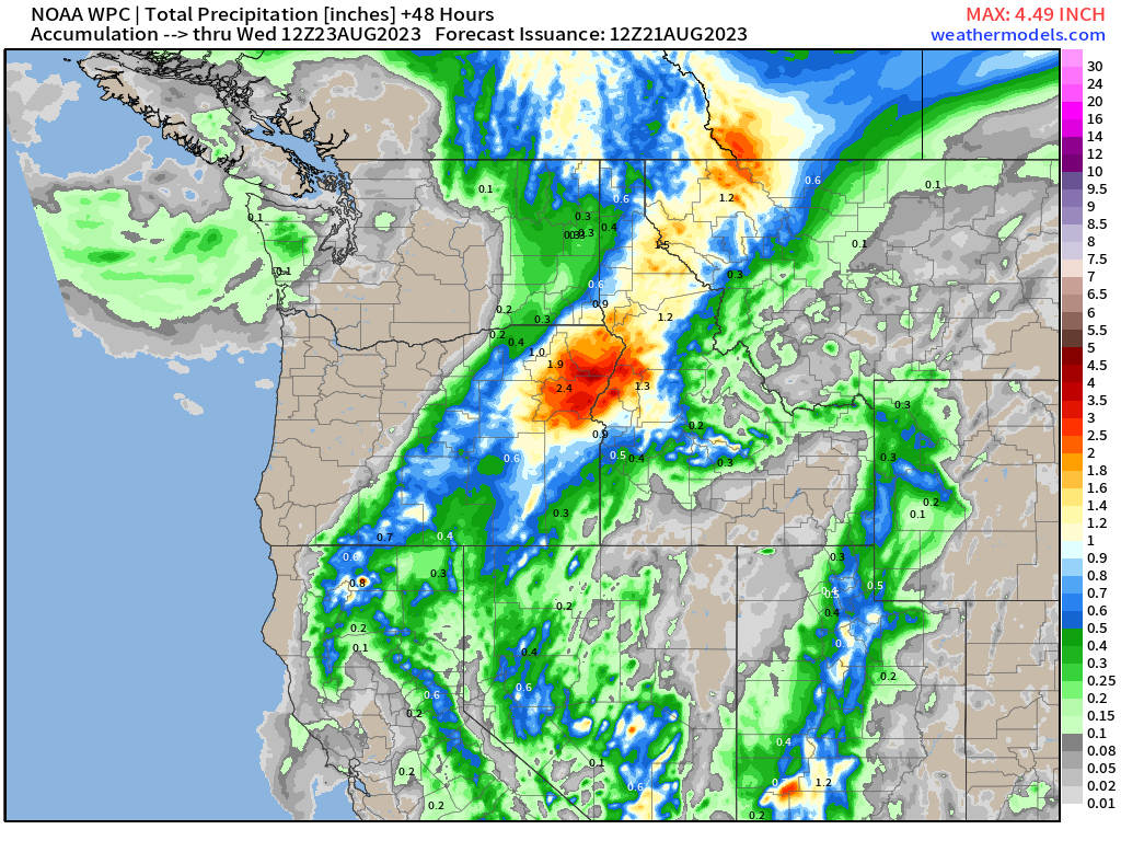
Rainfall maps for the next 48-hours for Texas and the Pacific NW and Rocky Mountain states from the remnants of Hillary.

Medium Range Atlantic Tropics
Keep reading with a 7-day free trial
Subscribe to Weather Trader to keep reading this post and get 7 days of free access to the full post archives.