


Main story on Thursday is the rapid intensification of Hurricane Hilary off the SW coast of Mexico in the Eastern Pacific.
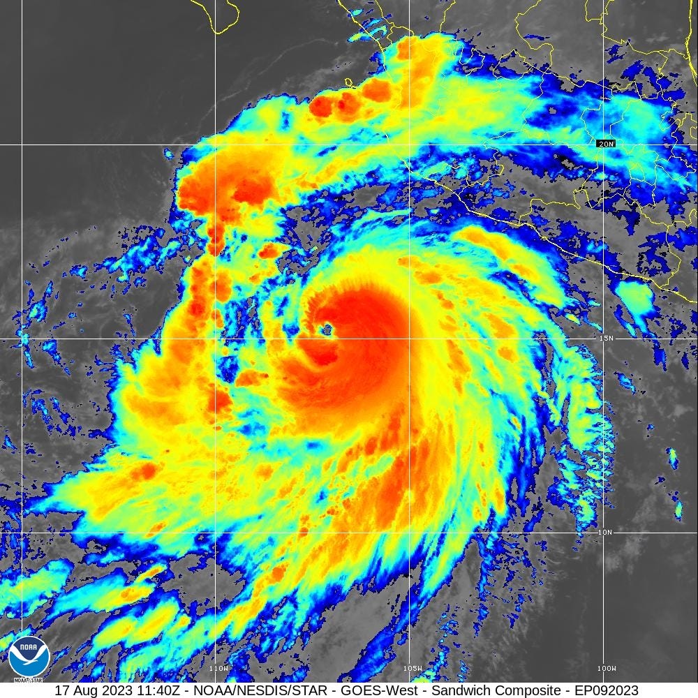
Hurricane Hilary could be Category 4 by later today, and make a run at Category 5.
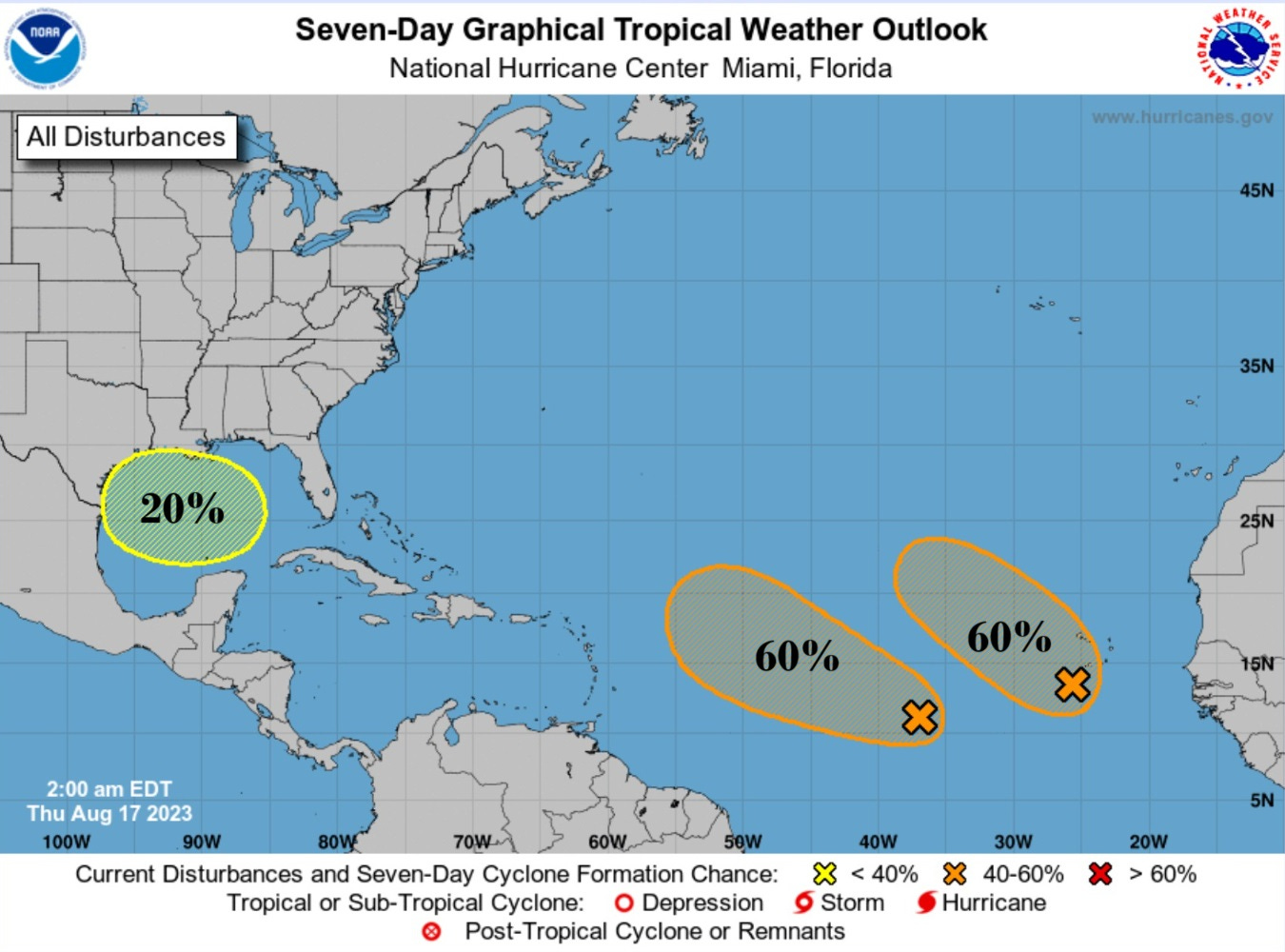
In the 7-day NHC tropical weather outlook, there are still 3 areas being watched for tropical cyclone development: Gulf of Mexico (20%) and two waves in the MDR (both 60%) as of Thursday morning 2 AM. These systems have a 30% to 40% chance of developing in the next 48 hours, so they bear watching. However, they are in the middle of the Atlantic and no threat to land for many, many days, if either develop into named storms.
Short term Atlantic Tropics
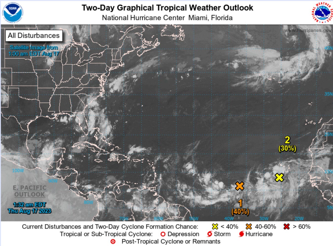
The eastern tropical wave is designated as Invest 98L and the western wave is Invest 99L. We’ll watch over the next 24-48 hours for either of these waves to spin up — probably briefly — into a tropical depression.
The ECMWF HRES and GFS do not develop either significantly through 10-days.


Medium Range Atlantic Tropics
Keep reading with a 7-day free trial
Subscribe to Weather Trader to keep reading this post and get 7 days of free access to the full post archives.