


August 13, 2024 Tuesday Weather Update
Ernesto nearing hurricane strength, slowing down

Happy Tuesday August, 13, 2024!
Tropical Storm Ernesto (05L) has intensified to 60 mph and will be a hurricane by Wednesday morning, or sooner. The forward motion has slowed from 28 mph to 18 mph, and that trend will continue as the system turns to the NW and then N into this weekend.
Puerto Rico to see tropical storm conditions into Wednesday with potential for hurricane winds if Ernesto ramps up quicker than forecast.
No direct threat to the U.S. East Coast, but Bermuda could take a direct hit followed by Atlantic Canada seeing effects from a large post-tropical Ernesto.
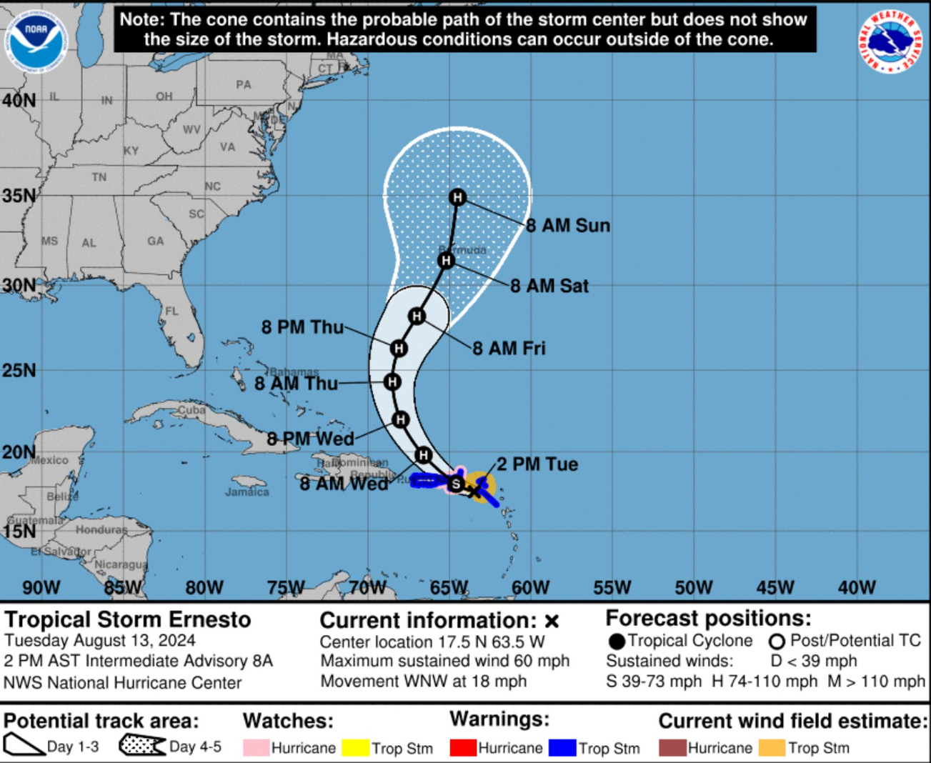
The maximum intensity is at 95 knots — or just on the edge of Category 3 (Major Hurrricane status). I think Ernesto will reach 105-knots at its maximum.

The model guidance is tightly clustered in the cross-track but not the along-track.
Texas to remain HOT and dry for next 10-days+ with much of the state 100°F including Dallas-Fort Worth.

1:30 PM ET Current Temperatures

Check out the very comfortable 70s and 80s across the northern 60% of the Lower 48.
HRRR Simulated Radar Next 18-hours
A non-severe thunderstorm complex finally fizzles away across southern Missouri but a few more storms may follow in their wake. Another complex develops over Nebraska overnight to give the corn stalks a drink. Happy farmers!
Monsoon moisture continues to fire storms over the Rockies.
Atlantic GeoColor Satellite | 1:40 PM ET
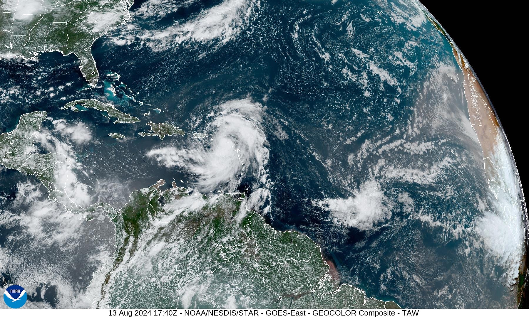
Ernesto looks imposing — on verge of hurricane intensity. Another tropical wave to the SE does not show organization.
NASA Dust Forecast

The dust layers look to settle down after this next surge comes off the continent. You can see the milky hue in the previous satellite image.
Ernesto Wind Gusts | DWD Germany ICON
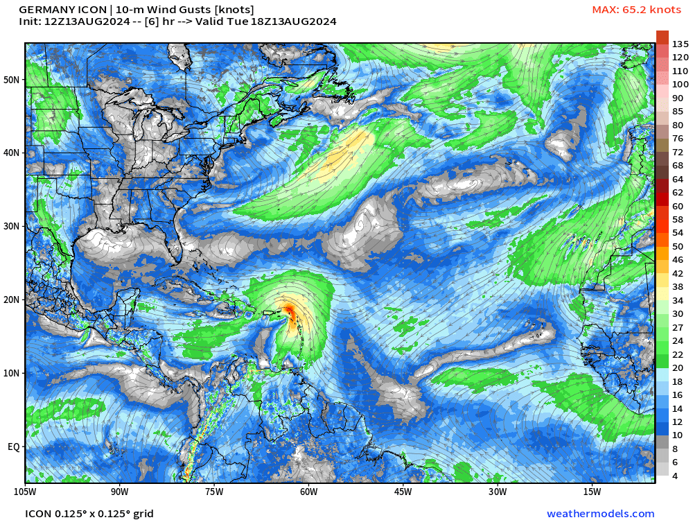
Nice view of Ernesto gaining latitude and becoming a very large, likely major hurricane before undergoing extratropical transition south of Newfoundland. We’ll hope it misses Canada.
ECMWF Ensemble Tracks for Ernesto Next 10-days
Keep reading with a 7-day free trial
Subscribe to Weather Trader to keep reading this post and get 7 days of free access to the full post archives.