


August 12, 2024 Monday Weather Update
Tropical Storm Ernesto named but will remain well off US East Coast

Happy Monday!
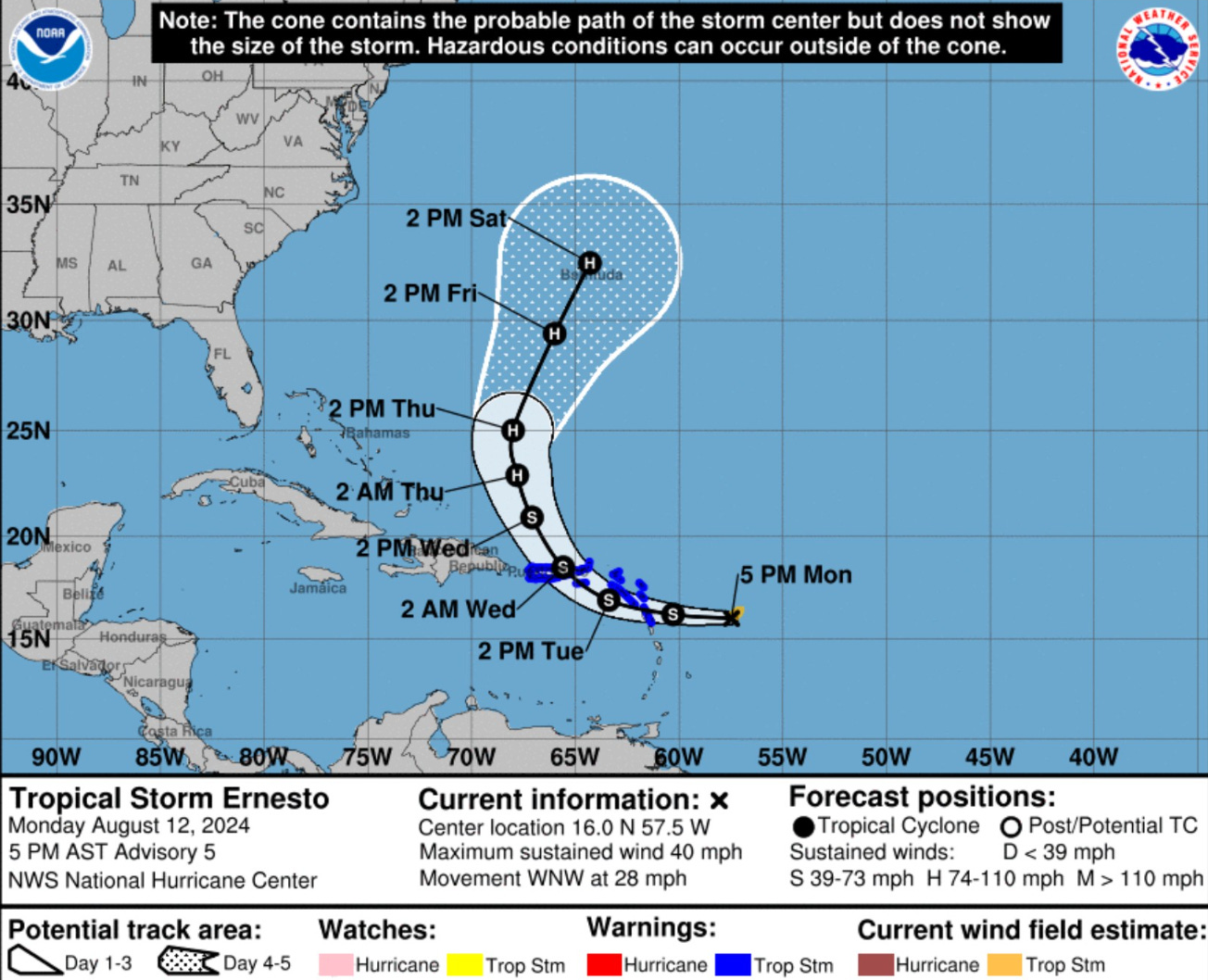
Tropical Storm Ernesto (05L) named 300 miles east of Antigua and 600 miles ESE of Puerto Rico on a blistering pace WNW at 28 mph. Ernesto is slowly getting better organized with broken bands of convection in a very large circulation, but storms near the center have bubbled up.
Puerto Rico likely to see tropical storm conditions into Wednesday.
Ernesto should rapidly intensify at some point later this week as it heads north toward Bermuda, which could see significant impacts this weekend.
No direct threat to the U.S. East Coast, but Atlantic Canada could see effects from post-tropical Ernesto.
Texas to remain HOT and dry for next 10-days+
Atlantic IR Satellite | 5:00 PM ET
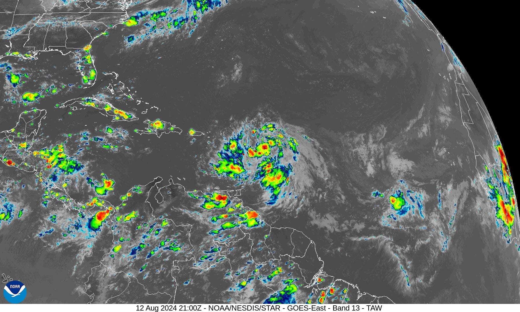
Aside from very large Ernesto, the rest of the Atlantic tropics look dry under influence of strong subtropical high pressure.
Ernesto 05L Model Spaghetti
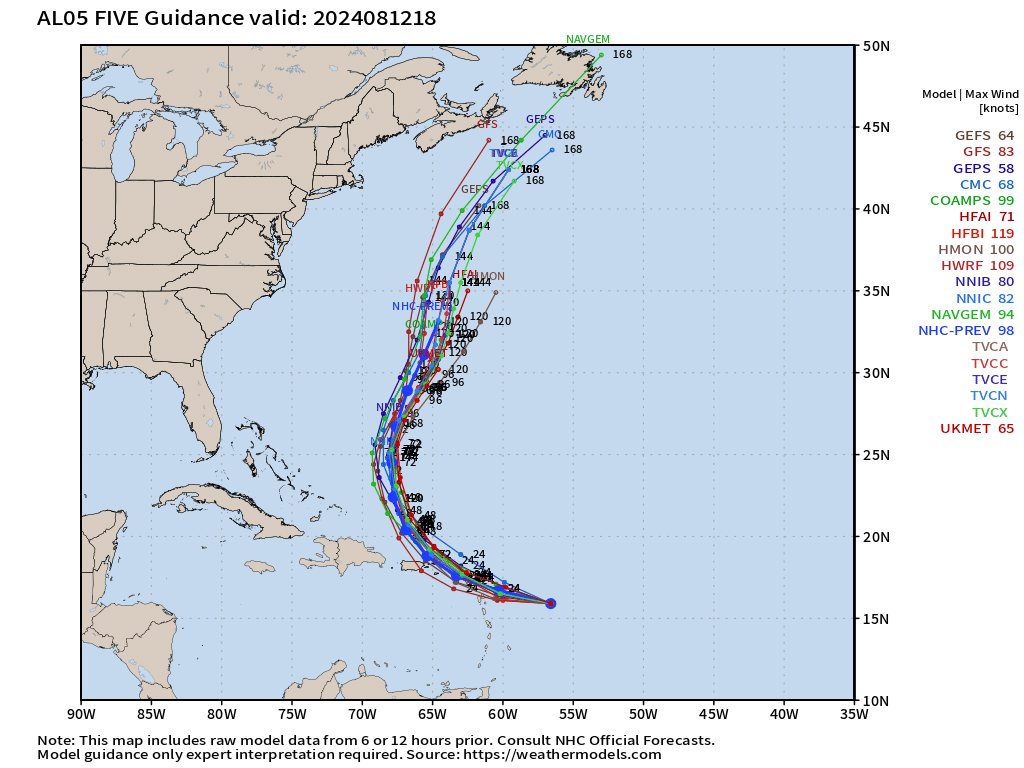
This model spread is very small across-track, but more significant along track. However, that means Ernesto will not make it west of 70°W. This model agreement seems unusual, but the steering currents are much larger on the synoptic scale than Ernesto, which will be like a cork in the stream.
ECMWF Ensemble Tracks for Ernesto at Day 5
Keep reading with a 7-day free trial
Subscribe to Weather Trader to keep reading this post and get 7 days of free access to the full post archives.