


August 10, 2024 Saturday Tropical Update
Invest 98L organizing over central Tropical Atlantic

Welcome to new and renewal subscribers into Year 2 of Weather Trader. Your support allows me time and space to operate this blog, keep up to date with research, and cheerful and happy.
Headline for Saturday
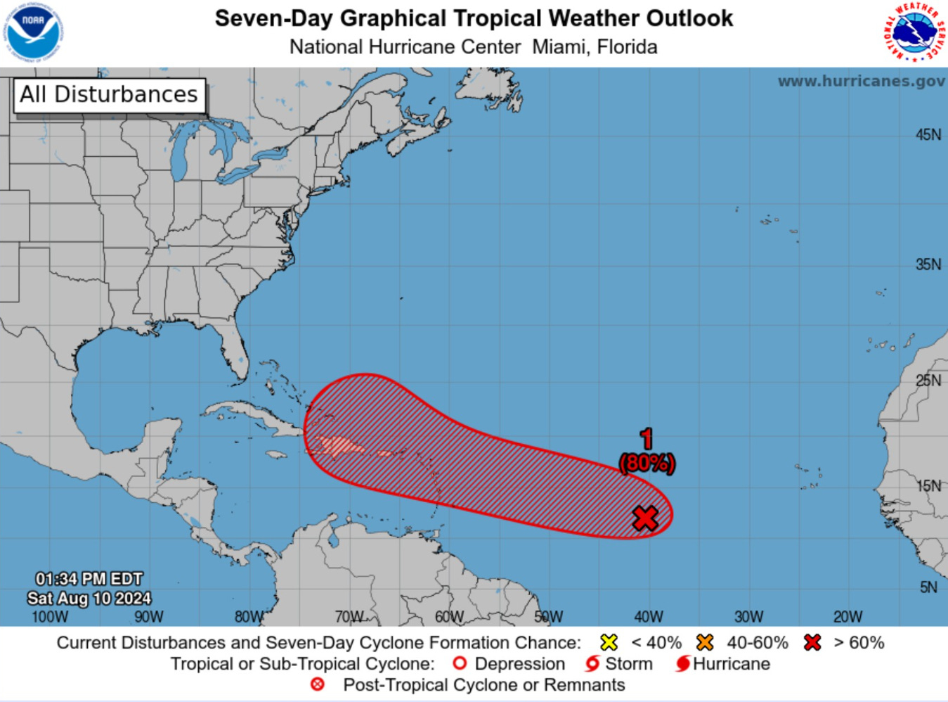
Invest 98L has showers and storms in a broad circulation over the central tropical Atlantic. NHC has increased development chance to 40% in the next 48-hours and 80% in the next 7-days. The main question is not if — but when 98L will become Ernesto, and then track through the Caribbean and Greater Antilles. Models are suggesting a northward turn before reaching 70°W longitude sparing the U.S. from direct impacts.
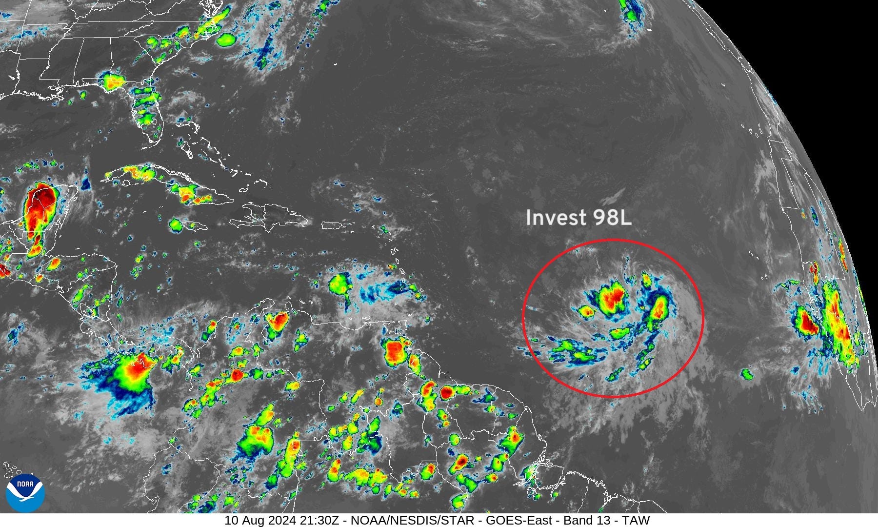
IR Satellite | 5:30 PM ET
Tropical wave looks healthy even embedded within a consistently dusty and dry/stable Saharan Air Layer parade coming off Africa.
NASA Dust Forecast | Next 10-days
We can see those dust plumes traveling westward across the Atlantic with the heaviest concentrations at about 20°N latitude. The tropical waves will cruise along just south of the worst of the dust.

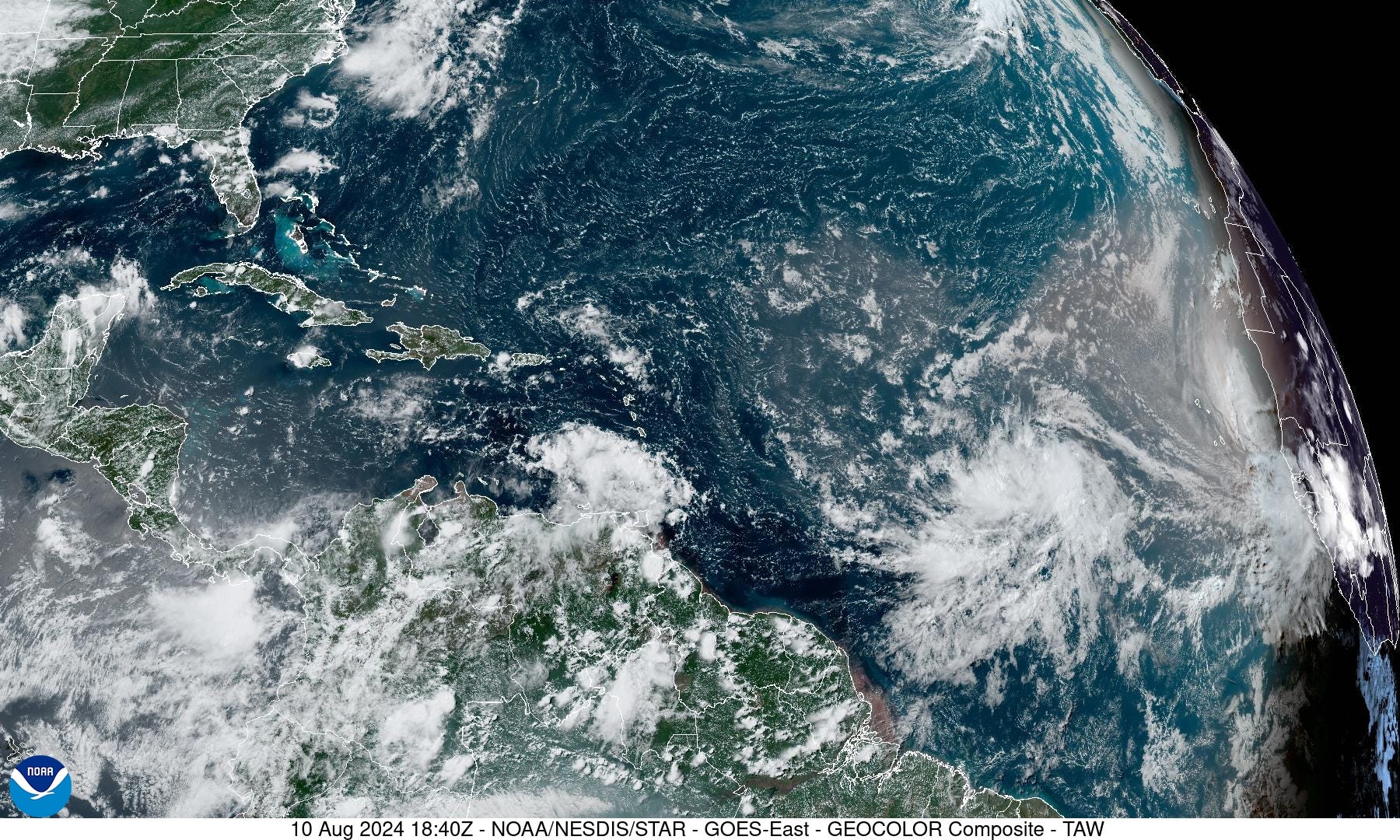
GeoColor Satellite Image | 2:40 PM ET
The milky brown hue of the dust layers nicely seen in the visible satellite imagery from GOES-East. Invest 98L is in a good location for further development as the worst of the dust is upstream, and won’t catch up to the circulation.
Invest 98L Model Spaghetti

The 12z models are complete in this ATCF spaghetti map with a recurving track looking quite likely, but there is obviously uncertainty about how far west Ernesto will get — to 70°W? And, if Puerto Rico and Hispaniola will take direct impacts in the 3-4 day range.
Keep reading with a 7-day free trial
Subscribe to Weather Trader to keep reading this post and get 7 days of free access to the full post archives.