


August 1, 2024 Thursday Tropical Wave Update
Invest 97L slowly organizing into expected tropical depression in Gulf of Mexico

Invest 97L is on a track to the eastern Gulf of Mexico where environmental conditions will be much more favorable for rapid development — especially with untapped ocean surface temperatures at nearly 90°F
NHC has bumped up the development chance to 70%. The next name is Debby.
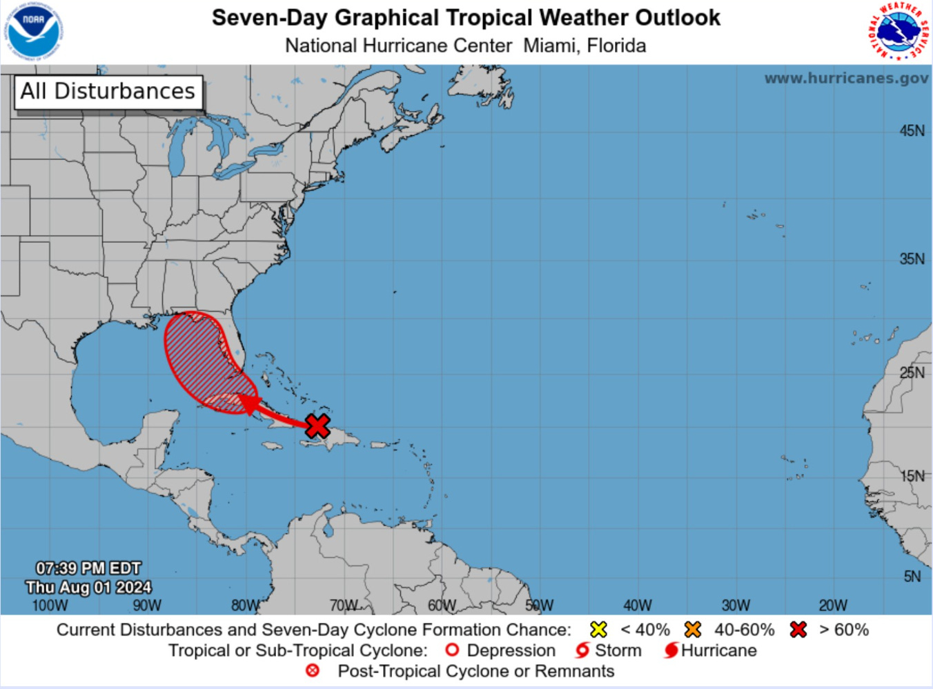
Model guidance through 4-days is clustered on the Big Bend of Florida between Apalachicola and Tampa Bay. Thereafter, the system could stall, loop, or drift slowly back over water and the warm Gulf Stream. The Carolinas would need to watch for a secondary landfall — perhaps much stronger.

IR Satellite
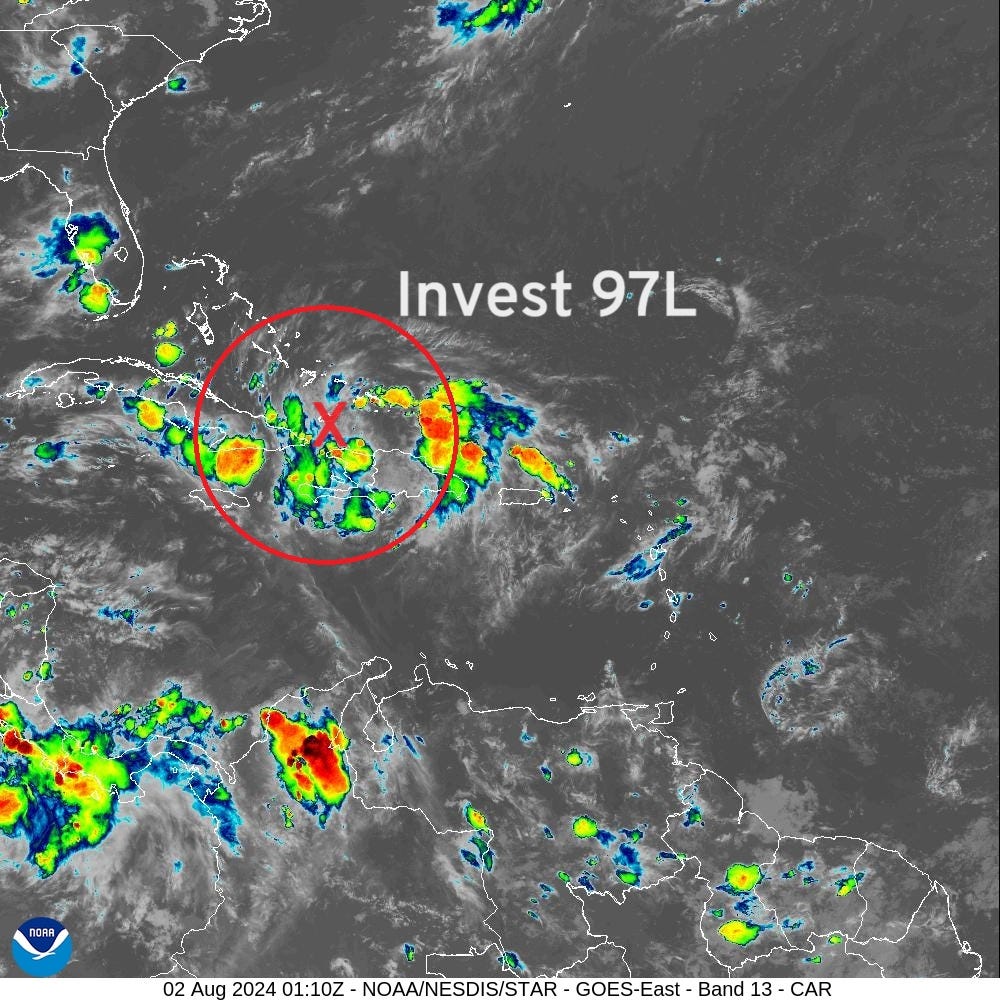
NHC analyzed (18z) the tropical wave [Invest 97L] just east of the tip of Cuba near Hispaniola. Convection is still scattered.
A tropical depression is likely to form this weekend or early next week over the eastern Gulf of Mexico near the Florida Peninsula.
ECMWF 12z HRES Model Solution | Next 10-days
Keep reading with a 7-day free trial
Subscribe to Weather Trader to keep reading this post and get 7 days of free access to the full post archives.