August 1, 2023 Hurricane Season
Invest 96L at 40% is struggling while Dora 05E is rapidly intensifying
Sea surface temperatures are very warm heading into August across the Main Development Region
Actual ocean surface temperatures [SST] on August 1, 2023 from the ECMWF HRES weather forecasting model [weathermodels.com] shows very warm waters well in excess of 28°C over a large area of the Tropical Atlantic and over 30°C in the Gulf of Mexico.
Weather models that are coupled to the ocean are capable of resolving the diurnal variations of the ocean surface. That includes ECMWF EPS and NOAA GEFS. So, if we take a climatological comparison at 12z, it may be slightly different than 00z in some parts of the world. I like using the NWP based SSTs since the OISSTv2 algorithms are based upon satellite retrievals and averaging that is less sophisticated than the NWP data assimilation schemes. Also, you can visualizing the forecasts going through 1 or 2 weeks.
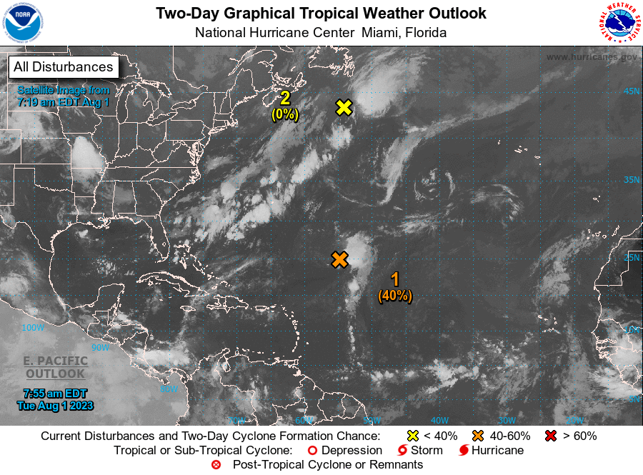
Near-term Atlantic Activity
Invest 96L from NHC tropical discussion 40% (2-day) and 50% (7-day) but it will only have a brief opportunity or window of development.
Central Tropical Atlantic (Invest AL96): A 1014 mb low pressure
is centered near 24.5N 54.5W or about 610 nm northeast of the
northern Leeward Islands, moving NW at 10 to 15 kt. Disorganized
scattered moderate to isolated strong convection is noted within
240 nm of the center in the northeast quadrant and 310 nm
southeast quadrant. Strong to near-gale force winds accompany the
low, mainly in the E semicircle, with seas 9 to 12 ft. Environmental
conditions still could support tropical cyclone formation during
the next few days while the system moves northwestward and then
northward over the central subtropical Atlantic.
The only area of interest is Invest 96L and NHC knocked down the development chances from 70%, then 50% and now 40% as it tracks northward in the central subtropical Atlantic. The overall environment is hostile with interference from a variety of upper-level disturbances randomly spinning nearby in the the Atlantic.
For subscribers, I will include extended range outlooks, the Eastern Pacific, and the Western Pacific typhoons using a variety of weather model and satellite analysis. Please consider signing up for additional content so I can produce more blogs on a variety of weather and climate related topics. You can even request data analysis or research or suggest worthwhile ideas.
Updates will be frequent.
Keep reading with a 7-day free trial
Subscribe to Weather Trader to keep reading this post and get 7 days of free access to the full post archives.


