


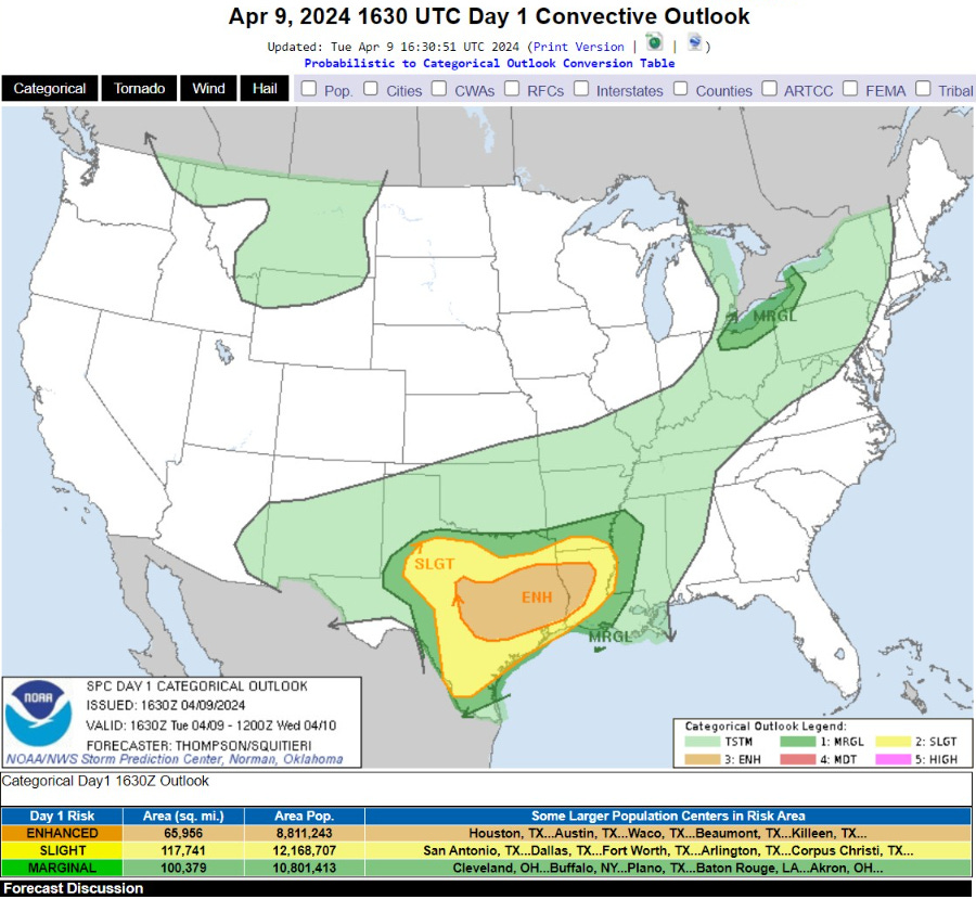
April 9, 2024 Severe Weather Risk Increases on Wednesday to Moderate Across Louisiana
Boatloads of rainfall from Texas to the Ohio Valley from powerful storm system

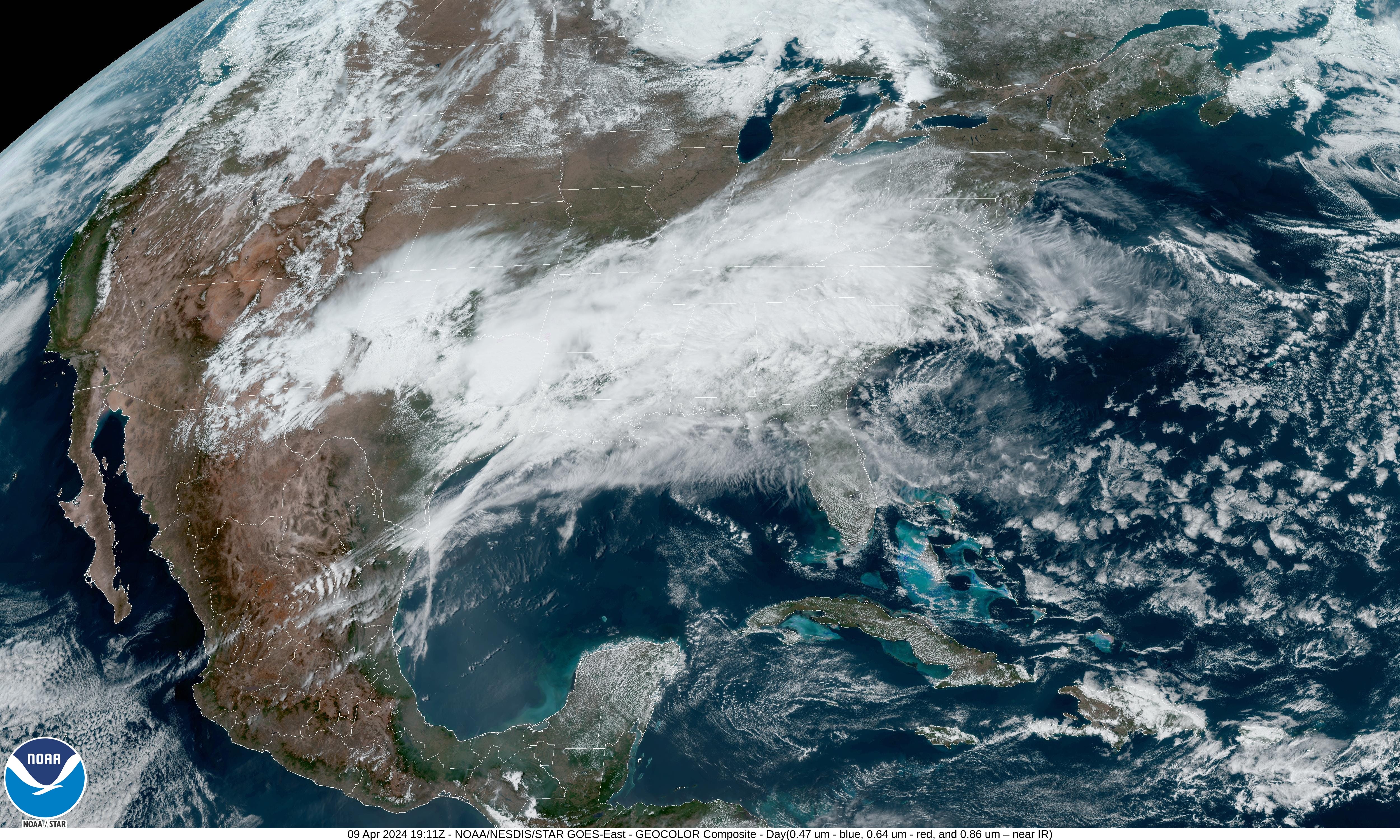
Satellite imagery shows a developing storm system over Texas with a frontal boundary draped into the Ohio Valley. Thick cloud cover and rainfall from moist Gulf of Mexico flow will also include severe weather with risk of tornadoes increasing into Wednesday focused on Louisiana = Moderate risk.
Tuesday Afternoon Temperatures 3:00 PM ET


The clouds and rain are keeping temperatures in check from Texas into the Carolinas. However, where the sun is shining — without the moon covering it up today — temperatures are nicely in the 70s including Detroit, Philly, NYC, and DC. Beautiful Spring day with > 157 Million at/above 70°F.
Next 18-Hours Weather | Simulated Radar

Waves of thunderstorms will develop out of Texas and move into Louisiana and Mississippi over the next 18-hours. Severe weather including hail, winds, and tornadoes — wide array of risks on top of heavy/excessive rainfall.
Tuesday Weather

The heavy rain / flash flooding is red hatching on the map, and the focus of the most impactful weather stretching from Dallas and Houston to Memphis.
For the rest of Tuesday until Wednesday morning at 8 AM ET, the risk for severe weather is “enhanced” but that increases eastward later in the day.
Wednesday Weather

Severe weather threat moves eastward across the Gulf Coast states.
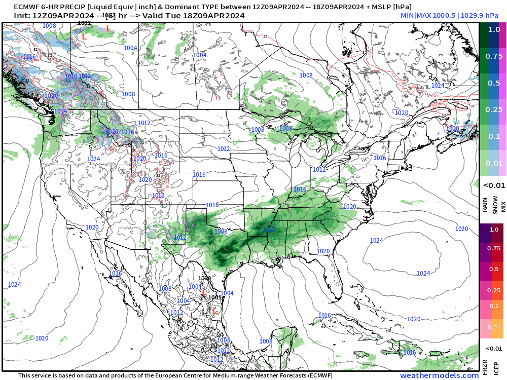
Next 48-Hours Precipitation | NWS NDFD

Red = 2”+ of rainfall with potential of locally much more in thunderstorms. Highest is > 6” in NE Louisiana.
HRRR Next 48-Hours Simulated Radar

Severe Weather on Wednesday
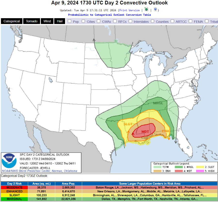
   ...THERE IS A MODERATE RISK OF SEVERE THUNDERSTORMS FROM PARTS OF
   EASTERN LOUISIANA INTO SOUTHERN MISSISSIPPI AND ALABAMA...

   ...SUMMARY...
   Widespread severe thunderstorms are forecast beginning Wednesday
   morning across parts of the central Gulf Coast States. The potential
   will exist for several tornadoes, a few of which may be strong
   (EF2+), and widespread damaging winds, some of which may be
   particularly damaging.
Wednesday High Temperatures
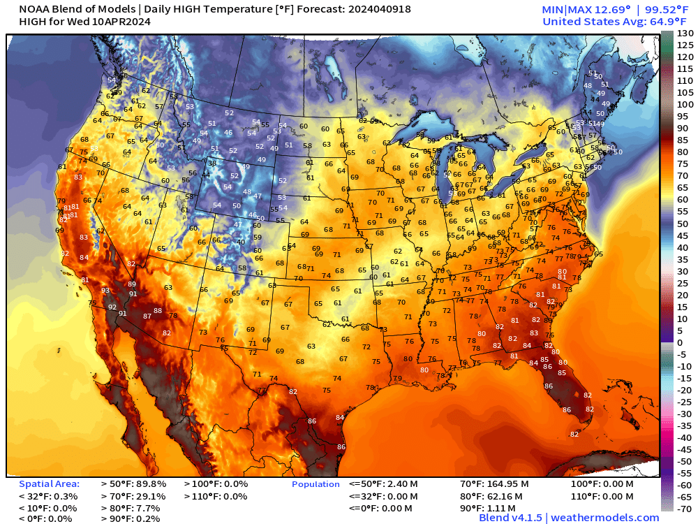
The temperature maps are looking more spring like, finally! Only cool spots are in Maine and the northern Rockies.
Next 8-Days Weather Systems
The main event during the next 3-days is the powerful low pressure system tracking from Texas into the Great Lakes.
The central pressure drops into the 970s (!) in the ECMWF 12z forecast model. This is unusually strong / intense for mid-April.
That will make for very gusty winds across the Lakes into the Northeast on Friday.


WPC 7-Day Precipitation Forecast
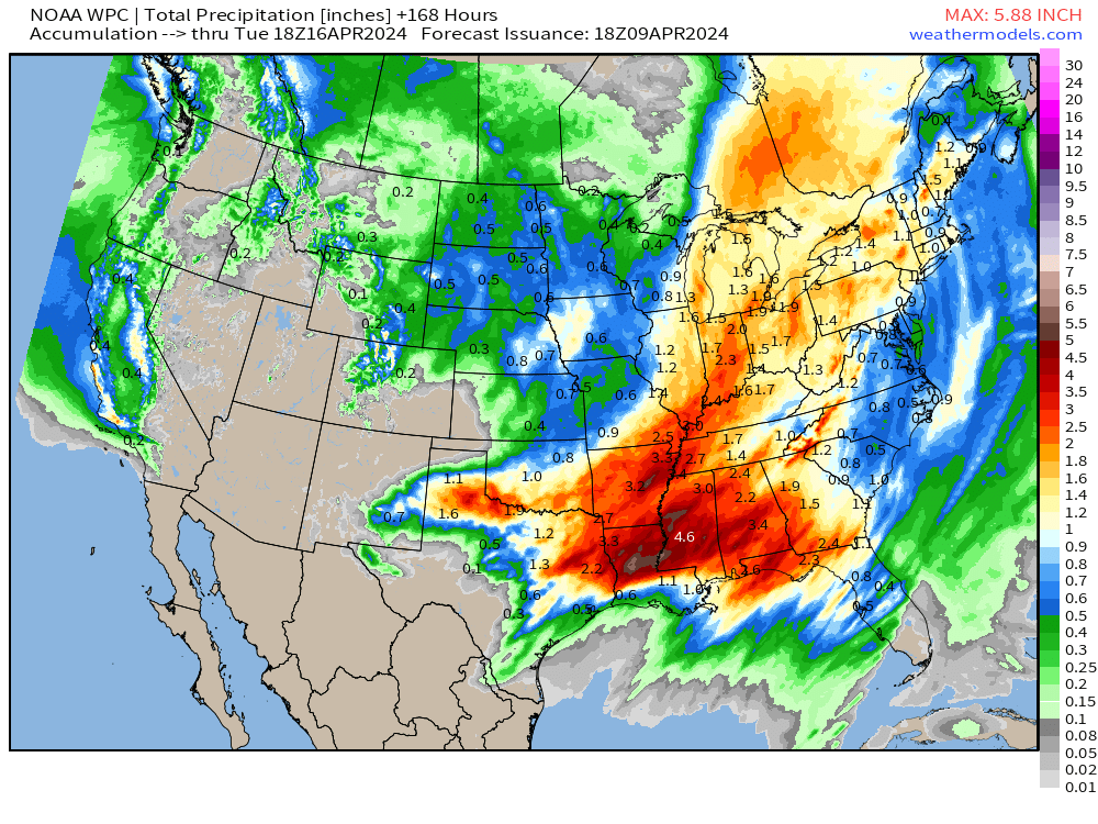
Nice swath of 1-2” of rainfall at least from Texas into the Southeast [2-4”] into the Great Lakes.
ECMWF Ensemble 7-day Temperature Anomaly Chunks
Next 7-Days From April 9-15

Canada remains VERY warm — compared to normal — always important caveat. However, the 7 to 10°F above normal across the Great Lakes and Northeast will be very welcome.
Days 7-14 From April 16-22

Eastern U.S. is much above normal for the 3rd week of April. Wonderful!
Thank you to Subscribers and Supporters! Almost the growing season — so much is going on in the world of weather!
Maps sourced from weathermodels.com designed and innovated by yours truly! I actually create all of my content from scratch.
Great update. TY!
Thanks as always