


April 8, 2025 Tuesday Weather Update
Quiet period ahead

Good Morning!
With a quiet period of weather coming up — well deserved — I can take some time to dig into the weeds with some analytics.
ECMWF vs. GFS Model Skill
Weather models are scored on the skill with various metrics including root mean squared error (RMSE) and anomaly correlation, which is a pattern matching taking into account climatology.
The ECMWF IFS [blue], ECMWF AIFS [black], and NOAA GFS [red] anomaly correlation for 5-day forecasts and Northern Hemisphere 500 hPa Geopotential Height (Z500) is charted for the past 3-months.

The ECMWF artificial intelligence trained system called AIFS is the winner by a small margin over the conventional or full-physics IFS model.
NOAA GFS lags in skill and is almost always the worst performing model with significant “drop outs” or dips in skill that equate to a less skillful forecast. Forecast skill scores below 0.90 are rare with ECMWF’s system at 5-days while GFS regularly dips below the mark.
Regardless, we don’t know which model will perform best — although we can use some post-processing techniques to understand where errors will occur — so we must use all of the model guidance we have available in the most beneficial manner. That may mean multi-model ensembles or weighted combinations based upon historical performance, clustering by flow regime, or downscaling with high-resolution mesoscale models like WRF.
There are countless other metrics to score weather models, and some systems perform better with storms like hurricanes vs. winter systems.
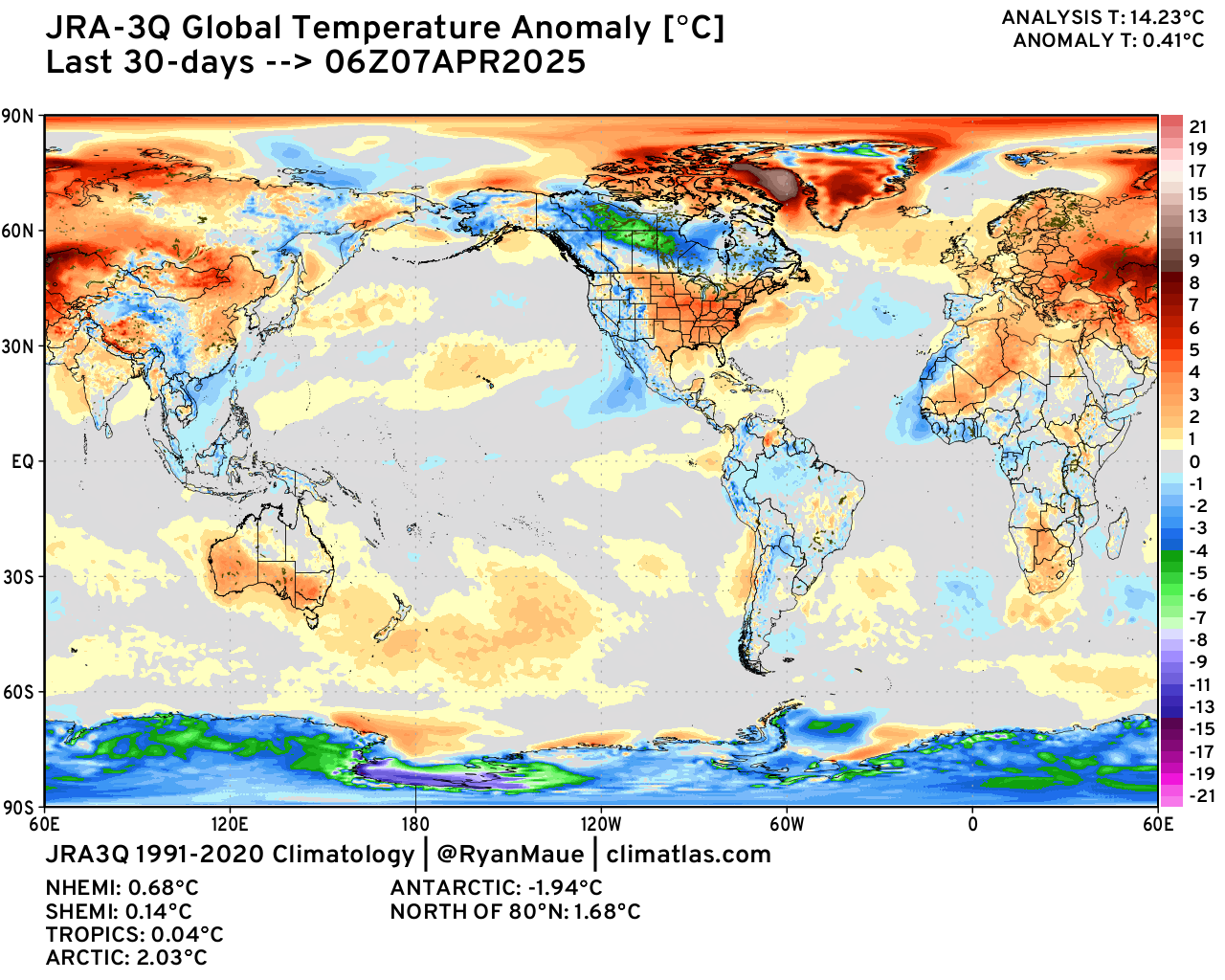
Earth’s Tropics Return to Long-Term Normal Temperatures
Media highlights global temperature on monthly and annual time scales with “hottest ever” superlatives, but as we know, the climate is simply averaging together weather on short-time scales to create days, weeks, months, years, and decades — centuries. There are natural climate oscillations underway that modulate weather on a global scale especially the El Niño Southern Oscillation — including La Niña and El Niño.

The climate baseline with this chart is 1991-2020 — the most recent 30-years normal. In mid-2023, a very rapid onset El Niño dramatically warmed tropical temperatures from -0.2°C to almost 1°C in 6-8 months peaking in early 2024. Then, slowly but surely, went down the roller coaster to where we are now: -0.1°C or almost back where we started as the Earth’s climate has cooled. However, the Northern Hemisphere middle latitudes remain abnormally warm with late-winter/early spring warmth in Europe and central Asia.
Note, the color scale has blank space (gray) between -0.5°C and +0.5°C anomaly. So if the entire maps was colored by the global mean of +0.41°C, then it would be entirely gray. Also, this is the 1991-2020 climate baseline, so add about +0.85°C to get the deviation from 1850-1900 at the end of the Little Ice Age, or as IPCC defines it, pre-industrial.
Weather Today
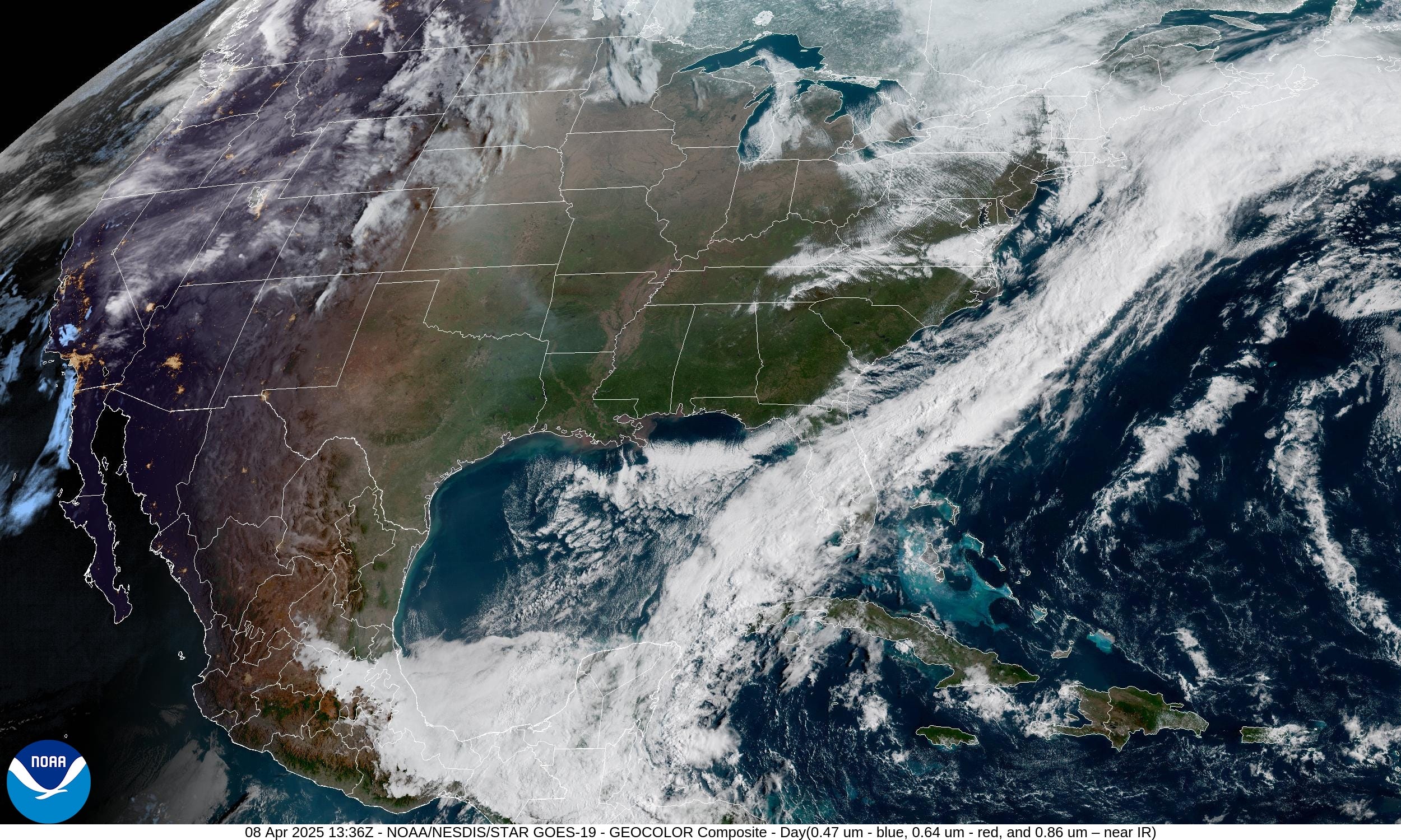
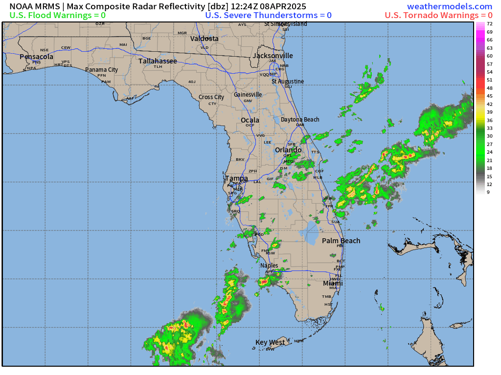
Some lingering showers in South Florida with the cold front that’s taking forever to leave the United States. However, crystal clear skies behind the front — and pleasant weather — slowly warming with the help of the April sun.
Current radar (9:44 AM) shows some storms south along Alligator Alley.
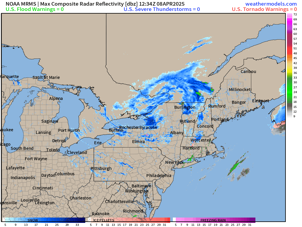
Meanwhile, winter continues over the Northeast with a strong area of low pressure spinning into New York.
24 Hour Snowfall Forecast
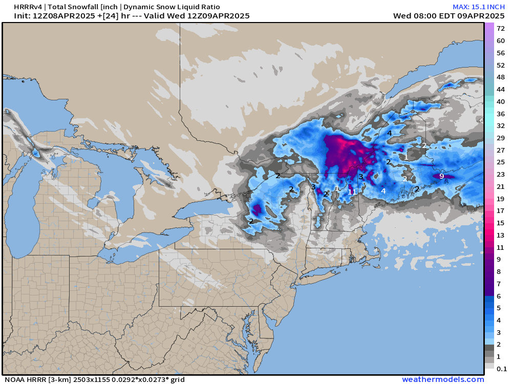
Could be 15-inches in Quebec, maybe a foot on Mount Washington, and Lake Ontario enhanced snowfall on the Tug Hill Plateau in the 8-10” range.

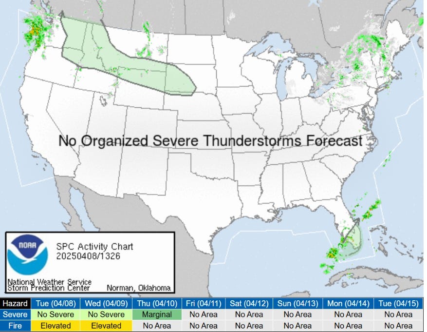
No severe thunderstorms expected today — or through next Tuesday!
HRRR Simulated Radar Today
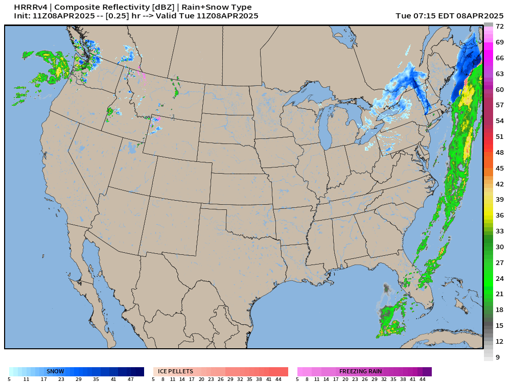
Low pressure into the Pacific Northwest — Northeast snowfall.
Early Afternoon Temperatures on Today, April 8th
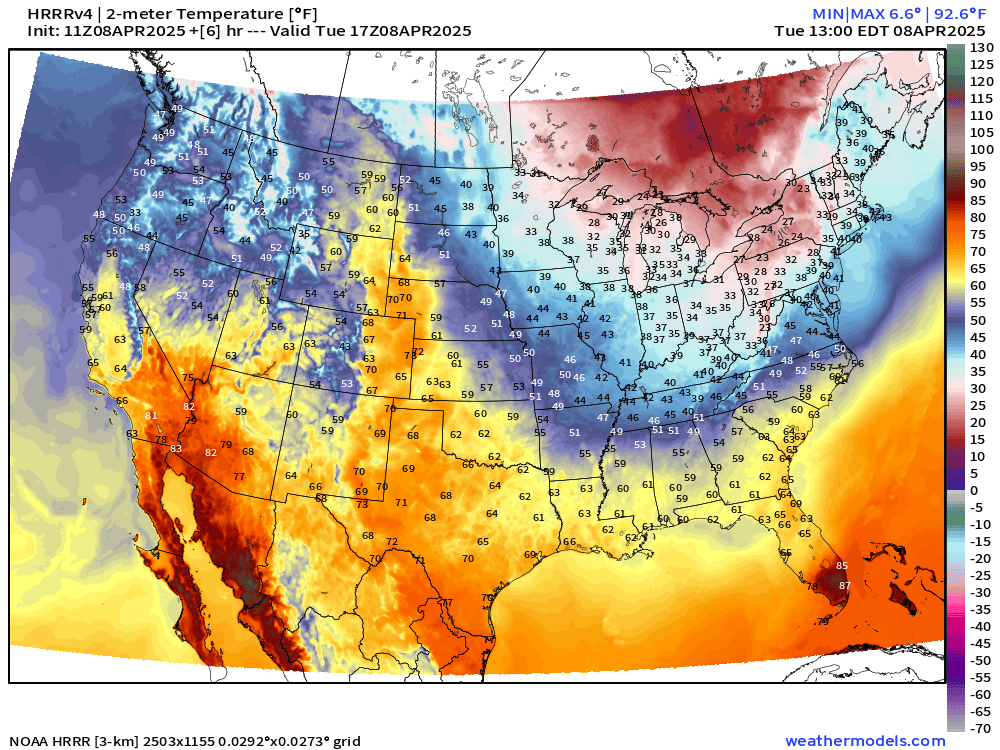
Chilly temperatures behind this cold front with 25°F below normal by early afternoon — only in the 30s in the Ohio River Valley.

Florida might see 90°F around Miami before the front and rainfall moves through.

ECMWF Precipitation Type through Thursday Morning
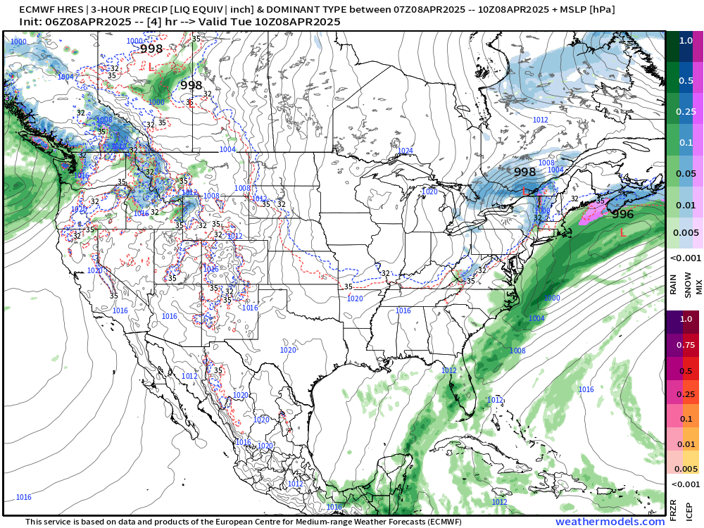
Quiet on Wednesday across much of the Lower 48 — except for another Clipper System in the Great Lakes with some mixed precipitation in Michigan, and heavier rainfall in IN/OH.
Keep reading with a 7-day free trial
Subscribe to Weather Trader to keep reading this post and get 7 days of free access to the full post archives.