


April 7, 2025 Monday Weather Update
Much cooler week ahead with mostly dry conditions

Good Morning!
Current Integrated Vapor Transport

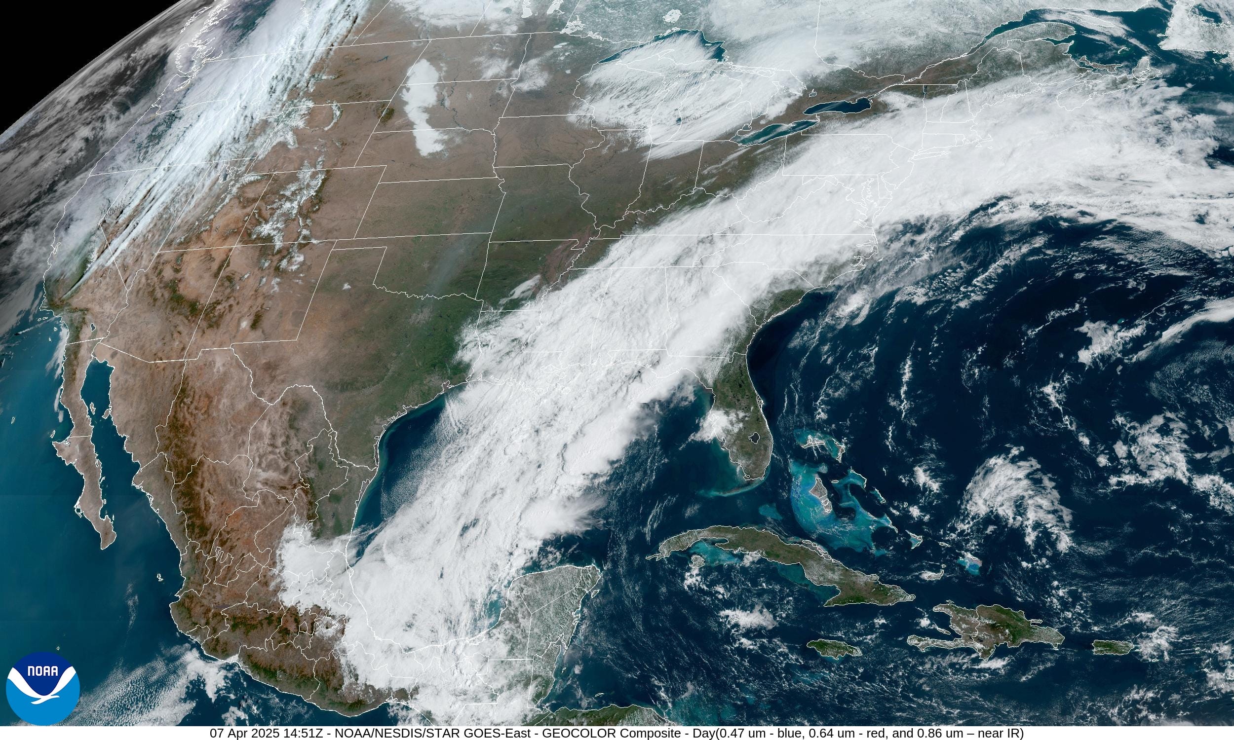
We’re finally saying goodbye to this persistent wet pattern with the atmospheric river unloading enormous rainfall amounts across the mid-Mississippi River Valley with Arkansas, Missouri, Tennessee and Kentucky all being flooded. Cloud cover will take a while to clear across the Southeast but soon drying and sunshine.
Total rainfall in the last 7-days has large area of 8-10” from NE Texas into Memphis and to Cincinnati.

In the past 60-days, as compared to climatology / normal, the Great Lakes into the Ohio Valley and down the Mississippi all in the 100-200%+ range of precipitation.


Some updated numbers on the last 2-week’s worth of rainfall across the Ohio River and Mississippi River Valleys:
USA [Lower 48] received a total of 108T gallons of precipitation (including liquid equivalent of snowfall):
Texas: 10.6T gallons, Arkansas: 7.4T, Kentucky 6.2T, Missouri 5.1T, Michigan 4.9T, Tennessee 4.8T, Alabama, 4.5T, Louisiana 4.1T, Mississippi 3.8T, Ohio 3.8T Illinois 3.8T, Oklahoma 3.6T, Indiana 3.5T
I do have precipitation data from the ERA5 reanalysis back to 1940, but it’ll take some processing to determine the historical rarity of this amount of rainfall especially in late March to early April.
Lightning Density Last 7-days

Exceptional lightning coverage across Arkansas with so many thunderstorms!
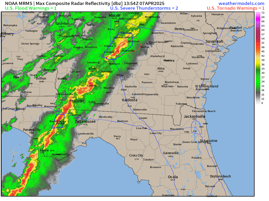
Weather Today

The tail end of the cold front still has the [Slight] chance of severe weather including tornadoes.

Tallahassee next in line for nasty storms with potential for damaging winds.
Current Radar: 11:14 AM ET
HRRR Simulated Radar Today
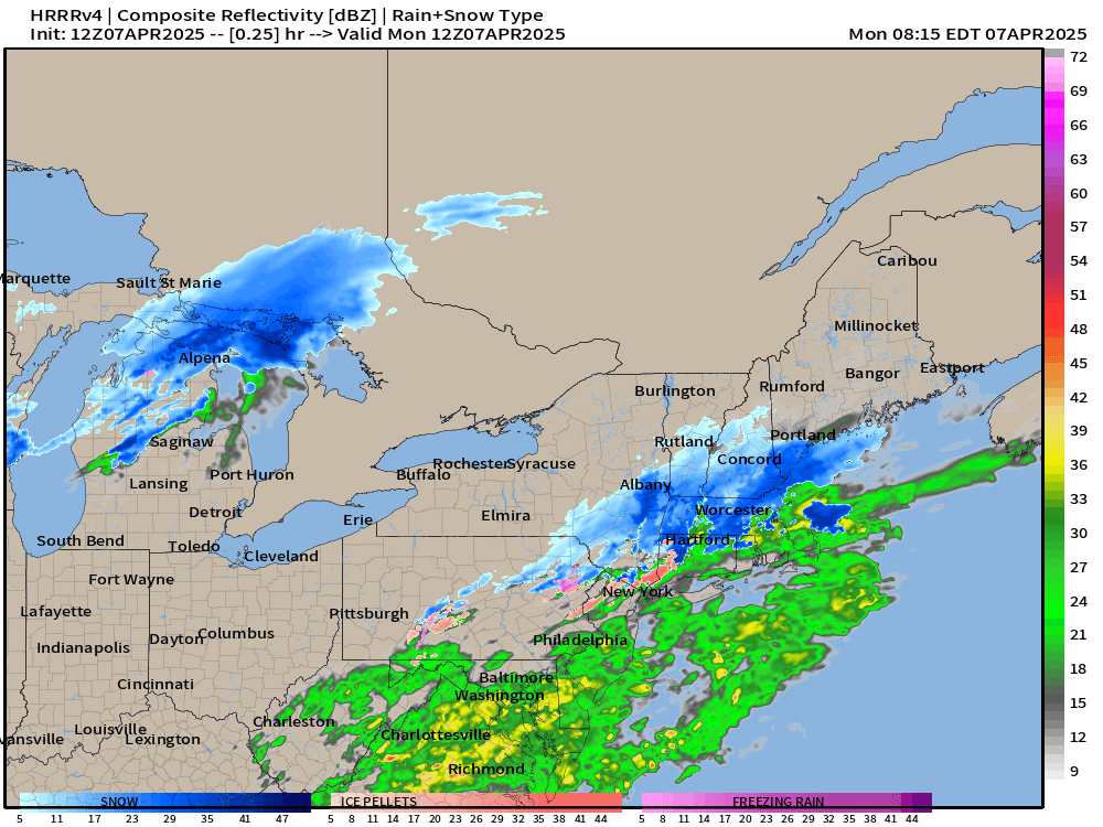
Awful Clipper System with snowfall across Michigan, Ontario including Toronto, Montreal, and New England.
HRRR Simulated Radar | 48 Hours Through Wednesday Morning

The Northeast will be dealing with this Clipper System with snowfall in Maine until late Tuesday. However, the rest of the Lower 48 will be mostly quiet with only some moisture into the Pacific Northwest — broken record there!
Keep reading with a 7-day free trial
Subscribe to Weather Trader to keep reading this post and get 7 days of free access to the full post archives.