


April 30, 2025 Wednesday Weather
Tornado potential in North Central Texas
Good Morning!
We’re 1 month from the start of Atlantic Hurricane Season. Not much going on across the tropics except for a dust cloud coming off the African continent. Large amounts of dust stabilize the atmosphere preventing clouds from breaking through the convective cap to form storms. Also, the dust keeps a lid on solar radiation reaching the ocean surface and tends to be a cooling agent.
NASA GEOS-5 Dust Analysis Today

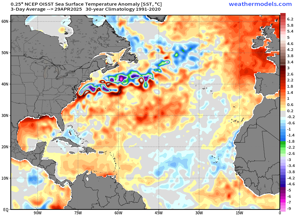
Sea Surface Temperature Anomaly
Amazingly — and a huge change from previous years — ocean temperatures in the main development region (MDR) of the Atlantic tropics are running below normal (1991-2020) climatology. The Gulf Stream is also a bit further south than normal.
Precipitation Observed Last 30-days

April 2025 has been a very wet month across the central Mississippi River Valley into the Ohio River Valley with many states over 10-12” on average including Kentucky and Arkansas.
Precipitation Anomaly (% of normal) last 30-days

However, not everywhere is way above normal. The Lower 48 taken as a whole is 108% above normal, but Florida has been exceptionally dry until yesterday with only scattered storms. Some places in the Sunshine State haven’t received an inch in the past month.


Precipitable Water Next 6-days
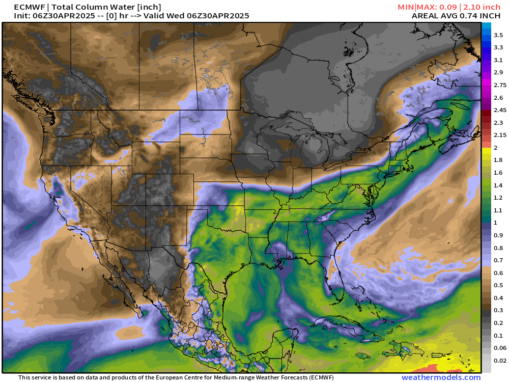
Over the next few days, the moisture plume out of the Gulf is replaced with dry and cooler Canadian air associated with the development of a ridge over trough blocking system. This will shut the door on moisture in the Plains and provide a longish dry spell for planting.
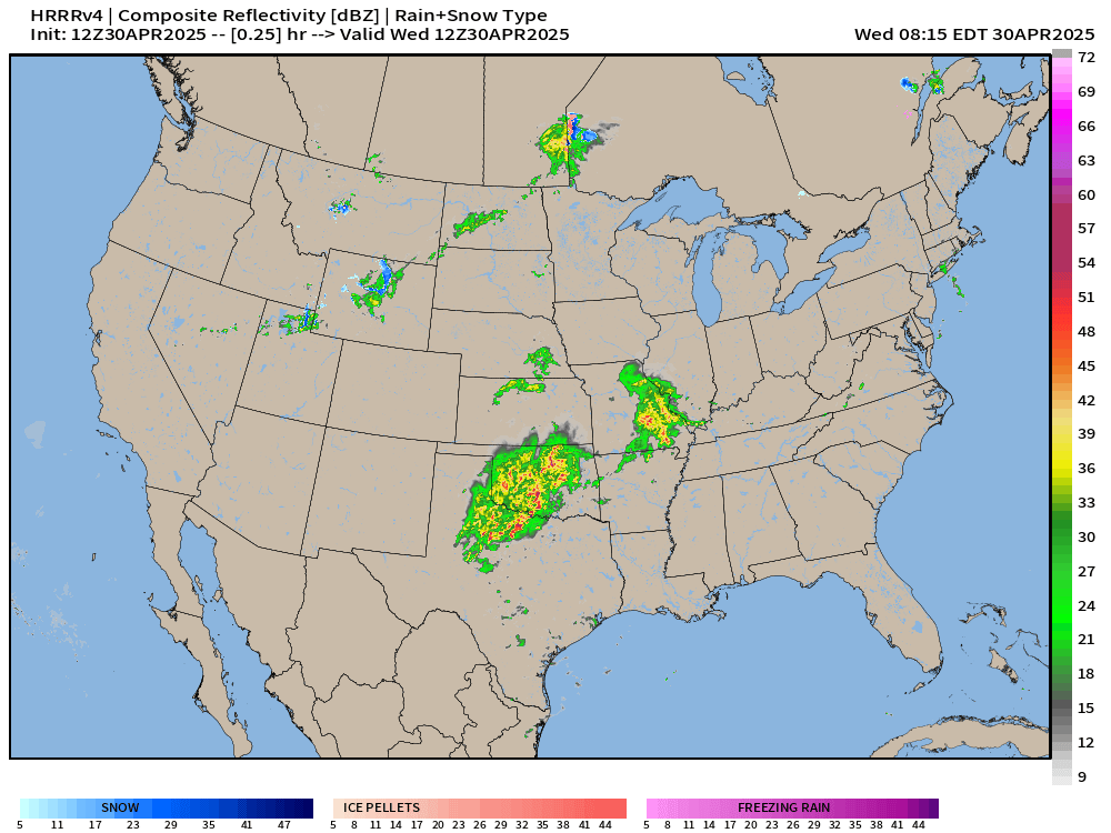
Today’s Radar: 10:44 AM ET
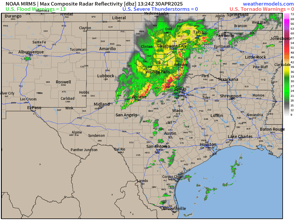
Watching a complex of storms move through Oklahoma with severe (damaging winds) just north of Dallas in Texas.

HRRR next 18-hours through 2 AM ET on Thursday
The storms hold together for the next 12-18 hours across ArkLaTex and intensify with Enhanced Risk of severe weather into the afternoon. Scattered showers and storms elsewhere in the northern Plains and Midwest but not an all day event.
RRFS-A has a slightly different approach to the squall line and discrete supercell development ahead of it.

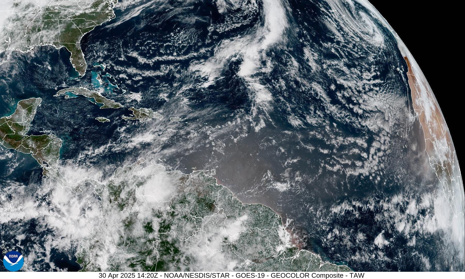
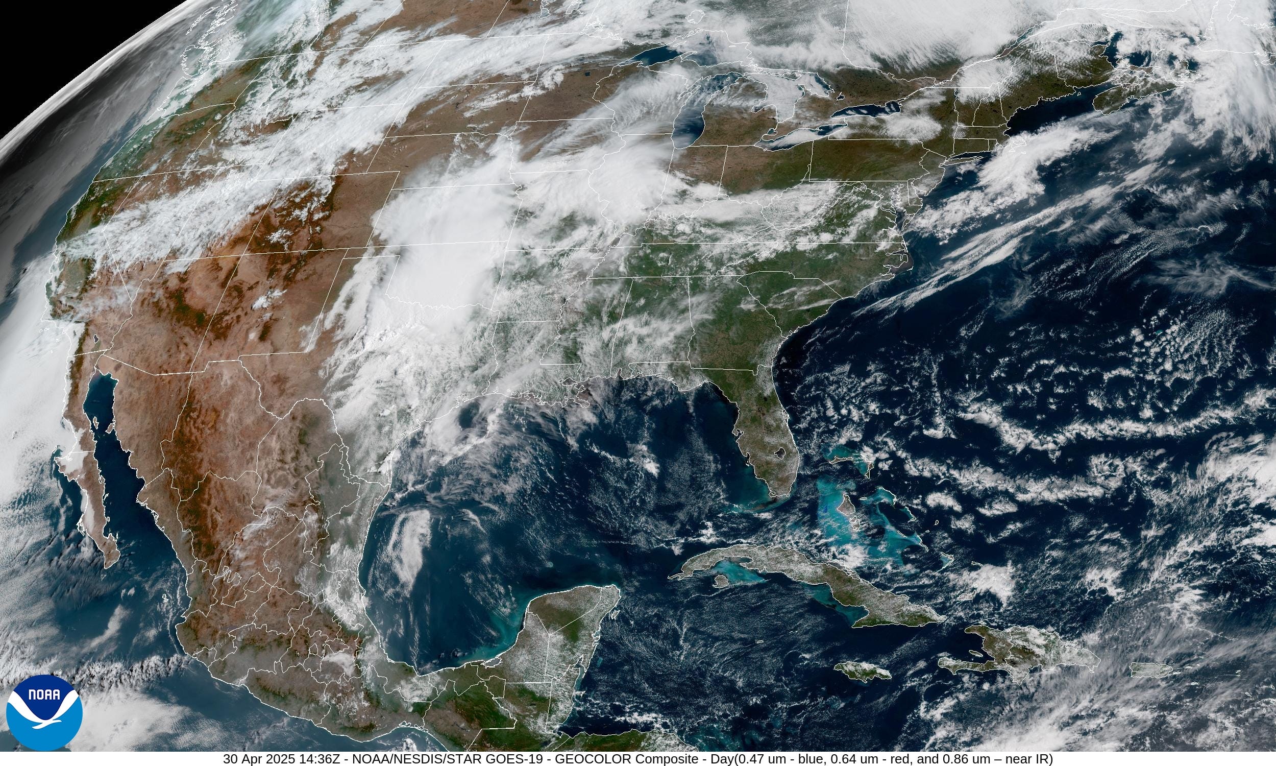
Current Satellite Imagery
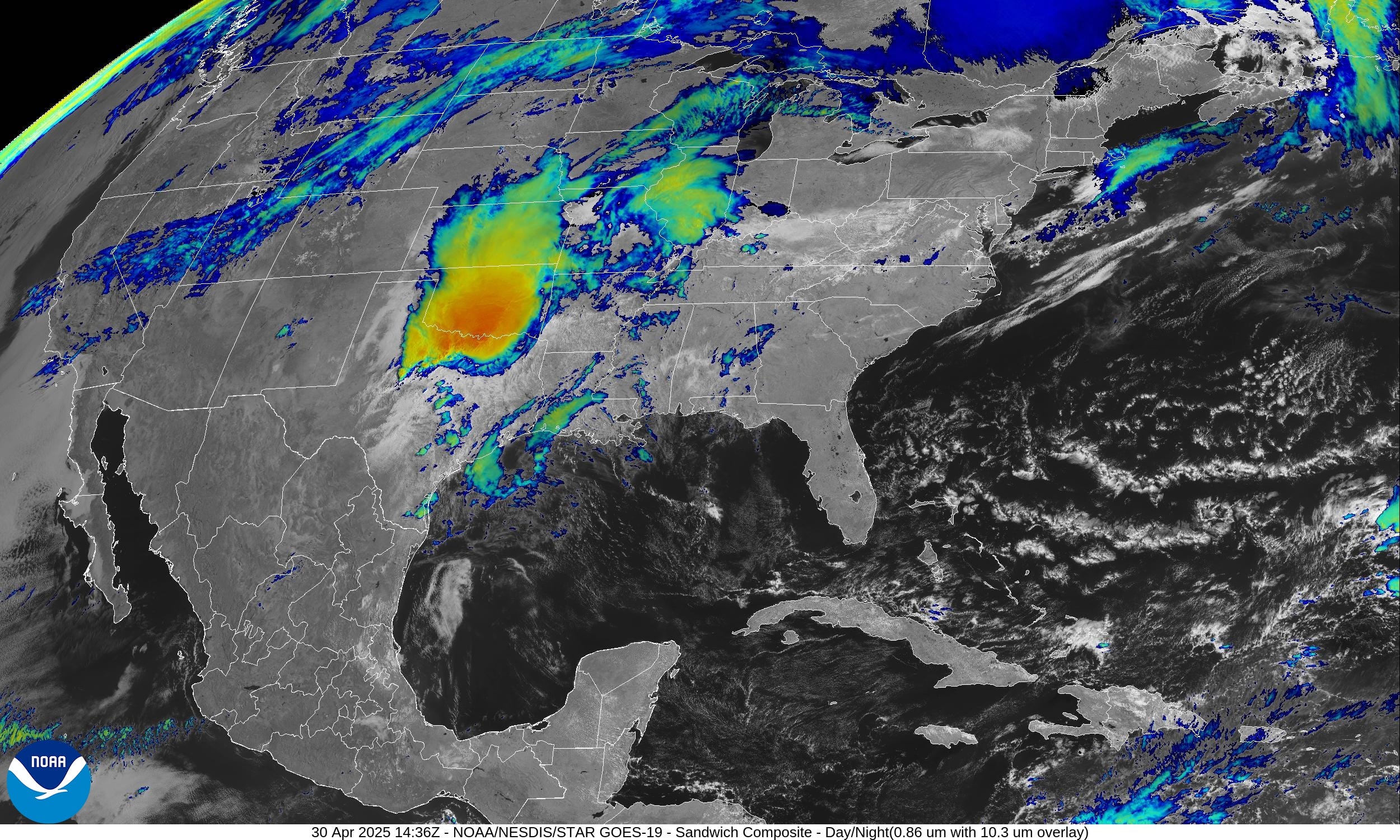
Just that area of convection in north Texas and Oklahoma. Otherwise mostly clear around the storms with a beautiful day shaping up for most of the Lower 48.
Weather Summary Wednesday

Boatloads of rain just south of the warm front boundary draped across Kansas into the Ohio River Valley.
All new paid subscribers can use this coupon link to receive 20% off the Newsletter and receive all daily updates heading into hurricane season. All current paid subscribers are locked in to original $5/month rate as friends of Ryan.
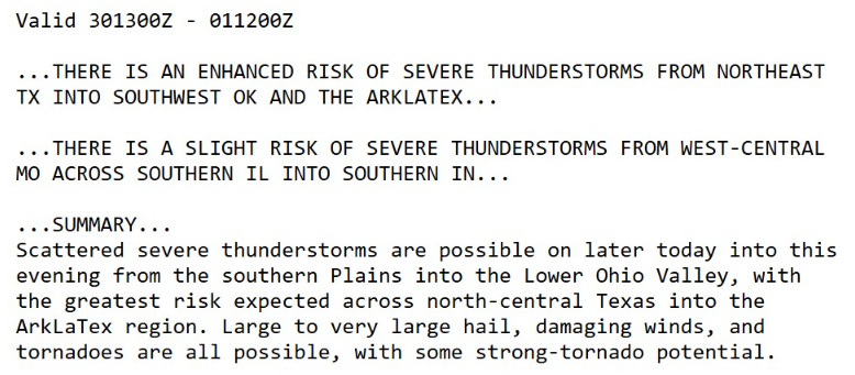
Enhanced Risk of Severe Storms
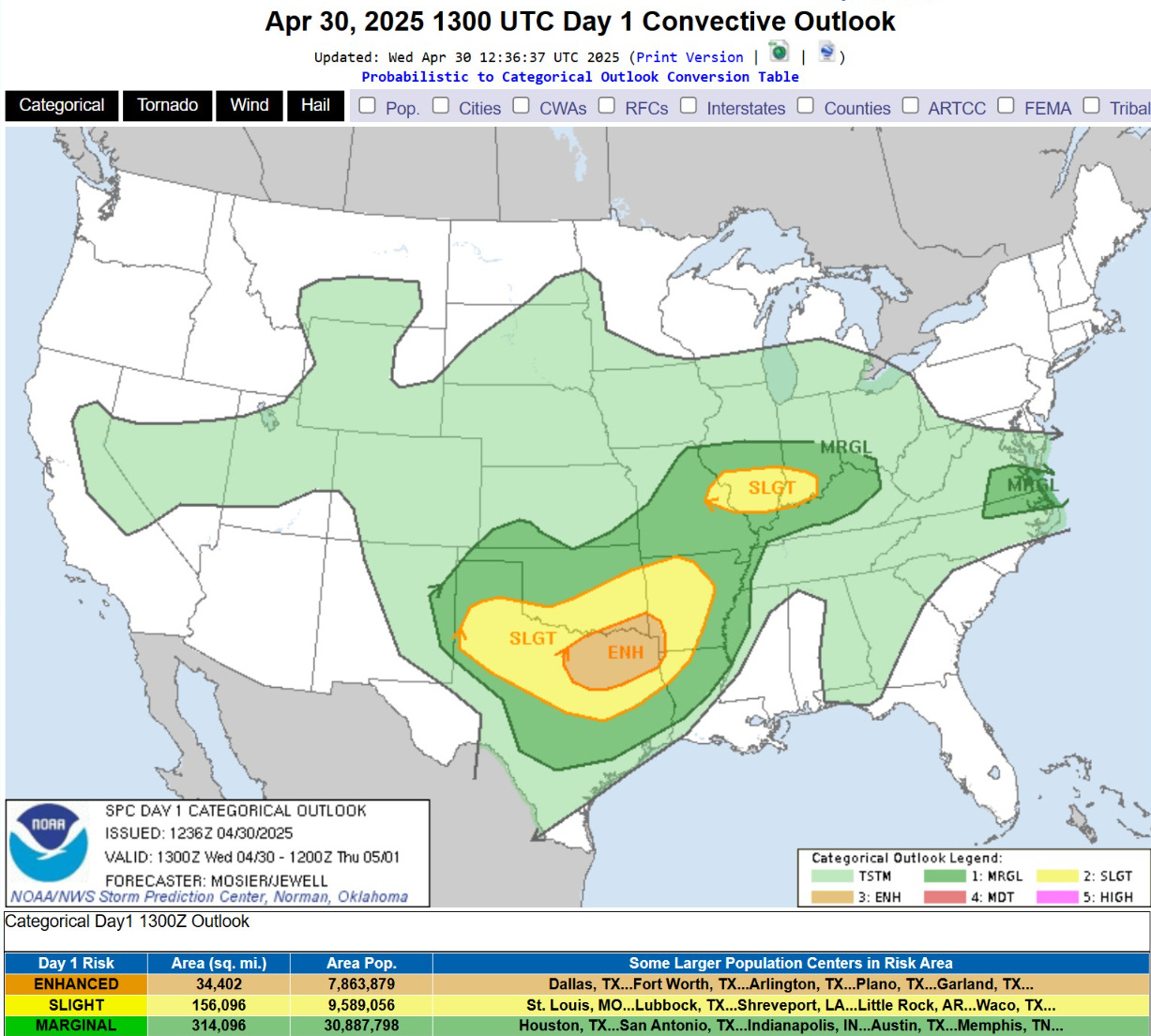
Main focus will be on NE Texas for potential for strong tornadoes later this afternoon.
Temperature Analysis | 10:15AM ET

Chilly this morning across Northern Michigan with only 110K population below freezing, but they deserve a mention!

Temperature Anomaly | 10:15AM ET
Keep reading with a 7-day free trial
Subscribe to Weather Trader to keep reading this post and get 7 days of free access to the full post archives.