


April 27, 2025 Sunday Weather Update
Severe weather outbreak likely Monday in the Midwest
Beautiful Sunday!

Aside from some scattered showers with the heating of the day, the Southeast looks warm and plenty nice to head outside. Florida will be quite hot in the 90s so maybe the beach is where many will end up.
The area of low pressure in New England will exit and take its rain and clouds, but probably not much warming out of the 50s in Boston. Monday will be considerably nicer with sunshine and 70s.
A cut-off low is spinning over Nevada and will help direct moisture and upper-level winds into the northern Plains and Midwest into Monday for the potential of a major severe weather outbreak. SPC is up to MODERATE risk, which is substantial at Day 2 (also was in the Day 3 forecast yesterday) suggesting all of the ingredients are in place for large hail and strong tornadoes within supercells.
Current Satellite Imagery
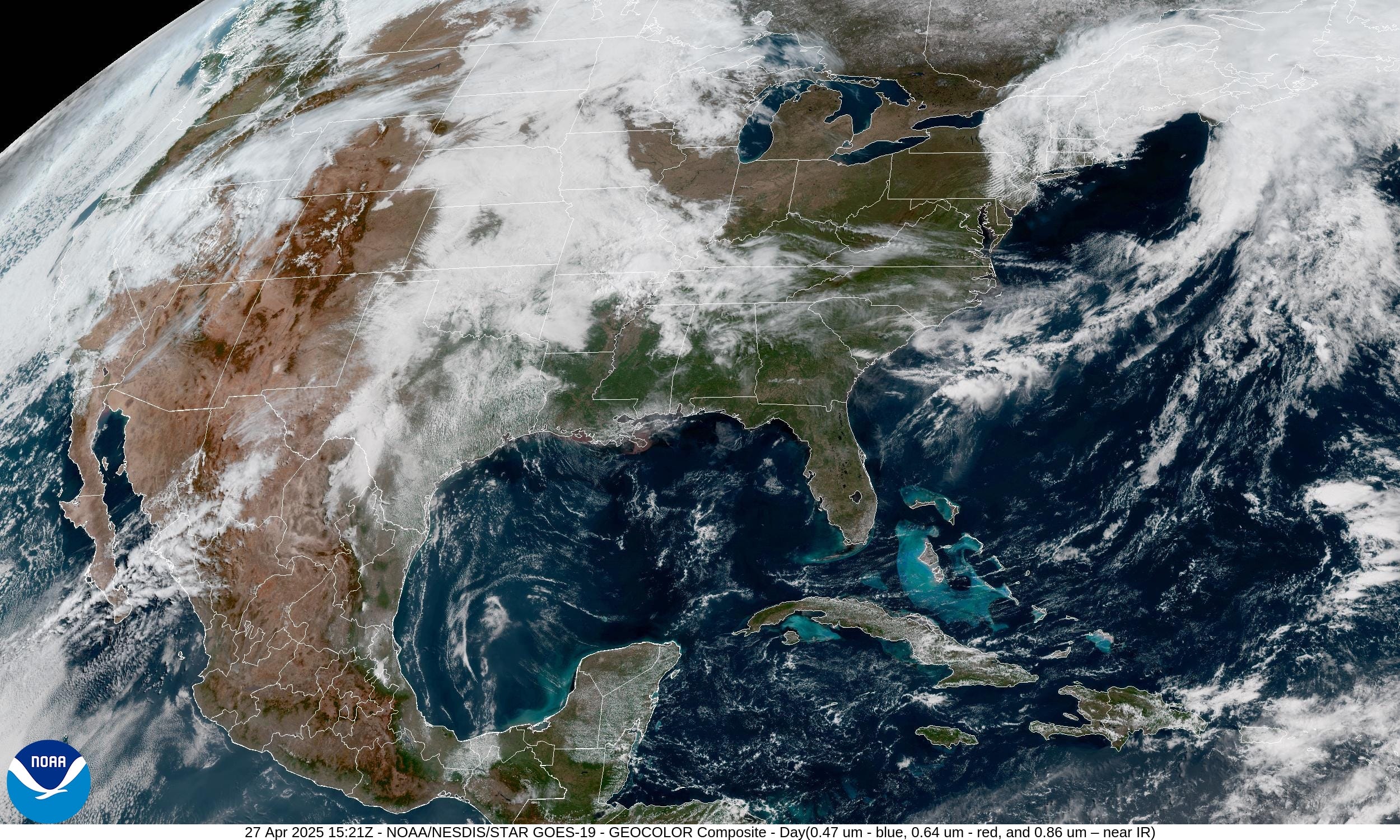
New England is socked in with clouds — but brilliant sunshine and warmer temperatures behind the front from Michigan to Maryland. Perfect late April spring day.
Florida and the Gulf of Mexico are clear. Clouds cover the central Plains.
Severe Weather on Sunday
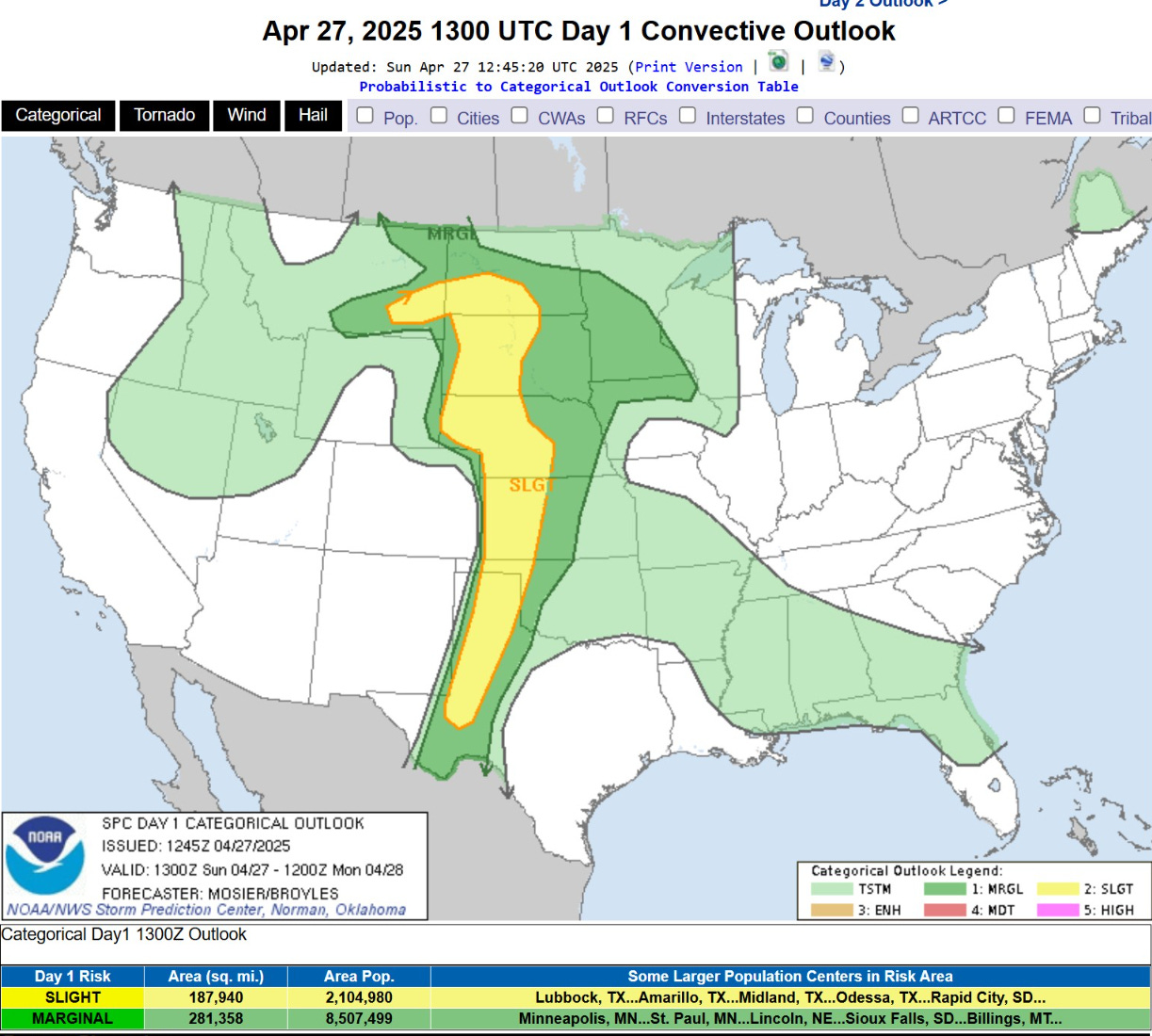
Only a slight chance of severe weather but still potential for large hail and a brief tornado where a supercell finds the optimal environment after the heating of the day.
Sunday’s Weather
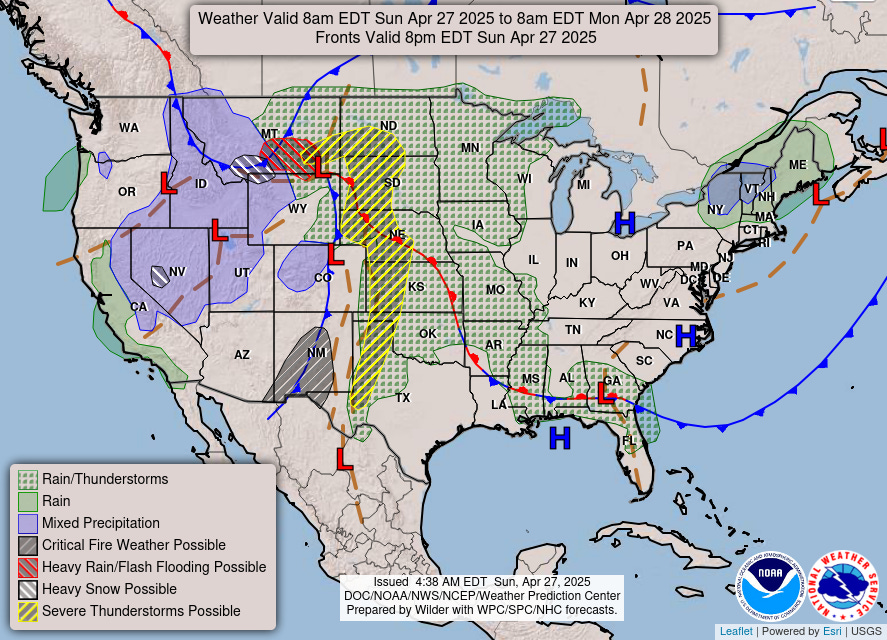
A frontal boundary extends out of the Plains into the Southeast but not expecting much more than pop-up showers. Hardly a washout today.
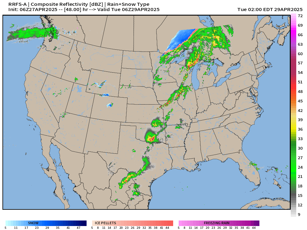
HRRR Simulated Radar 48-Hour Forecast through Tuesday 8 AM ET
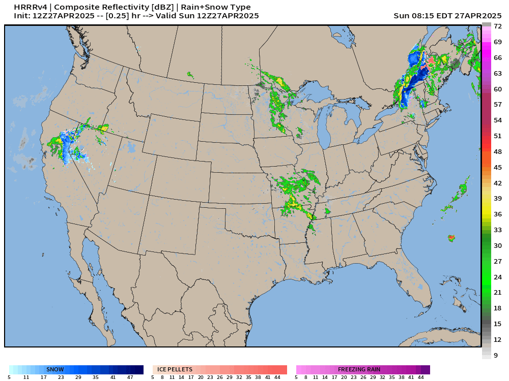
HRRR through Monday is not very aggressive at all with the convection across Minnesota and Iowa — failing to get it organized after the storms fire in the evening.
HRRR may be missing something …


So, let’s look at RRFS-A (Experimental) using a different model core (MPAS). This model has much more substantial severe thunderstorm development (6 PM ET) on Monday matching the SPC expectations.

Later at 2 AM on Tuesday, a long line of broken storms extends from Michigan to Texas along the frontal boundary.
The Upper-Level ingredients are in place with strong winds from 850 mb to 500 mb out of the SW with the positive trough tilt. Any storms that develop within the very moist environment will have the opportunity to rotate. GFS 12z +36 hours


Convective Outlook on Monday | Moderate Risk
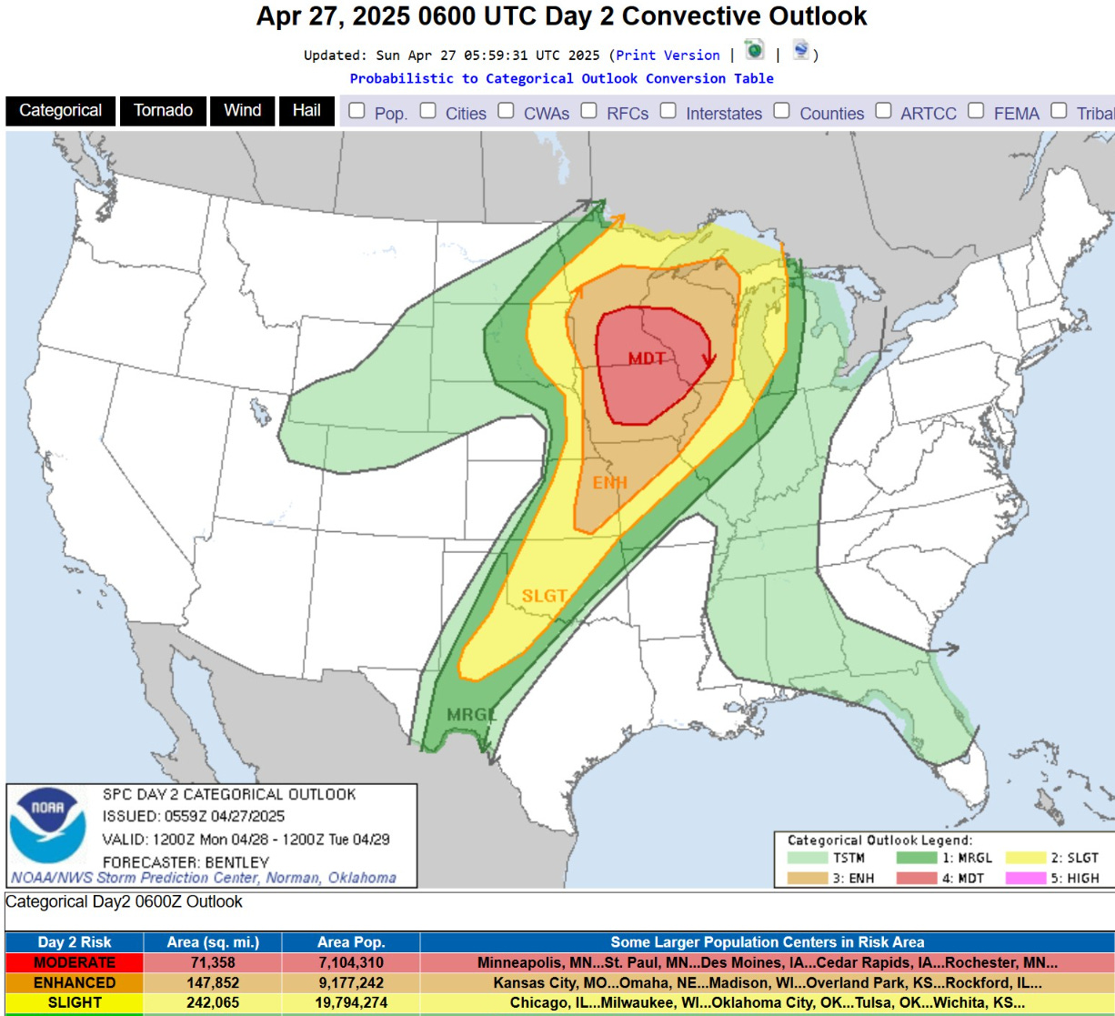
Significant population areas are under the Moderate Risk including Minneapolis-St. Paul, Des Moines, and Cedar Rapids. The Enhanced Risk area almost reaches St. Louis and Chicago, and includes Kansas City and Madison, Wisconsin.
Keep reading with a 7-day free trial
Subscribe to Weather Trader to keep reading this post and get 7 days of free access to the full post archives.