


April 24, 2025 Thursday Weather Update
Busy pattern continues into next with rainfall
Good Morning!
Over the next 10-days, the typical Spring moisture flow out of the Gulf continues meaning day after day convective/storm chances in the Plains and Southeast. Troughs and frontal boundaries push back the subtropical air mass, but it regains latitude and pushes north bit by bit as the Spring advances.
In the tropics, the Intertropical Convergence Zone (ITCZ) billows with showers and storms as it moves westward just north of the Equator. As we approach summer, the ITCZ shifts northward to 10°N latitude and tropical storms can more easily form out of tropical waves or monsoon troughs.
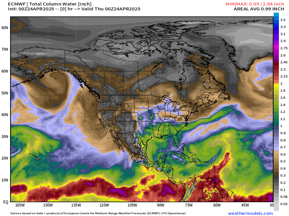
My favorite Weather Model Parameter: Precipitable Water
Observed Lightning over the past 2-days and 14-days


The thunderstorm lightning strike “hot spot” over the past several days has been north Texas from the panhandle into Dallas, and then along the front range dry line boundary. Storms form in west TX/OK/KS and then track E/NE with some organization into mesoscale convective complex systems (MCS) and can sustain themselves into the overnight hours. Around a strong ridge, these are typically called “ridge rollers” and can spawn long-lived derecho or MCS with damaging winds. We haven’t seen that yet this Spring.
Observed Rainfall Last 2-weeks

The thunderstorms were slow moving over the past few days and dumped a lot of rain on several areas including DFW and Houston. Quite the coverage of more than 2-inches over the past 2-weeks with embedded localities over 12”.

Big winner just WNW of DFW with 12.75” observed in 2-weeks
Missouri and Oklahoma also with areas of up to 8”

Current Satellite Imagery
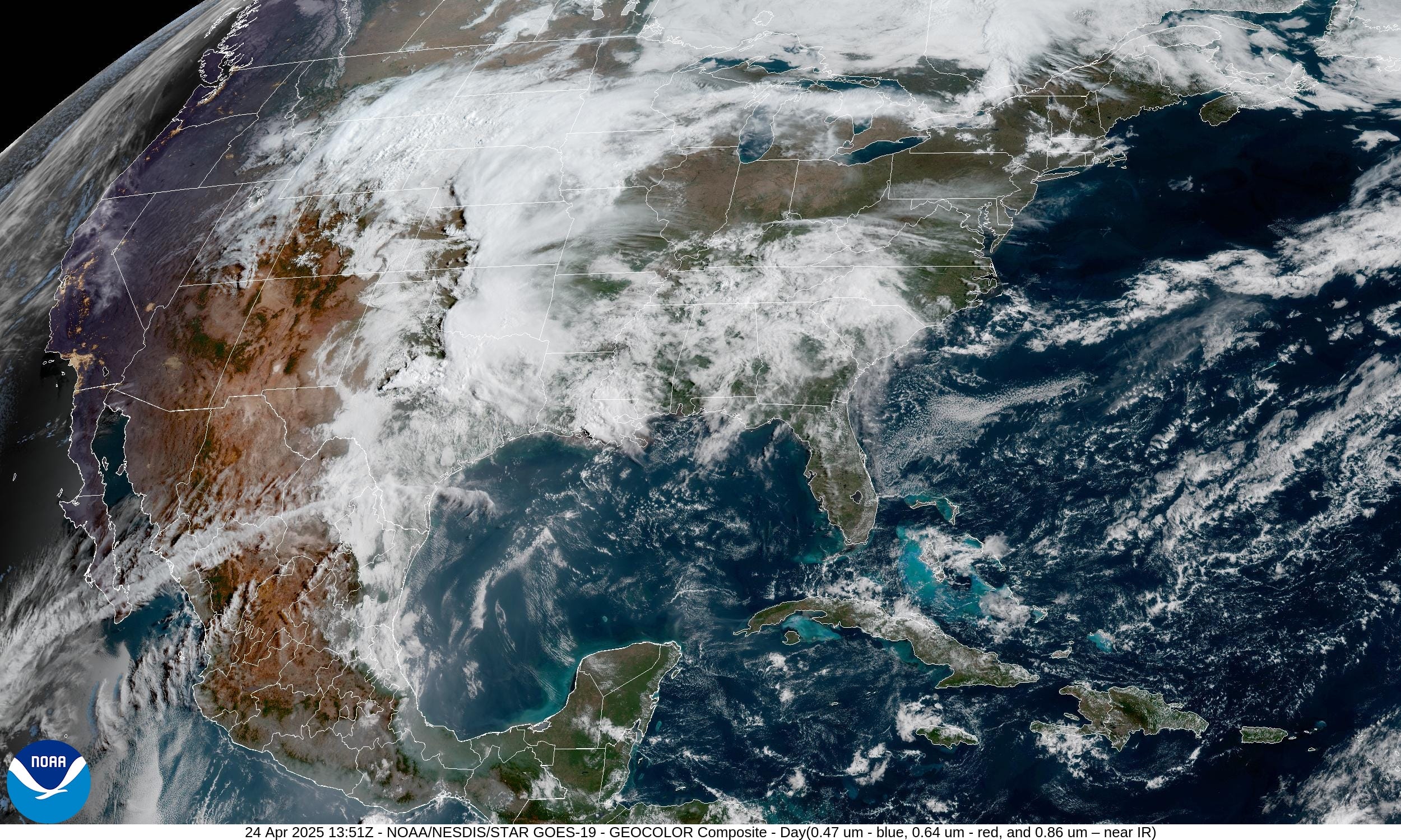
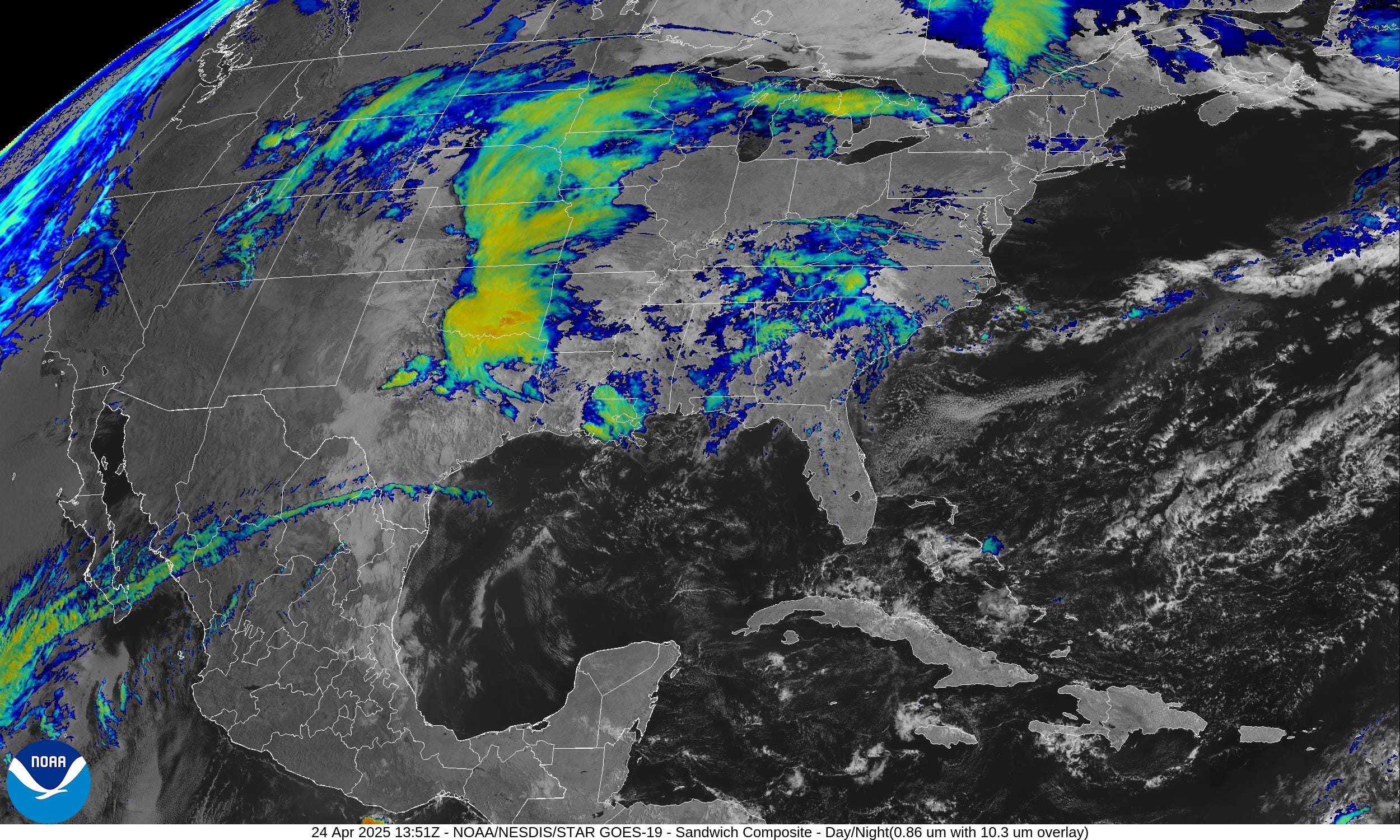
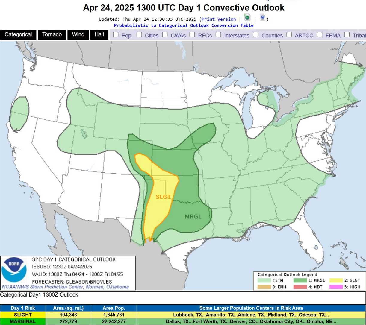
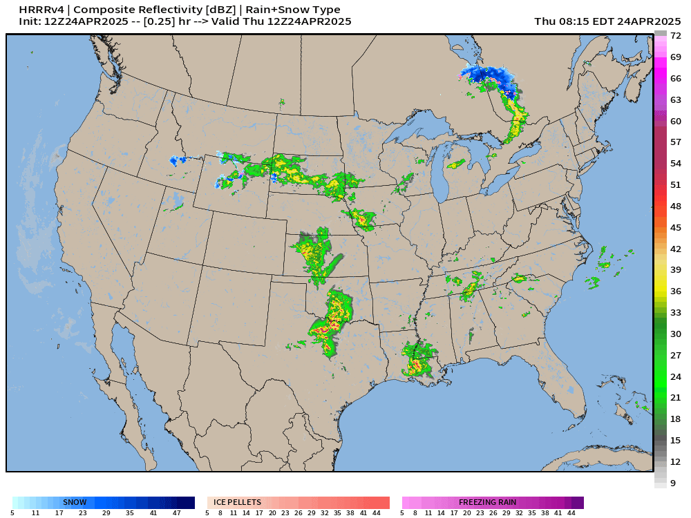
Leftover showers and storms from yesterday’s convective bursts continue this morning with clouds in a moist air mass. Heavy rain is the primary threat with a Slight Chance of Severe weather in the Plains from Texas to Iowa.
We’re dealing with stalled frontal boundaries and generally unstable air leading to cloud cover. This wet pattern will continue into early May.

Radar earlier through 8 AM CT showing the rainfall approaching Dallas stretching into southern Oklahoma. No severe warnings at this time.

HRRR 18-Hour Forecast through Friday 2 AM ET
Less convective coverage later this afternoon compared to the last 2 days where the storms formed in the lee of the Rockies. Bountiful rainfall as the weak area of low pressure tracks through the Plains. No major problems especially if you need more rain!
Temperature Analysis | 9:30 AM ET

60s very popular this morning!
Temperature Anomaly | 9:30 AM ET

Overall the Lower 48 is 4.2°F above normal
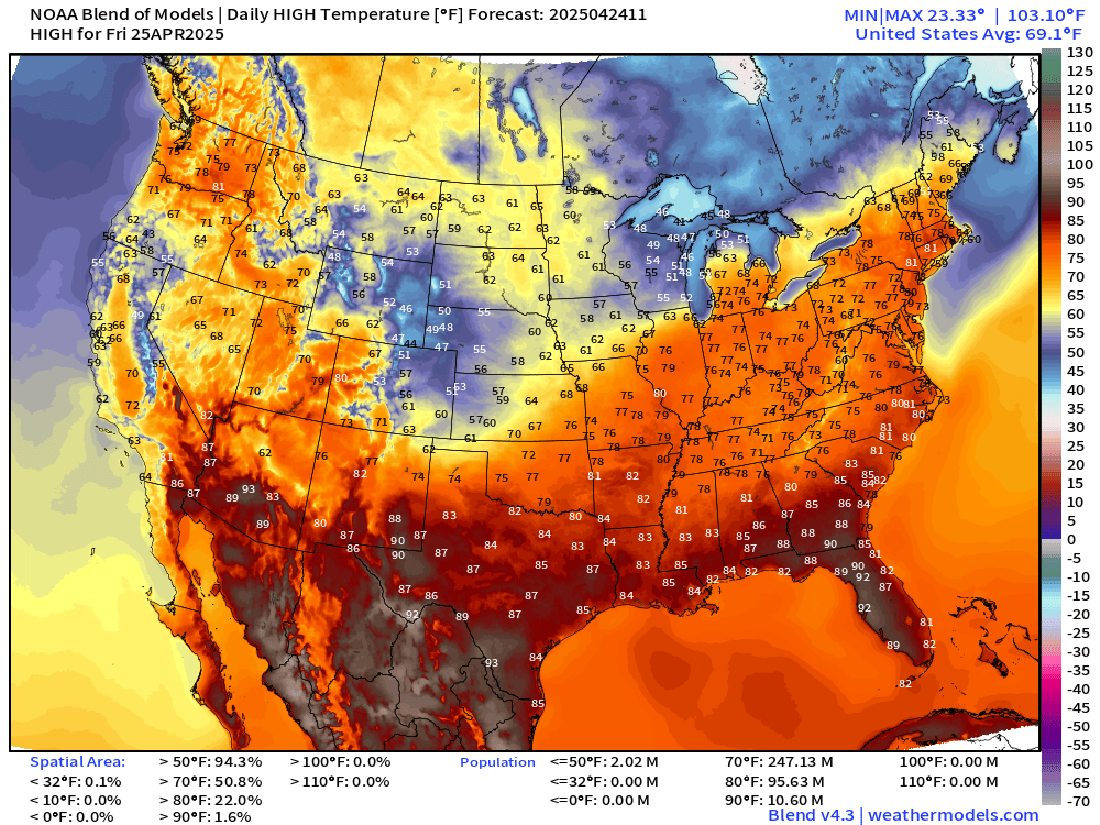
High Temperatures on Thursday

80s into Southern Michigan

Close to 80°F in NYC

80s into Detroit. 265 million at/above 70°F, upper-70s in NYC and Washington D.C.
High Temperatures Next 8-days
Glad to see more sustained orange on the map = 70s heading into May. Not seeing any heat waves, but seasonable warmth in early May in the 70s and 80s.
Precipitation and MSLP Next 6-Days | ECMWF 06z
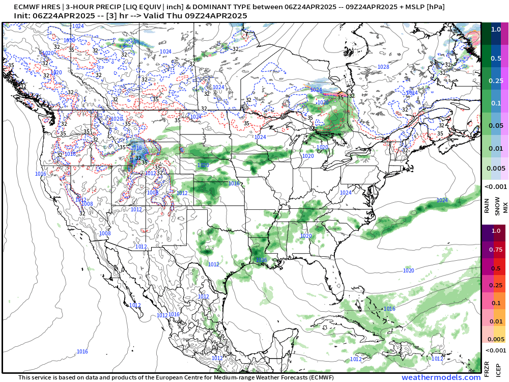
Substantial storm system for Northeast this weekend. Then, just waves of rain and storms with the progressive pattern — plenty of troughs and ridges moving through on a 1-2 day cycle keeping the Lower 48 quite unsettled.
Rainfall | Ensemble Mean Next 15-days

3” to 4” of rain in 15-days across Texas including Dallas.

NWS Rainfall Next 72-Hours

NWS WPC Precipitation | Next 7-days

2” to 4” in the central Plains from north Texas to Oklahoma City over the next 7-days. More than 1-inch extending across the upper-Midwest and into Canada. Also more than 1-inch in Ohio River Valley for the next week.
Blend of Models | 10 Days Precipitation

ECMWF 06Z AIFS | Upper-Level Pattern for North America next 10-days

A strong pan-Canadian trough sets up shop into early May, which means generally ridging and warmth to the south with cooler temperatures over Arctic Canada.
The weekly temperature anomaly from AIFS shows this pattern well.


Over in Eastern Europe and North Africa, we see the effects of the cut-off low meandering through the central and Eastern Mediterranean


ECMWF EPS 00z | Weekly Temperature Anomaly
Much above normal for the next 2-weeks, except for California.
Week 1: April 24 - 30

Week 2: May 1 - May 7

Texas cuts back on the heat for Week 2, and the overall temperature anomalies have gone downward compared to last few days.
Who writes and researchers this Newsletter? Dr. Ryan N. Maue [X https://x.com/ryanmaue] with 20-years experience of daily weather model production and analysis. You may have seen my weather maps! I live in Atlanta but was born and raised in Northern Michigan. I know snow, and southern heat and humidity.
Maps sourced from weathermodels.com designed and innovated by yours truly! Please subscribe there for real-time access to the newest maps, charts from all of the weather models including ECMWF.