


April 23, 2025 Wednesday Weather Update
Continued convective showers east of the Rockies
Good Evening!
After about 20-years of making weather maps an old way [GrADS], I’m in the process of adapting code and scripts to be more Google Maps oriented but with some tricks up my sleeve to increase the quality and customization. The main issue with web Mercator is not being latitude and longitude based but on tiles zoomed at various local, regional and global scales. Raw weather model data is processed in latitude and longitude space (EPSG 4326) and you cannot warp the web maps to latitude and longitude without losing the quality of the map because it become distorted. So, we need to go the other direction and assemble the maps with web Mercator. I’m not aware of a sturdy, operational workflow or business that provides this, so we’ll be on the ground floor of something new and cool. The end result will be more broadcast TV style mapping and pre-rendered output that should be eye-popping.
Example of styling of a placename map + roads


Almost done. Paid subscribers will have access to the App when it’s ready for Beta. It’s past MVP but it can’t handle the load of 100 users let alone 100,000, but those are good problems to have, right?
Current Satellite Imagery
Convection has billowed along the front range into the Plains and within the warm, moist air mass of the Southeast.
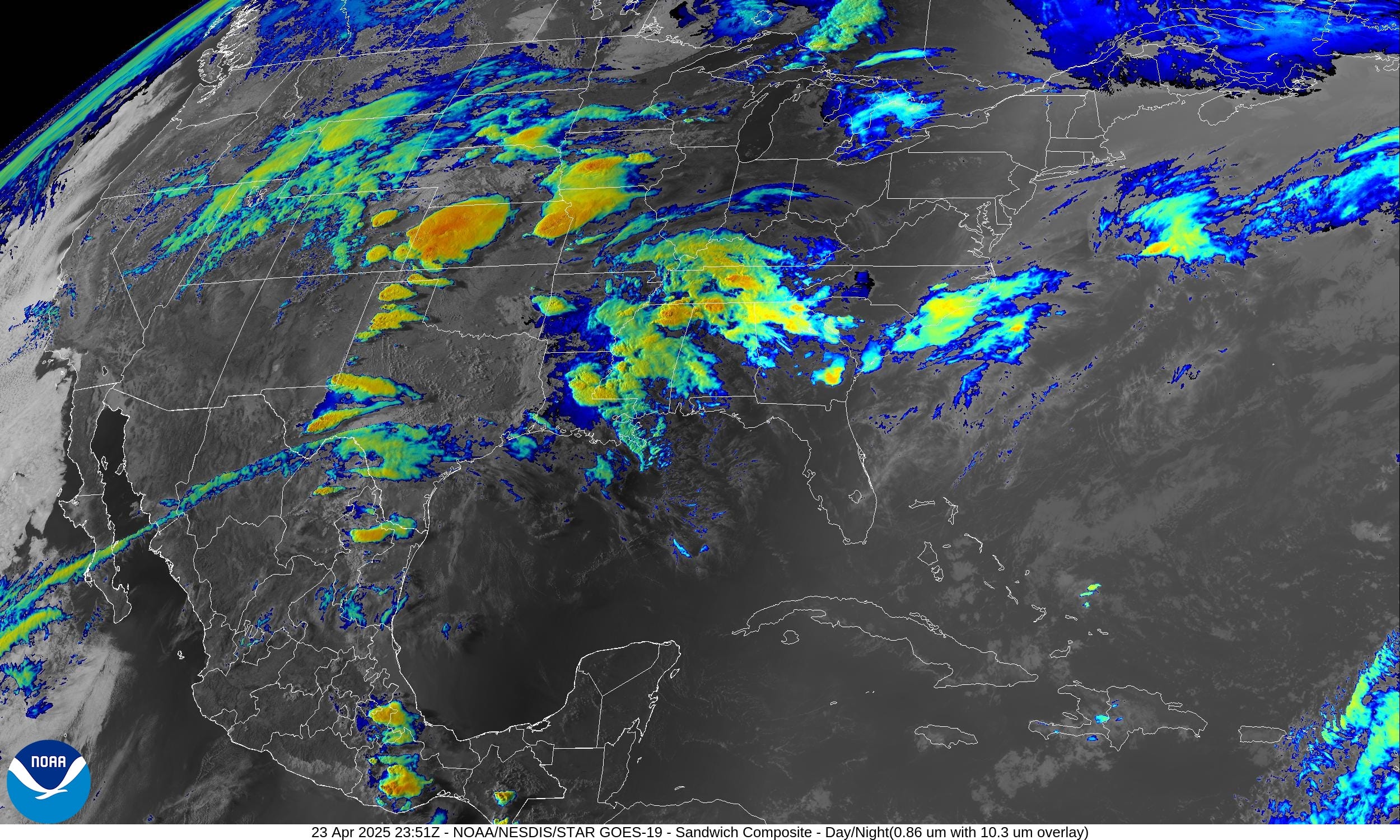
Yet again storms have fired in West Texas this evening, maybe a bit further west than yesterday evening. Over the next few hours, they will likely combine into a couple of Mesoscale Convective Systems (MCS) with potential for some damaging winds along the path to the east.
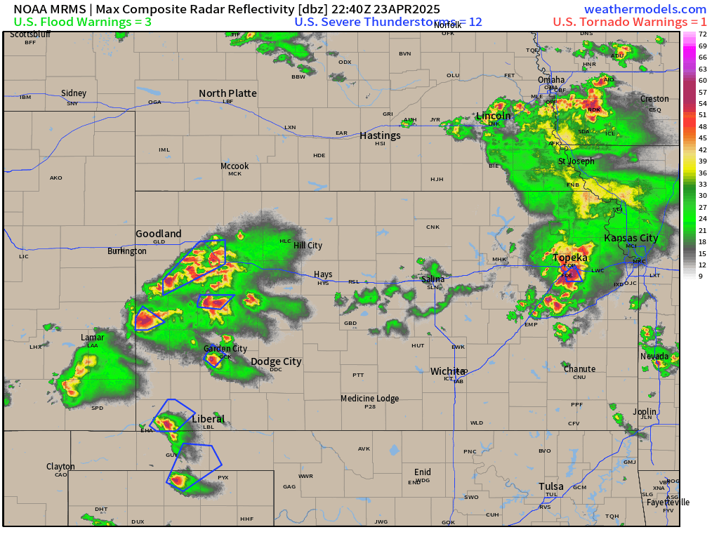
Not seeing tornadic cells but slow moving, heavy rain, winds, and hail producing storms in western Kansas and then heading into Kansas City and Missouri.
HRRR 48-Hour Forecast through Friday 2PM ET

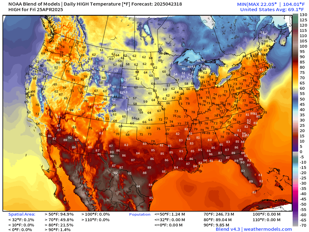
The storms continue into Friday with scattered coverage. If you get beneath a slow moving complex of storms, then you could easily see 2”-4” of rain, which is probably quite welcome for your gardens.
Temperature Analysis | 7:15 PM ET

Temperature Anomaly | 7:15 PM ET

Overall the Lower 48 is 4.5°F above normal
Weather Through 8 AM Thursday
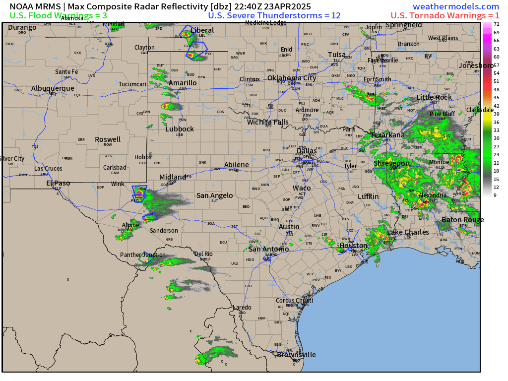
Slight chance of severe weather is verifying across West Texas and Kansas with severe thunderstorms watch boxes including some warnings.
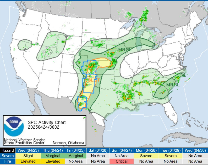
The culprit is a stalled frontal boundary across the Southern U.S. helping to lift the warm, moist air and produce convection.

Weather on Thursday with Fronts at 8 PM
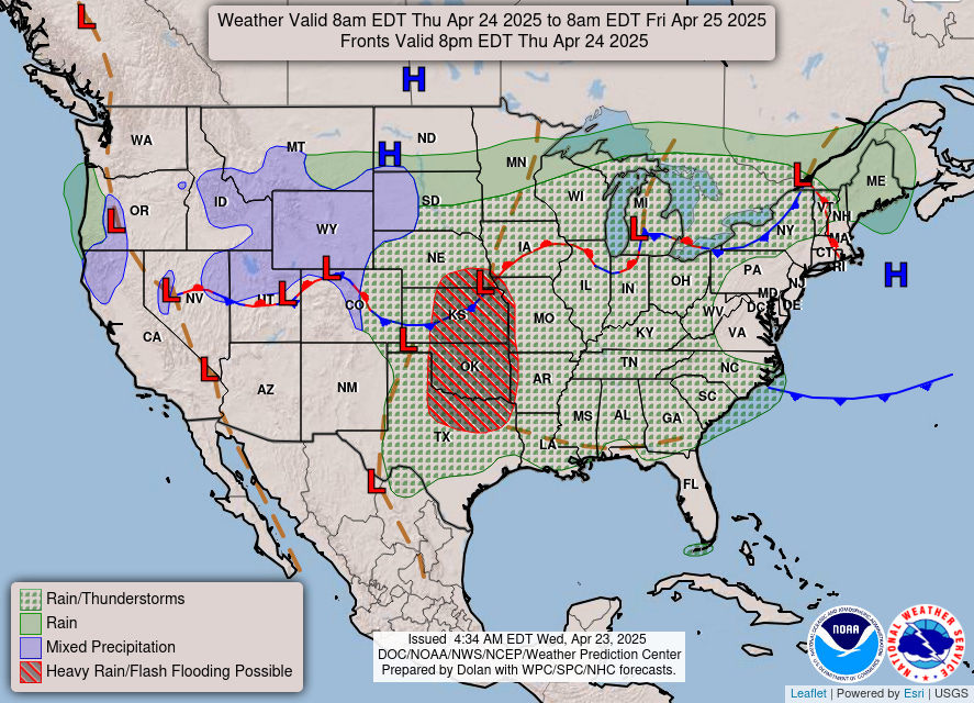
Not expecting severe weather on Thursday but heavy rain and flood potential in from north Texas including Dallas up to Omaha.
Lows Thursday Morning

High Temperatures on Thursday

80s into Detroit. 265 million at/above 70°F
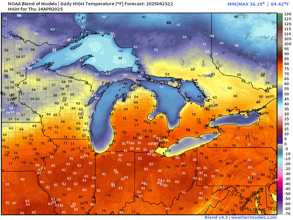
70s in NYC and Washington D.C.

High Temperatures Next 9-days
Glad to see more sustained orange on the map = 70s heading into May. Not seeing any heat waves, but seasonable warmth in early May in the 70s and 80s.
Keep reading with a 7-day free trial
Subscribe to Weather Trader to keep reading this post and get 7 days of free access to the full post archives.