


April 22, 2025 Tuesday Weather Update
Unsettled pattern east of the Rockies with plenty of rainfall
Good morning!
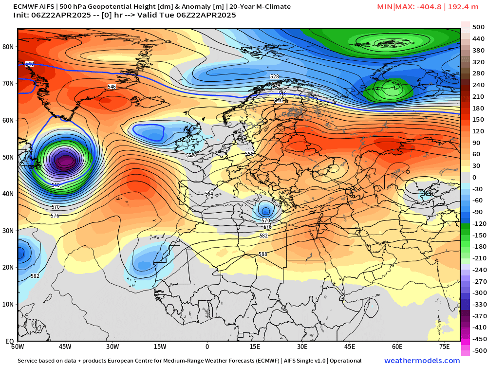
Let’s take a quick trip to Europe and North Africa to see some spinning cut-off troughs and Omega blocks forming from typical downstream Rossby wave progression across the Northern Hemisphere middle latitudes.
A sequence of troughs collect over the Mediterranean and if configured just right, they can access the cooler air from the polar front over Scandinavia and Germany.
At Day 10, AIFS has a Omega block sitting over the Med with the two lows or troughs and counter-clockwise flow helping to shunt cooler, moist air into North Africa, specifically Libya.
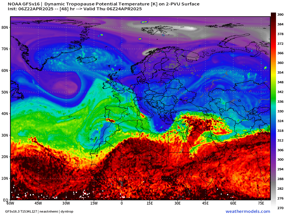
The Dynamic Tropopause simulation from GFS shows this long-lasting cut-off from the main middle latitude jet stream with rather strong reflection over the central and eastern Med.
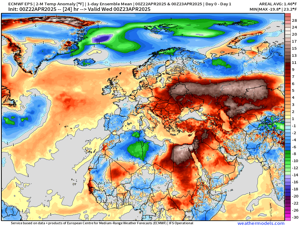
The result is much below normal temperatures in Libya and Egypt by Days 8-14 thanks to the much cooler air being pulled south out of northern Europe. However, downstream, very HOT — way above normal temperatures over Iran, Afghanistan, and Pakistan.
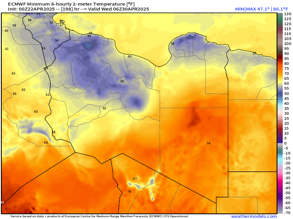
Temperatures in Libya — I know this is random — but can be relatively cool in the 40s and 50s overnight along the coast. We think of the extreme heat in the desert but it’s interesting to see that is not always the case even heading into May. During my graduate student days, I was fascinated by abnormal or extreme upper-level configurations that brought extreme (1% or 99%) outcomes to locations that typically see rather mundane or not variable weather.
Current Satellite Imagery

Back to the United States — and generally nice weather aside from some scattered showers that will continue to build as the daytime heating increases. Clouds will keep temperatures in check across the Southeast and Gulf Coast.
HRRR 18-Hour Forecast through Wednesday 2 AM ET

Thunderstorms are likely across and south of a frontal boundary extending from central Texas into the Southeast and Carolinas. Then, later this evening, potential for supercells and severe storms across West Texas into OK/KS.
Weather Today | Tuesday

SPC has the hatched area as Slight Chance of severe weather in their most recent outlook. “Large hail and severe gusts should be the main threats.”
Highs Today | Tuesday
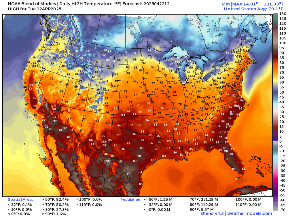
251 million at/above 70°F — and the average high temperature across the Lower 48 is 70.1°F.
Lows Wednesday Morning

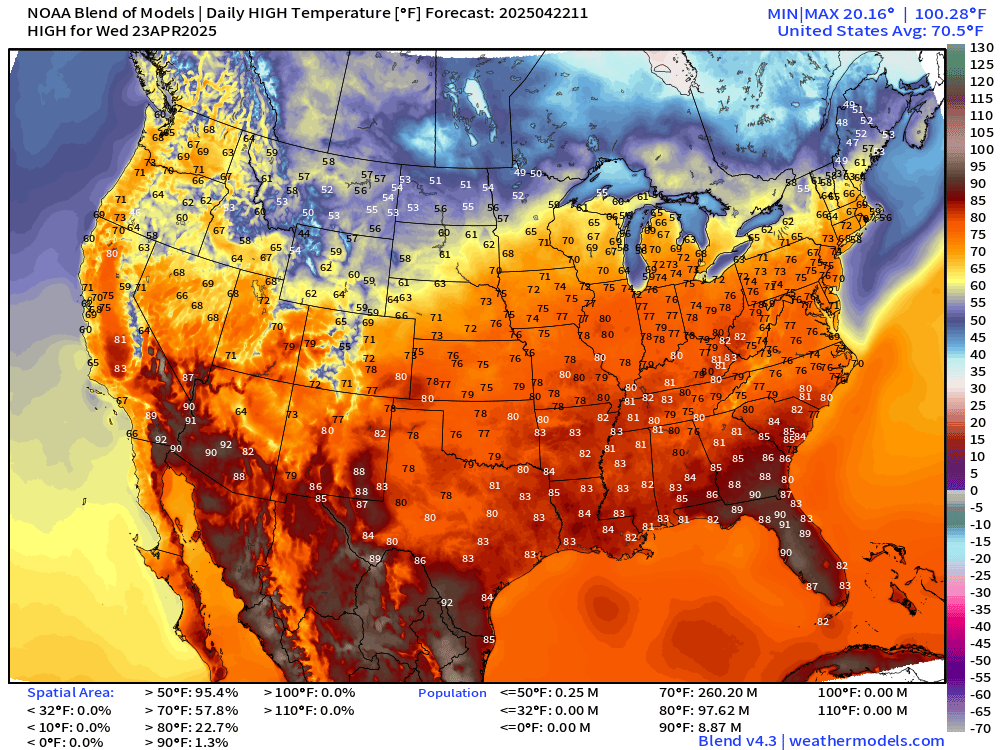
High Temperatures on Wednesday

Very nice 70s for 260 million Americans. And, the averaged high temperature across the Lower 48 is 70.5°F. 80s are expanding into Illinois and Ohio River Valley.
High Temperatures Next 9-days
The progressive pattern keeps introducing cooler, Canadian air behind frontal boundaries across the Midwest, Great Lakes, and Northeast, so comfortable — seasonable temperatures into early May.
Keep reading with a 7-day free trial
Subscribe to Weather Trader to keep reading this post and get 7 days of free access to the full post archives.