


April 21, 2025 Monday Weather Update
Great Lakes snow storm keeps winter alive
Good morning!
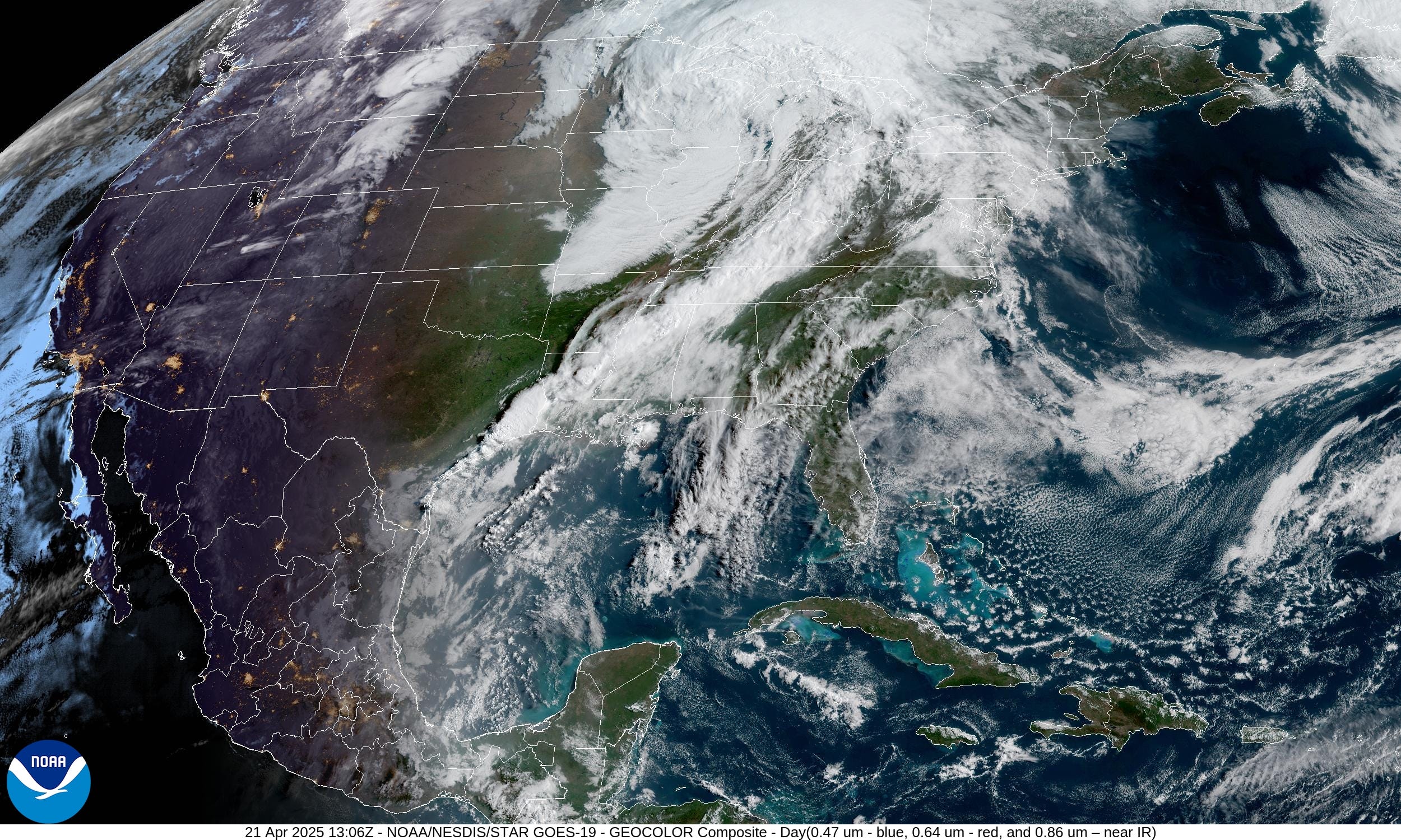
Yesterday’s frontal boundary swept through Arkansas, Missouri, and into Illinois before weakening overnight. Quite a few warnings for severe storms with wind damage, and a few tornadoes. So far only a few reports of tornado in Illinois with many more wind reports from Springfield, Missouri to Springfield, Illinois.


Current Satellite Imagery
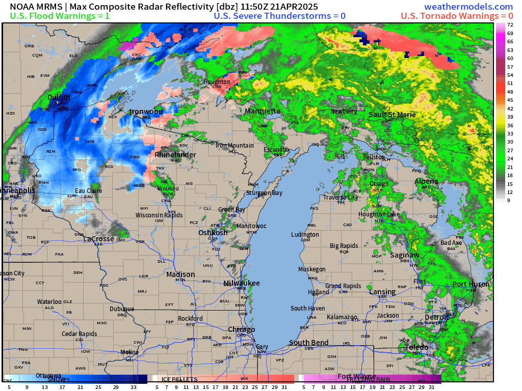
Winter continues unfortunately for folks in the Western UP of Michigan, Arrowhead of Minnesota, and Northern Wisconsin. Radar shows snowfall in Duluth and Ironwood. Accumulations will be light as temperatures warm a bit today.
RRFS-A Radar 18-Hour Forecast through rest of Monday

The frontal boundary has really thinned out with dry air winning the battle against any dynamic lift. However, some convective showers and storms will pulse with the heating of the day, but unlikely to be severe.
Weather Today | Monday

Highs Today | Monday
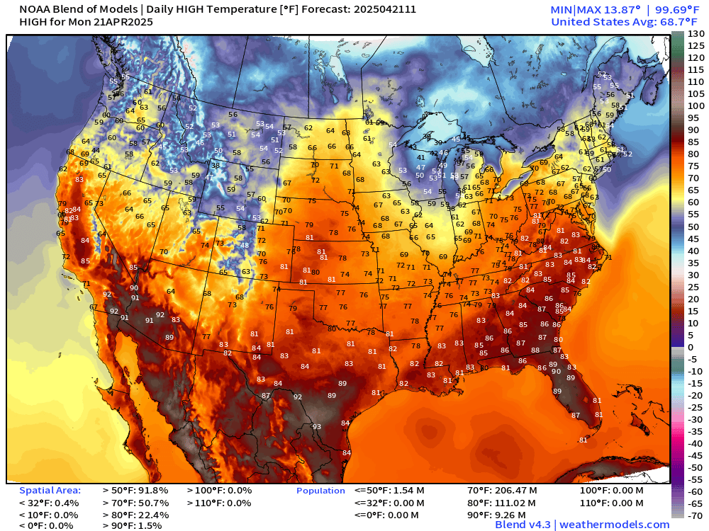
90s in Florida a few degrees hotter than normal. 206 million at/above 70°F
Highs in Michigan from Marquette to Houghton only in the 30s with a chilly wind off Lake Superior.

Lows Tuesday Morning

Less than 4 million population below freezing.
High Temperatures on Tuesday

Very nice 70s for 254 million Americans. And, the averaged high temperature across the Lower 48 is 70.0°F on the dot.
High Temperatures Next 9-days

Lower 48 highs remain around 70°F on average for the rest of the month. The overall temperature gradient is zonal with 80s in the Ohio River Valley undulating with weak frontal boundaries back to the 70s.
Keep reading with a 7-day free trial
Subscribe to Weather Trader to keep reading this post and get 7 days of free access to the full post archives.