


April 20, 2025 Sunday Weather Update
Missouri focus of tornado threat
Happy Easter Sunday!
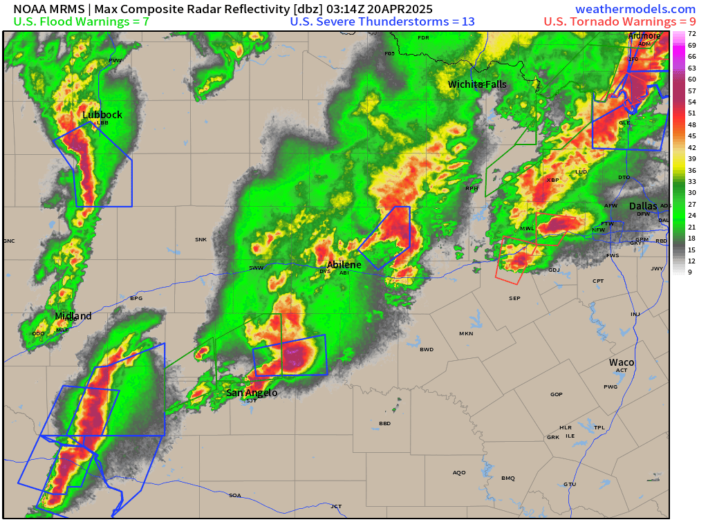
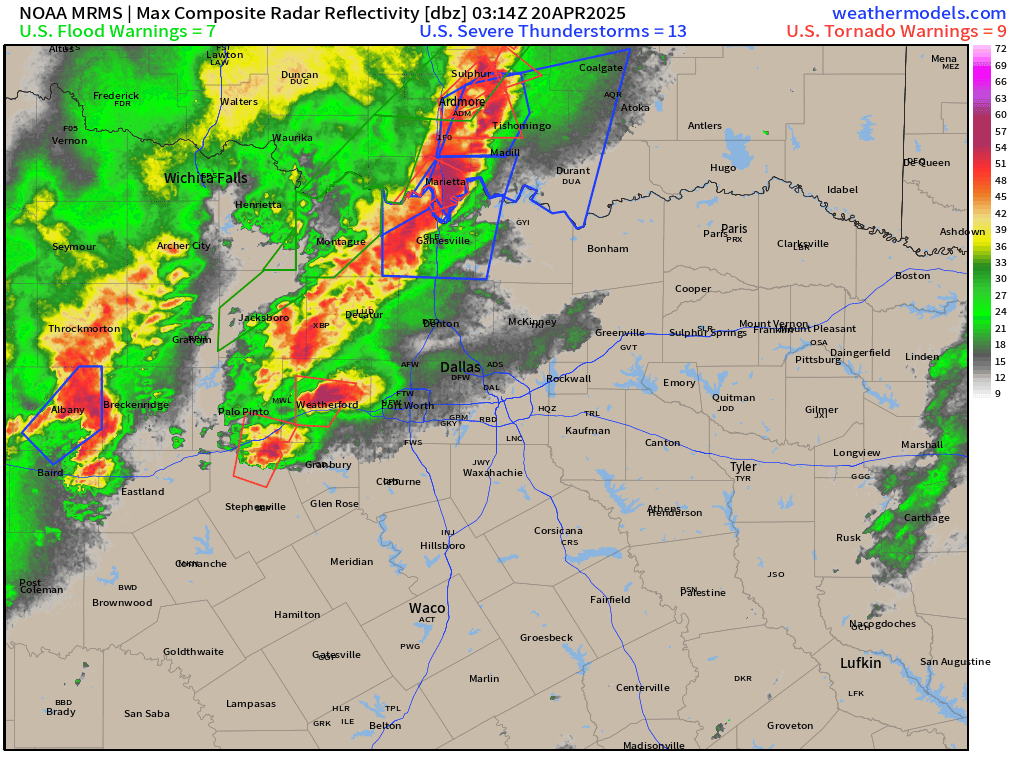
Yesterday evening, Texas really got a light show from heavy thunderstorms from San Angelo to Abilene and then just west of Dallas-Fort Worth. Multiple tornado warnings and reports of very large hail stretched along the frontal boundary with the developing storm system across the Plains.
The RRFS-A is the next generation mesoscale model set to replace HRRR sometime before 2030 (I know) and is running experimentally at ESRL for the upcoming months. Instead of using the FV3-model core, which has shown problems with convective scales, this version uses MPAS. More on that in the coming weeks.
The 11 pm CT forecast from 7-hours out from RRFS did a wonderful job lining up the individual convective lines. I’m impressed.

Radar through 11:34 PM CT for San Angelo to Abilene.
Same time for west of DFW across the Red River.
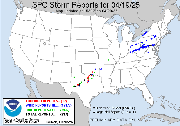
Storm Reports | Preliminary from Saturday
Also note the wind damage reports from the storms that skirted the Ohio River and the border between PA/MD.
Snowfall Observed over the Past 10-days

Winter going into overtime across the central Rockies from Montana to AZ/NM.
Current Satellite Imagery
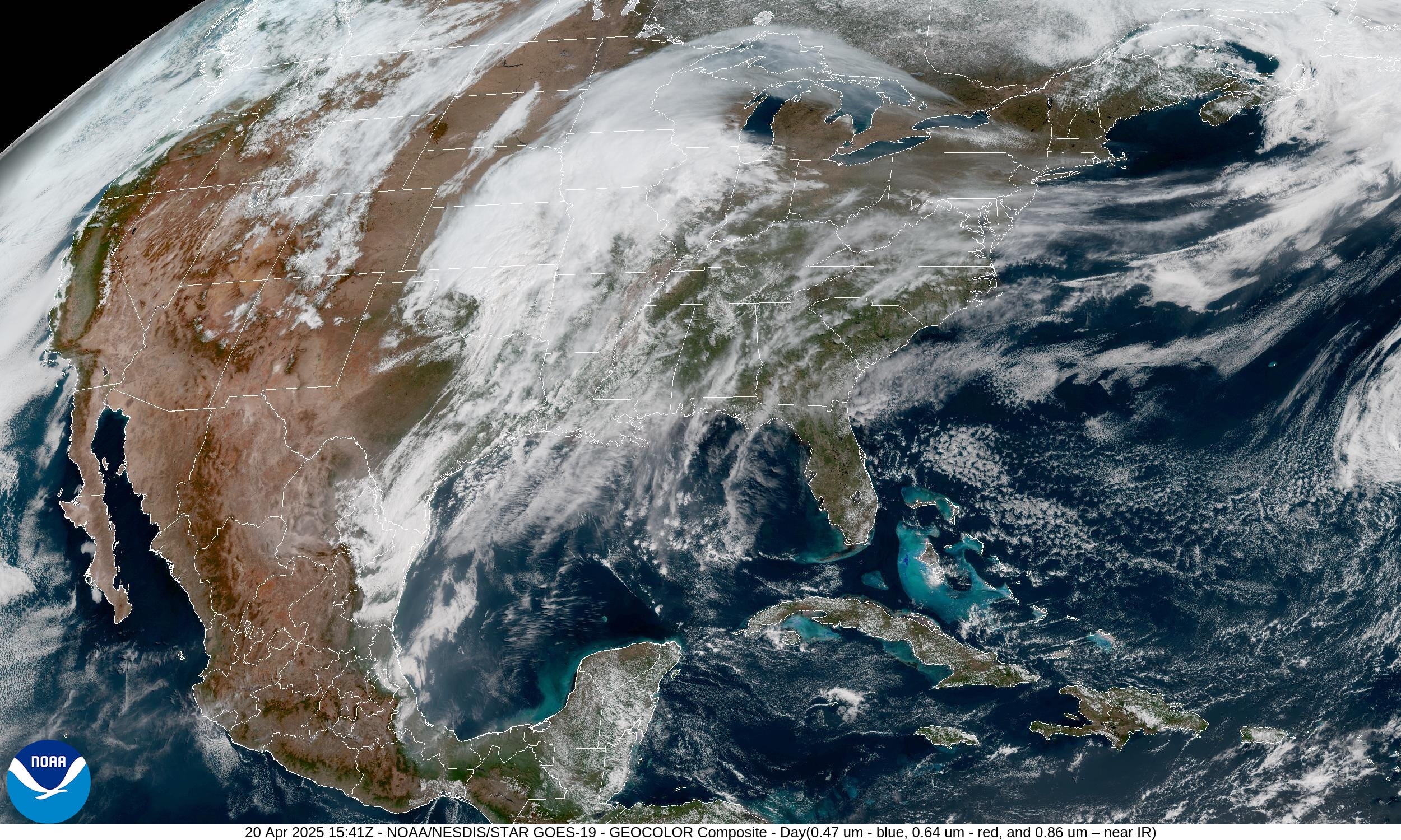
Comma shape in the clouds across OK and TX = storm system developing at it heads NNE today. Mostly cloudy in some places across the Southeast but otherwise sunshine into Michigan and the Northeast.
HRRR Radar 18-Hour Forecast through Monday morning 4 AM
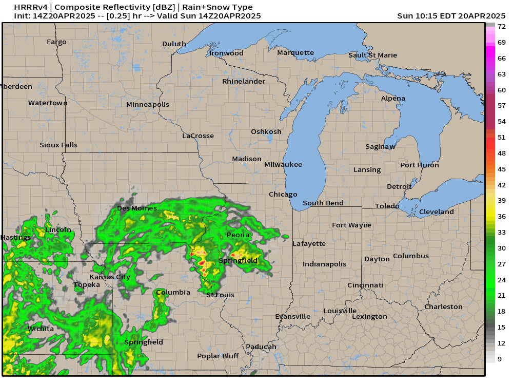
Most worrisome severe storms in Missouri today.

The low tracks through Kansas into MN/WI by early Monday morning.
Weather Today | Sunday

Keep reading with a 7-day free trial
Subscribe to Weather Trader to keep reading this post and get 7 days of free access to the full post archives.