


April 2, 2024 Tornado and Blizzard Warnings
Severe weather continues across Ohio Valley

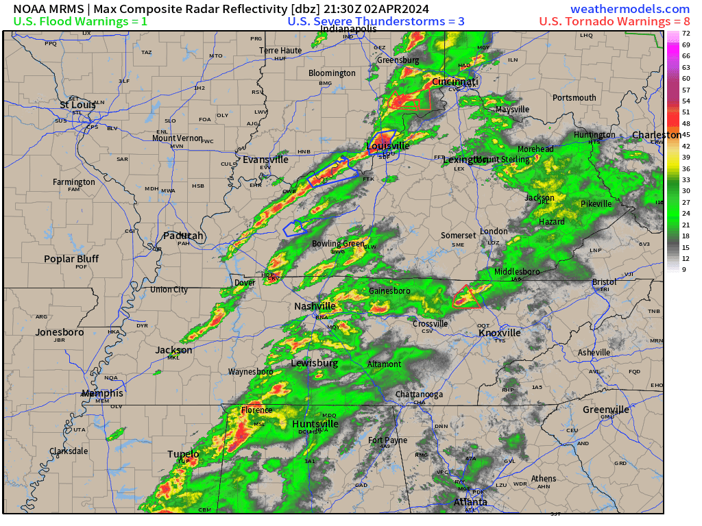
Severe weather underway in the Ohio Valley pushing through Nashville, Cincinnati into Columbus later this evening with tornado watch boxes hoisted.
The Mesoscale Discussion shows southern Ohio under threat of wind, hail, and tornadoes during next few hours as a broken line of storms with embedded supercells zips eastward.
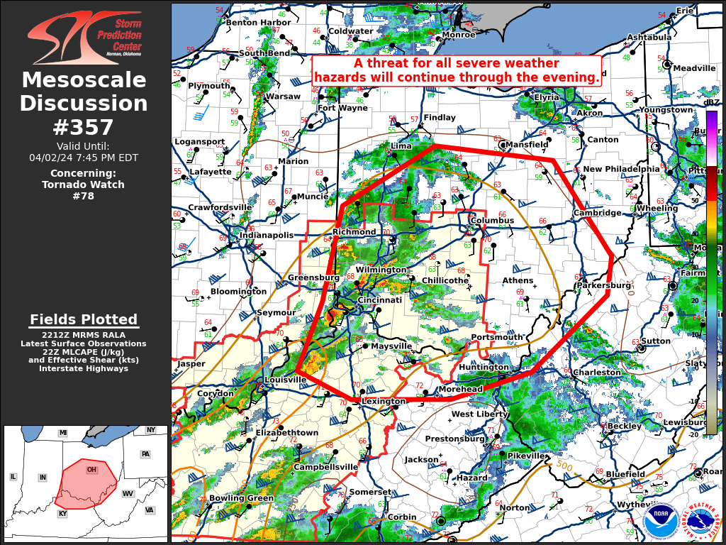
Radar through 6:50 PM ET shows a few severe and tornado warned storms mainly along a line from Cincy to Louisville — moving eastward.
These storms along the front are part of a very powerful blizzard centered over Southern Lake Michigan cranking away in the 980s mb central pressure.
Heavy snowfall underway in Wisconsin, Michigan and soon Illinois. The highest accumulations over the next 48-72 hours will be in Marquette, Michigan along Lake Superior in the Upper Peninsula with up to 41” in the NWS forecast.
Tuesday Evening Temperatures 6:15 PM ET

Temperatures only in the 30s across the Great Lakes with snowfall. Ahead of the front in the warm sector, mid-80s in the Carolinas and 70s and 80s in the rest of the Southeast. Cooler on Wednesday behind the front — significantly.
Tuesday Evening Weather
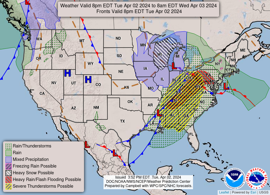
The threat for severe weather moves across the Southeast later this evening clearing Atlanta by Midnight. An area of low pressure forms off the Mid-Atlantic coast to become our next Nor’easter.
Wednesday Weather
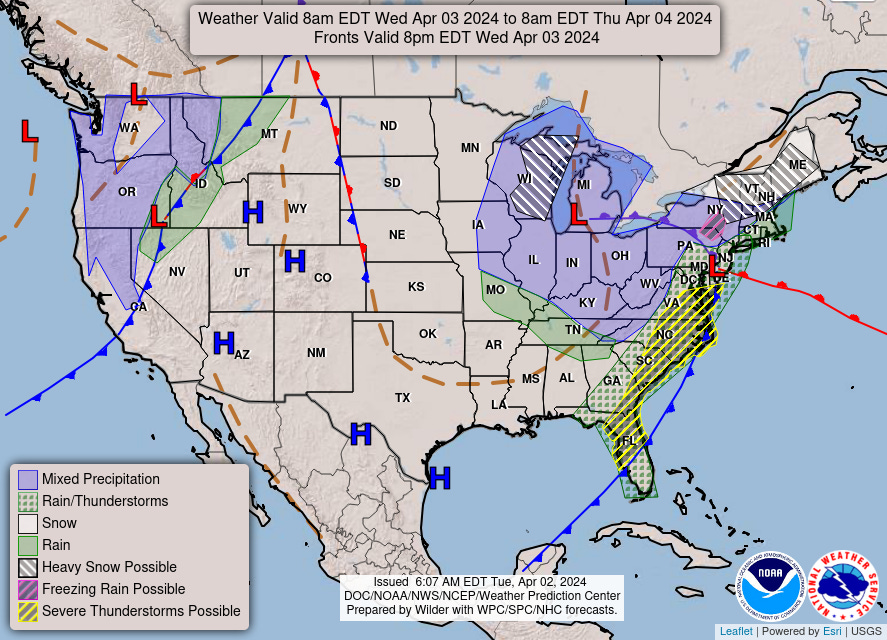
Heavy snowfall on Wednesday across the Great Lakes mainly in UP of Michigan and Wisconsin. Still a risk of severe weather along the east coast from North Florida to DelMarVa.
Wednesday High Temperatures

Nice and warm in Montana in the 70s! Warmth extends along the lee of the Rockies including Denver. The trough behind the cold front digs into St. Louis and Nashville with 40s and 50s for high temperatures. 63°F in Atlanta during the afternoon.
Eclipse Cloud Cover
Total cloud cover is often misleading with high clouds dominating the layers. For 18z on Monday, the only “bad” spots would be where low clouds and rainfall are occurring along the frontal boundary. This looks like a pretty good outcome for Texas around Austin into the Great Lakes.

Next 10-Days Weather Systems
Keep reading with a 7-day free trial
Subscribe to Weather Trader to keep reading this post and get 7 days of free access to the full post archives.