


April 19, 2025 Saturday Weather Update
Powerful storm system with severe weather threats from Texas to Missouri
Good morning!
Weekend weather headlines will be heavy rain and thunderstorms from Texas into the Mississippi River Valley including already waterlogged Arkansas and Missouri.
WPC maximum forecast for 7-days pushing 6-8” in the highest locations along the Red River Valley, and 2” over a large population from Dallas to St. Louis.

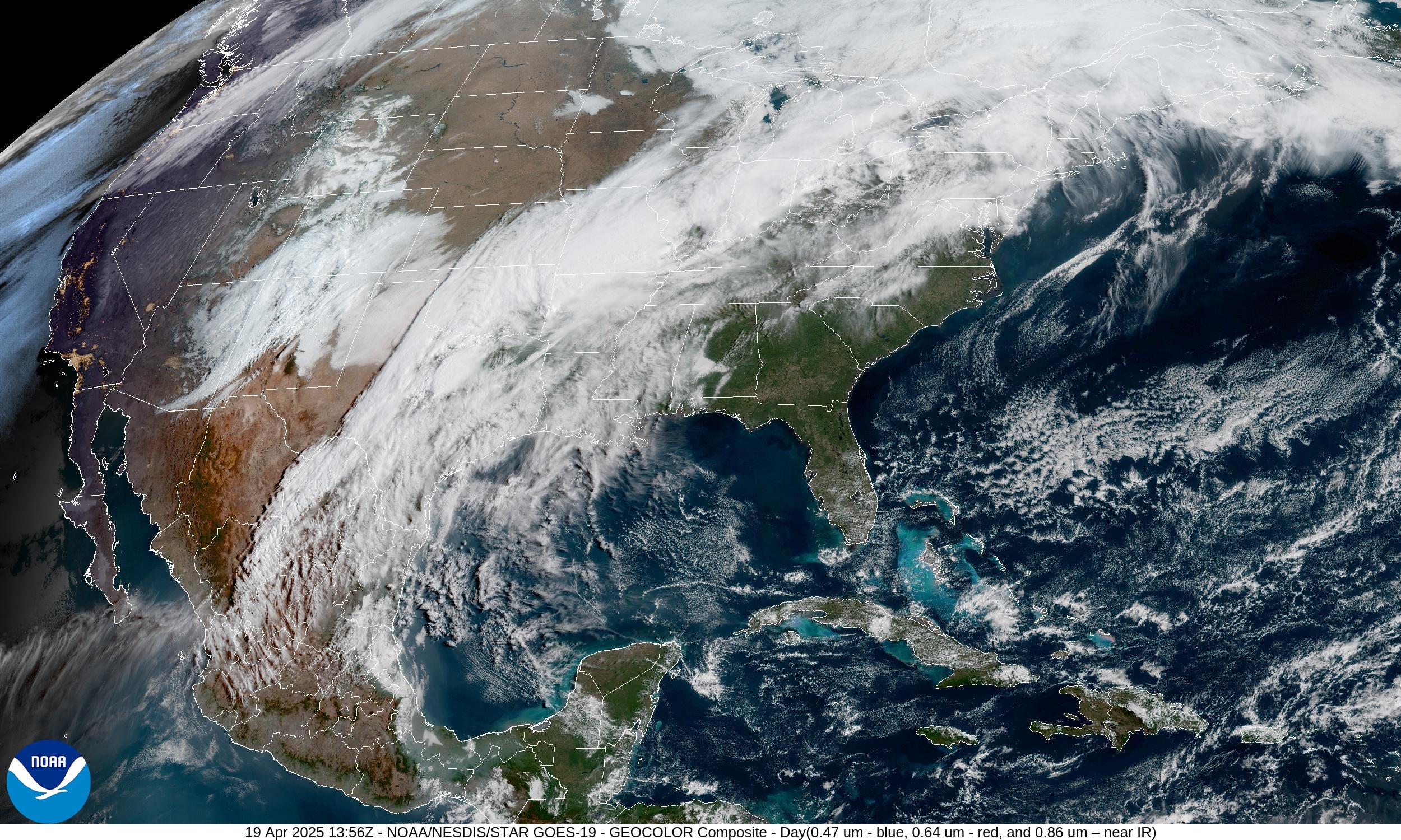
Current Satellite Imagery
Nice weather continues across the Southeast with temperatures well into the 80s. Can’t complain here in Atlanta for the dry spell to do some pressure washing and painting. However, there are bees EVERYWHERE and they are chewing into wood on the porch and fence.
Heavy rain continues this morning along the frontal boundary which will finally move east on Sunday once the area of low pressure intensifies and tracks into the Great Lakes.
HRRR Radar 48-Hour Forecast through Monday morning 8 AM

The area of low pressure is currently elongated from New Mexico into north Texas but will consolidate today and track across Oklahoma into the Iowa and Wisconsin by early Monday.
Weather Today | Saturday

Enhanced risk of severe thunderstorms in central West Texas w/population of about 400,000, so rather localized over Abilene and San Angelo.
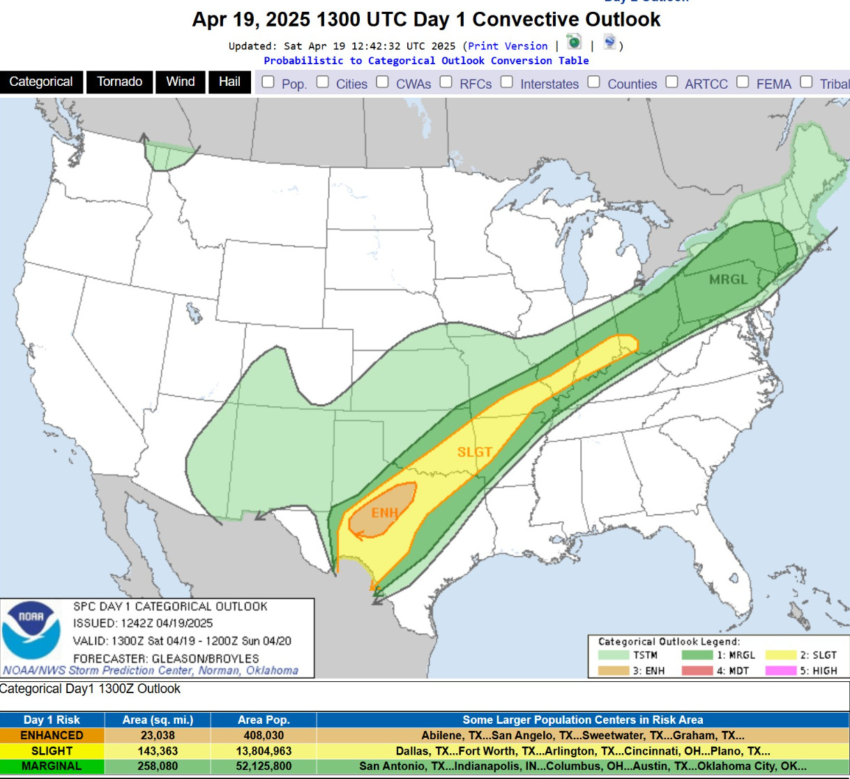
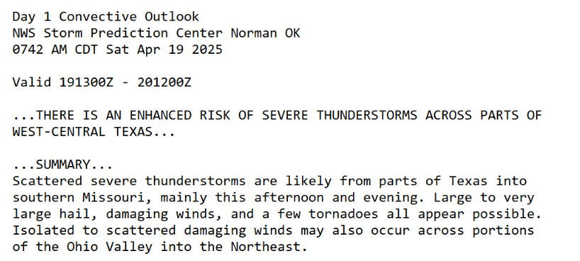
SPC advises for very large hail from Texas to Missouri.
Highs Today | Saturday
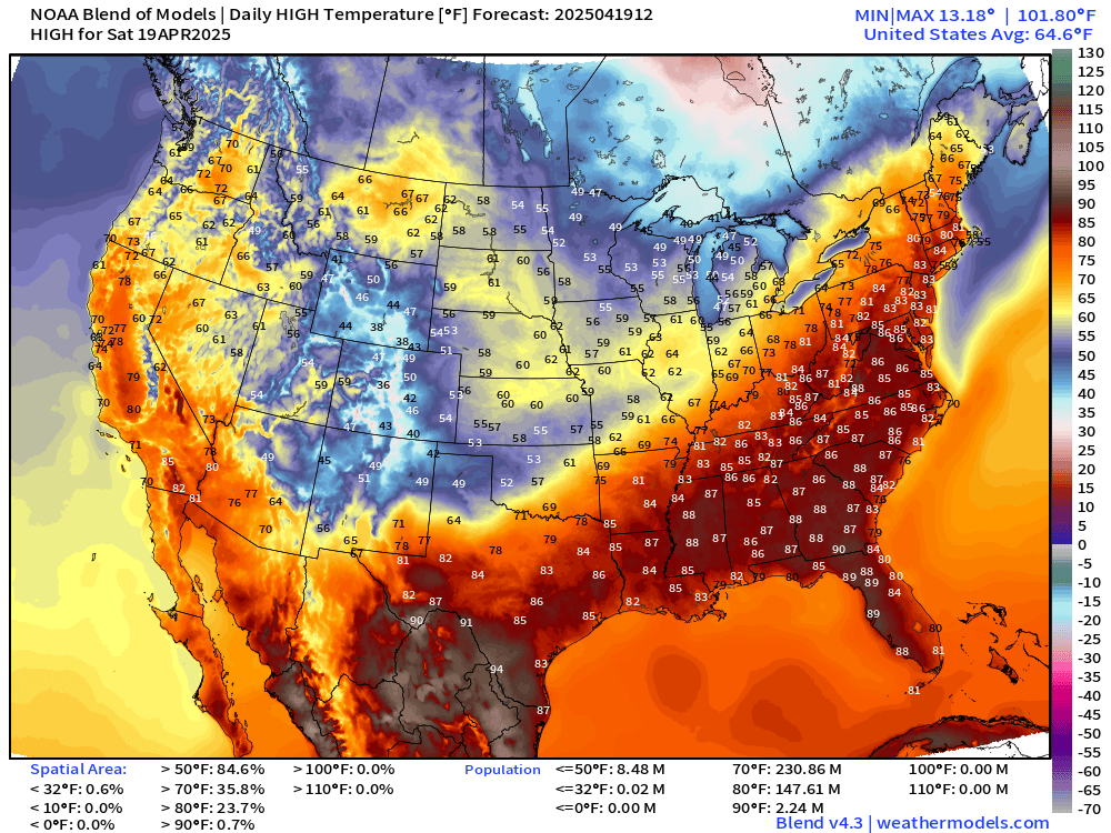
105 million at/above 80°F and 231 million above 70°F. Colorado and Wyoming still below freezing for daytime highs with the trough/storm system.
High Temperatures Next 9-days
90s starting to show up regularly in the Southeast. It’s almost May, so that’s right on schedule. Thankfully seeing more 60s and 70s sustained across the Midwest, Great Lakes, and creeping into New England.
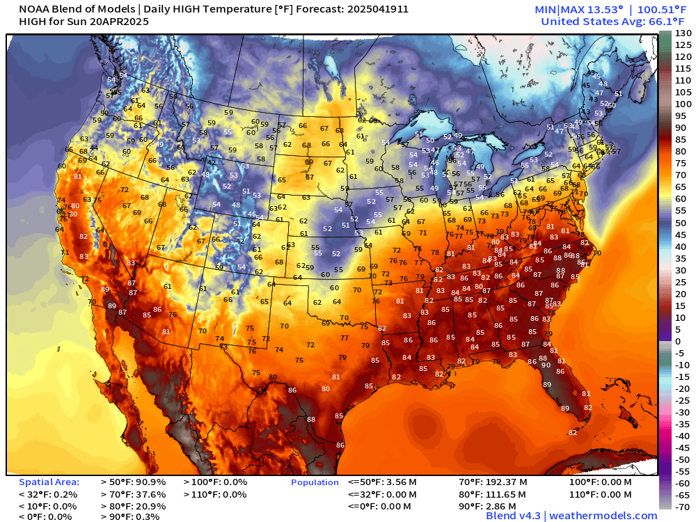
Weather on Easter Sunday
Keep reading with a 7-day free trial
Subscribe to Weather Trader to keep reading this post and get 7 days of free access to the full post archives.