


April 16, 2024 Midwest Severe Storm Threat centered upon Iowa
Still watching significant ridging and above-normal temperatures to end April

Sea Surface Temperatures in the tropical Eastern Pacific have transitioned to “cooler than normal” across the Equator along 120°W to the coast of Peru/Ecuador signaling the return of La Niña.

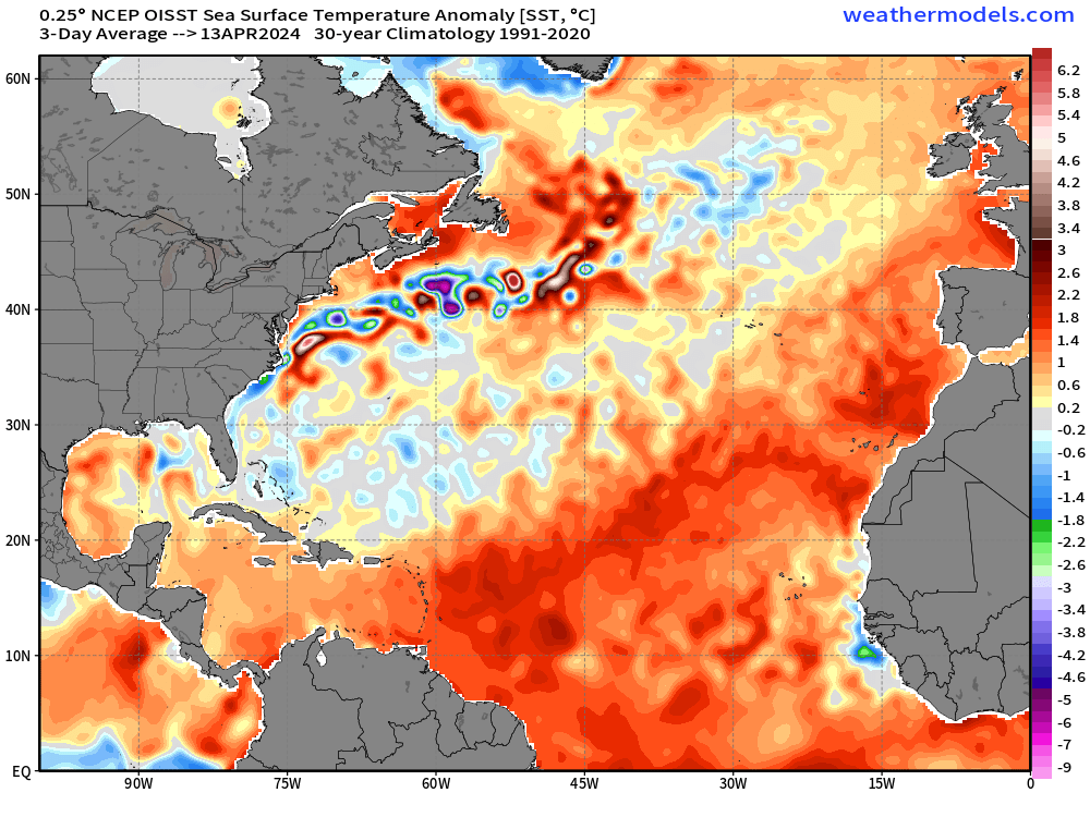
However, in the North Atlantic, ocean temperatures remain very warm for mid-April with much above normal SSTs almost basin wide. A pre-requisite for Atlantic hurricane development and maximum potential intensity is warm SSTs and 2024 surely has that ingredient in the soup.
Actual SST forecast at Day 10
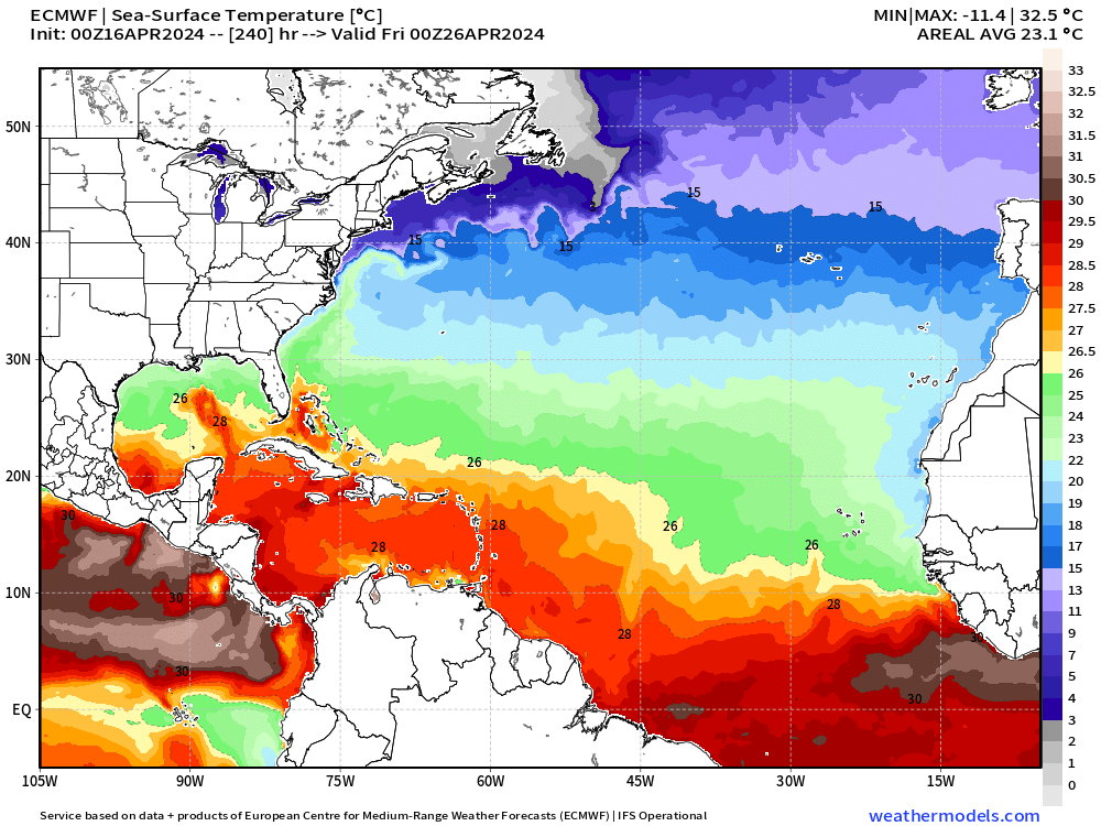
It’s important to remember that SST anomalies or deviations from normal do not do anything — it’s the actual SST or ocean temperatures that fuel tropical cyclones. In the Main Development Region of the Atlantic ocean, we need SSTs of 26°C to sustain a typical tropical storm or hurricane. The strongest or most intense are seen over waters of 28°C. The ITCZ or convergence zone where convective storms develop in the tropics will move northward during the next few months and position itself over the latitude with much warm ocean water. Currently, hurricanes don’t develop because there is no mechanism to get them initiated like an African Easterly Wave.
Note, the Gulf of Mexico is still too cool except for the Loop Current. And, the 26°C isotherm is still south of 20-25° latitude from the Bahamas into the far tropical Atlantic.
So while Atlantic SSTs are “above normal” right now into late-April, we don’t expect any development for another 6-weeks or so. Of course, there could be a surprise early-season subtropical development as in previous years, but not seeing any candidates.
ECMWF AIFS (AI) Weather Pattern Next 15-Days
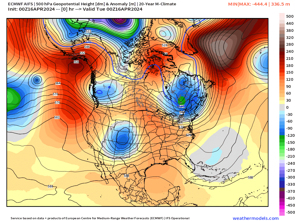
In general, to get a sustained eastern U.S. warm up, we need a ridge to develop or move from the Western U.S. across the Rocky Mountains. That looks to be the case with the ECMWF AIFS heading into late-April with strong ridging over the eastern half of the Lower 48. We’ll continue to watch this potential early season “heat dome” in the longer-range ensemble forecasts.
The A.I. trained version of the ECMWF IFS is highly skillful and you would be well-served from an forecast accuracy point of view to use model for longer-range predictions. Indeed, the AIFS has dominated the recent 7-day verification period by not dropping out (poor skill period) like the conventional IFS and NOAA GFS.
96.2% (AIFS) is incredible April levels of skill. It’d be really nice to have hindcasts to calibrate this system further!

Tuesday High Temperatures

Continued very warm across the Ohio Valley in the lower-80s including Indy, Cincy and Lexington. In the mid-80s in the Carolinas.
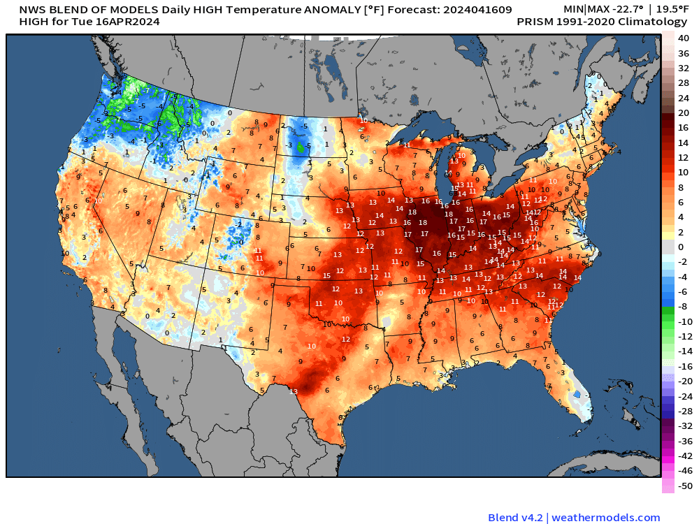
High temperatures are 14° to 17°F above normal centered on Interstate 80 southward into Nashville. The only cooler than normal area is the Pacific Northwest now that California has rid itself of the upper-level low.
Keep reading with a 7-day free trial
Subscribe to Weather Trader to keep reading this post and get 7 days of free access to the full post archives.