


April 15, 2024 Large Hail in Plains
End of month heat builds across central U.S. heading into May

Weather Trader Programming note: switching to morning updates [~7 AM] for day ahead weather with evening cleanup for 12z model suites. Please subscribe in order to receive posts in your inbox. Weather Trader is entirely a subscriber-supported newsletter with > 2,000 active readers. To receive new posts and support work and development, consider becoming a free or paid subscriber [20% off].
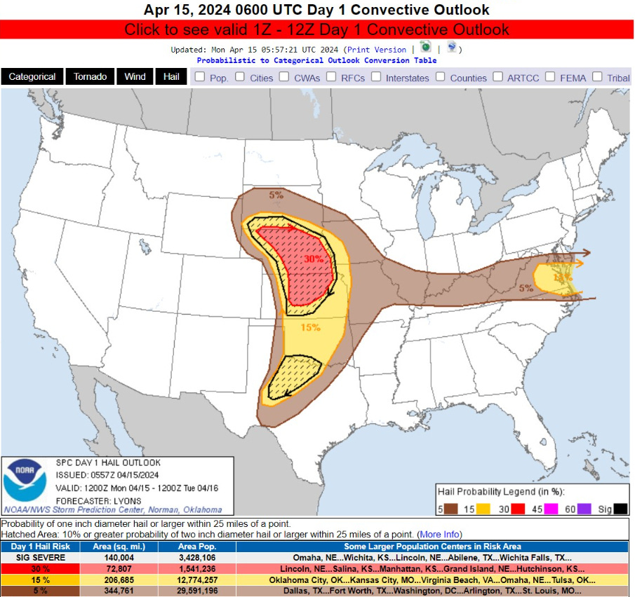
Severe weather threat across Plains with “Enhanced” risk over Nebraska for mainly large hail. SPC also has a slight risk for coastal Virginia but thunderstorms could also impact D.C. later this afternoon with heavy rain and gusty winds and some hail.
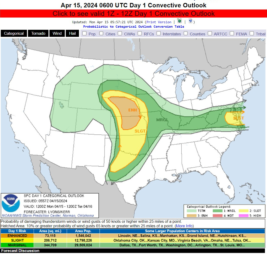
   Scattered severe thunderstorms are likely across the southern to
   central Great Plains, mainly this evening and into tonight. Large to
   very large hail, damaging wind gusts, and a few tornadoes are
   possible.
Monday High Temperatures

Another very warm Spring day across much of the Lower 48 population-wise with 230 Million at/above 70°F and 127 Million hitting at least 80°F including Indianapolis, Cincy, DC. and maybe 90°F in the Carolinas.
Cooler than normal across California continues on Sunday with 60s along the coast and Central Valley.
Monday Morning Temperatures 6:30 AM ET

Mild this morning south of a warm front stretching into the Ohio Valley and mid-Atlantic with 60s in St. Louis, Indy, and D.C. Only in the 40s in California.
Next 18-Hours Weather | Simulated Radar

HRRR shows the development of severe thunderstorms later this evening across the central Plains with overall cell movement from south to north.
The upper-level Low is easy to see spinning over Utah and Wyoming with still plenty of cold air available for snowfall in the mountains.

Storms develop in the D.C. area this afternoon and then intensify moving into Virginia Beach.
Monday Weather

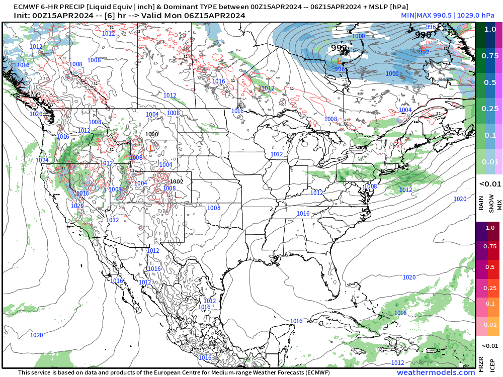
The area of low pressure developing in the Plains will deepen to about 989 mb over Nebraska by Tuesday morning.
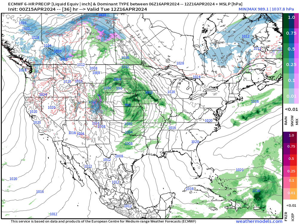
Next 66-Hours Precipitation | NWS NDFD

Beneficial rainfall from the Plains storm: 1-2”+ centered upon Iowa.
Next 7-Days Weather Systems
The upper-level low and surface storm take a while to move into the Great Lakes and finally exit the Lower 48 by Thursday. The tail end of a frontal boundary into next weekend will provide the next rain threat for Texas into the Southeast.
WPC 7-Day Precipitation Forecast

The next rainfall event shows up in the 7-day WPC forecast over Texas and Oklahoma with 1-2” totals.
Agriculture | 15-Day Precip Percentiles and Probability

Like the snowfall percentile maps I showed during the winter, we can sort the ensembles to create total precipitation (rainfall) percentiles — including the median amounts for the next 2-weeks. The red color on the map is 2-inches+ and covers the area east of the Rockies. I tend to not emphasize the precipitation anomaly maps as it can exaggerate both surplus and deficits when the overall “normal” amounts are relatively small during a 2-week period in mid-to-late April.

Probability of at least 2-inches of rainfall for the next 2-weeks looks healthy/high over the corn belt!
ECMWF Ensemble | 5-Day Temperature Anomaly
Next 5-Days From April 15-19

The next 5-days remain quite warm > 10°F above normal centered on the Ohio Valley. This map is a “degree day method” calculation using TMAX and TMIN vs. climatology.
Days 6-10 From April 20-24
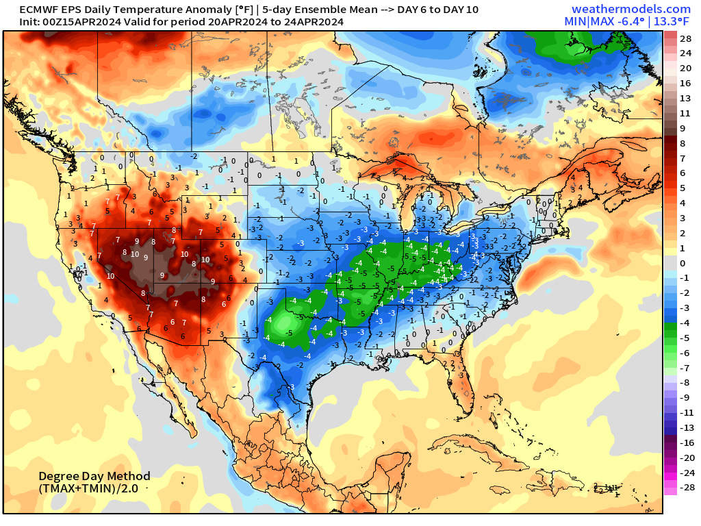
Cooler weather for Days 6-10 across the Mississippi River valley and Midwest. Warmth builds across the Great Basin.
Days 11-15 From April 25-29

Ensembles show a strong “warmth” signal for the last week of April!
Thank you to Subscribers and Supporters! Almost the growing season — so much is going on in the world of weather!
Maps sourced from weathermodels.com designed and innovated by yours truly! I actually create all of my content from scratch.