


April 15, 2025 Tuesday Weather Update
Atlantic hurricane season has cooler water than last year

Good Morning!
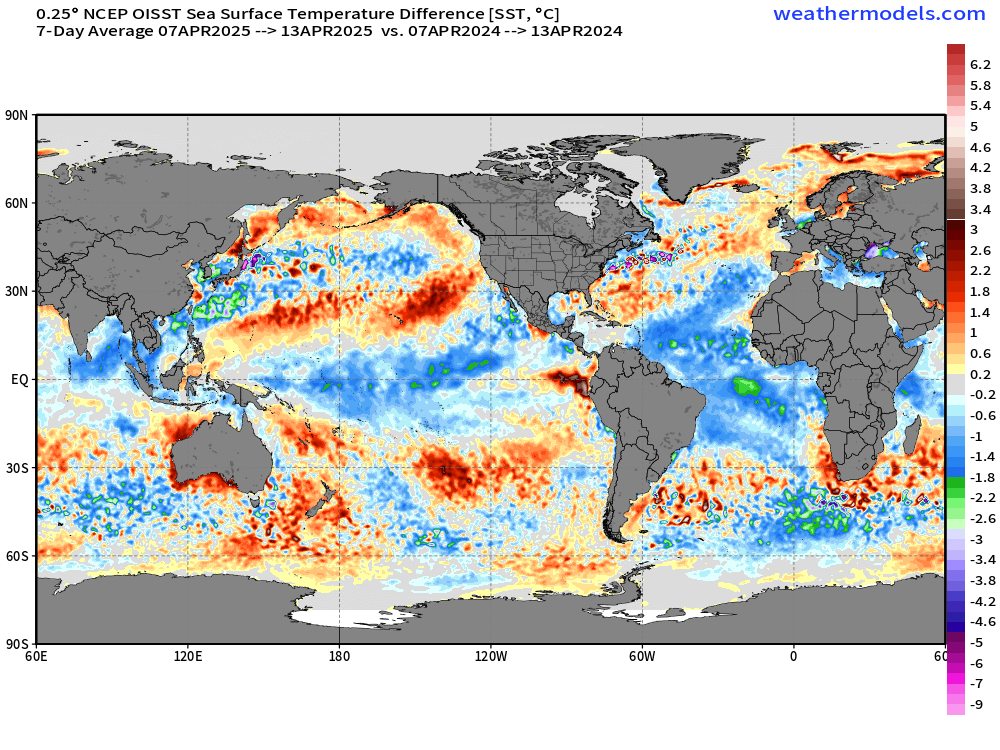
Quick look at the change in sea-surface temperatures across the Earth as we head into the middle of April and look ahead to the Atlantic Hurricane Season.
2025 minus 2024 shows a LOT of blue meaning significantly cooler across the tropics in the Indian, Pacific, and Atlantic Oceans. The central Pacific is cooler because of the transition to a weak La Niña while the Atlantic on both sides of the equator is dramatically cooler. I don’t entirely understand the mechanisms controlling the deep tropics Atlantic SST other than winds to mix up cooler water than below but there is also a “Niño” in the Atlantic that seems to be acting up.
2025 Global SST Anomaly
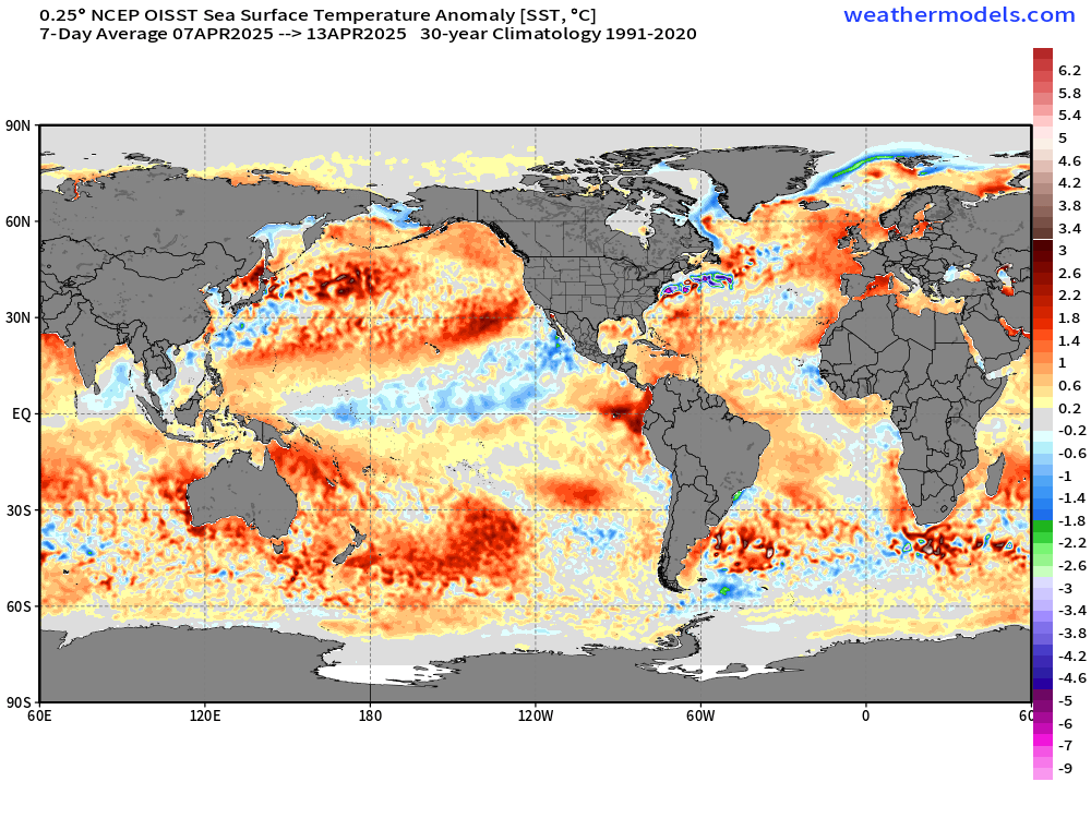
The coast of South America along Peru is seeing a “El Niño Costero” event with localized warmth extending to the tortoises in the Galapagos Islands.
Note how the Atlantic is near neutral in the Main Development Region off the coast of Africa to the Lesser Antilles.
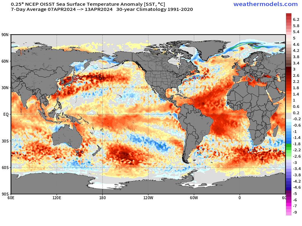
2024 Global SST Anomaly
Huge difference from 2024! Look at how blazing “hot” the Atlantic SSTs were compared to normal.
While warm SST is just one necessary ingredient for an active hurricane season with long-track major hurricanes, other important factors come into play throughout the summer. Initially in June-July, we watch “dust” or sand particulates in Saharan Air Layers lofted from the African continent over the Atlantic = reduction in development. Also, strong wind shear due to “teleconnections” from the Pacific — how El Niño and La Niña impact the Atlantic + large scale sinking / rising motion can either enhance or reduce convection or clusters of thunderstorms necessary for tropical storm formation. Before we get to the Atlantic, the formation, track, and intensity of easterly waves over Africa shifts the probability of development later on. Stronger waves further south usually mean higher chance of main development region formation.
That’s why Atlantic seasonal forecasting is so hard — it may seem like everything is signaling active/inactive but you get the opposite or end up with the average.
I’d buy a “near normal” season this year based upon the reduction in Atlantic sea surface temperatures.
Current Satellite Imagery

A band of broken clouds extends down a cold front into the southeast and Texas with much cooler air behind it. The area of low pressure spinning into Quebec has snowfall over the Great Lakes, and more rainfall in the Northeast before mixed precip takes over this evening.
HRRR Radar Forecast through Wednesday 1 AM

Let’s call this pattern “dreadful” with yet another wintry storm slowly tracking through the Great Lakes into Northeast.
Highs on Tuesday
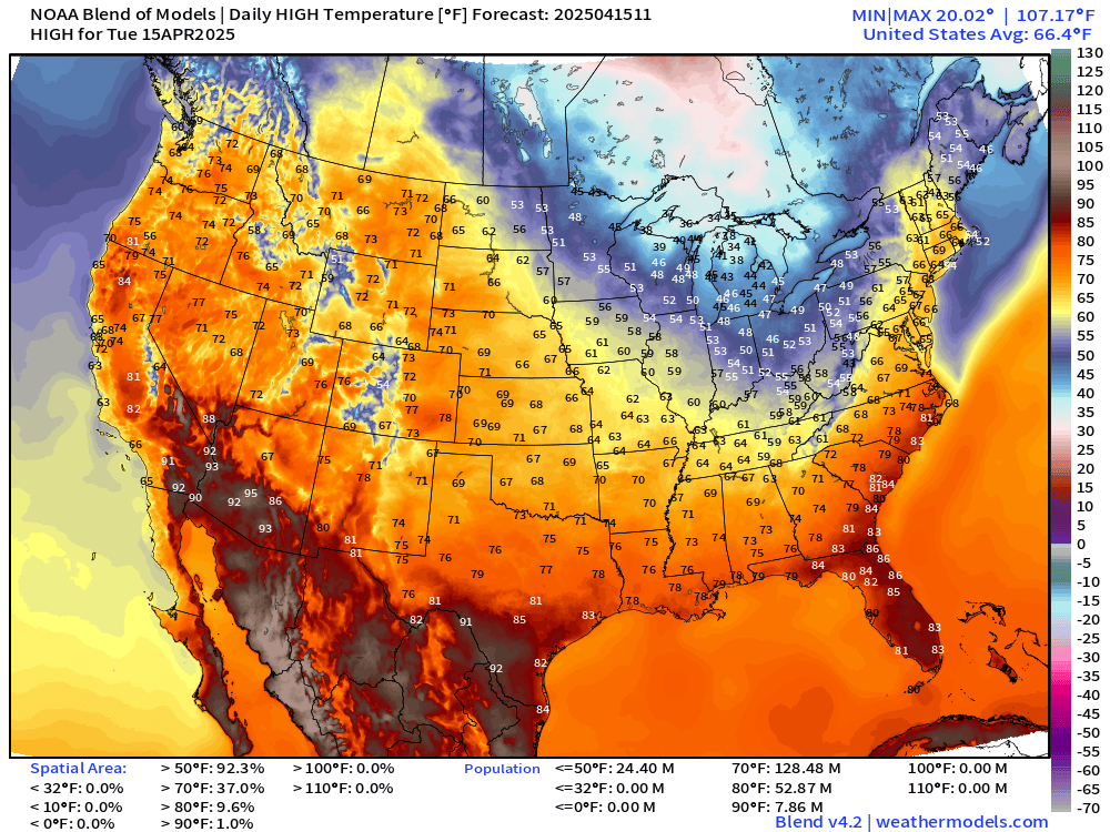
Easy to see the dip in the jet stream behind the frontal boundary with highs only in the 30s and 40s this afternoon across Michigan.
24 Hour Temperature Change

We’re about 15°F cooler behind the front at 9 AM this morning.
High Temperatures Next 9-days

Roller coaster with a couple more dips in the jet stream allowing cooler Canadian air to overcome the warmer, moist flow from the Gulf. The daily temperatures are dependent upon the frontal boundaries and whether you’re in the warm sector or behind the cool front.
High Temperature Anomaly Next 9-days shows the extremes with various air masses progressing through the Lower 48. In the aggregate, the Southeast looks warmest compared to normal for the duration, and that’s not surprising considering the origin of the air mass (from the subtropics/tropics) to be shown a bit later here with the Integrated Moisture Transport.

Coupon offer new and current subscribers through April 16: 20% off annual (upgrade) = $40/year. I’m increasing the price [$5 —> $8] for new subs on May 1st so lock in. Your continued support has allowed me with the help of Claude and Grok to develop new products. I am appreciative of all subscribers over the past year+ who have read the past almost 600 posts!
Easter Sunday Storm System in the Plains


This has the potential for severe weather with the dynamics looking impressive. However, the system is embedded within a cooler environment than might be expected for an April 20th system.


Otherwise, travel looks good for this weekend for Easter.
Keep reading with a 7-day free trial
Subscribe to Weather Trader to keep reading this post and get 7 days of free access to the full post archives.