


April 1, 2025 Tuesday Weather Update
Moderate (4/5) risk of severe weather across Mississippi River valley

Good Evening. Major severe weather outbreak + flooding centered on Memphis, Tennessee over the next 24-48 hours. Heat builds across the Southeast with a mid-level ridge. Around the backside of that ridge, a deep layer moisture flow out of the Gulf of Mexico will fuel thunderstorms and heavy rainfall that could add up to 12-inches.
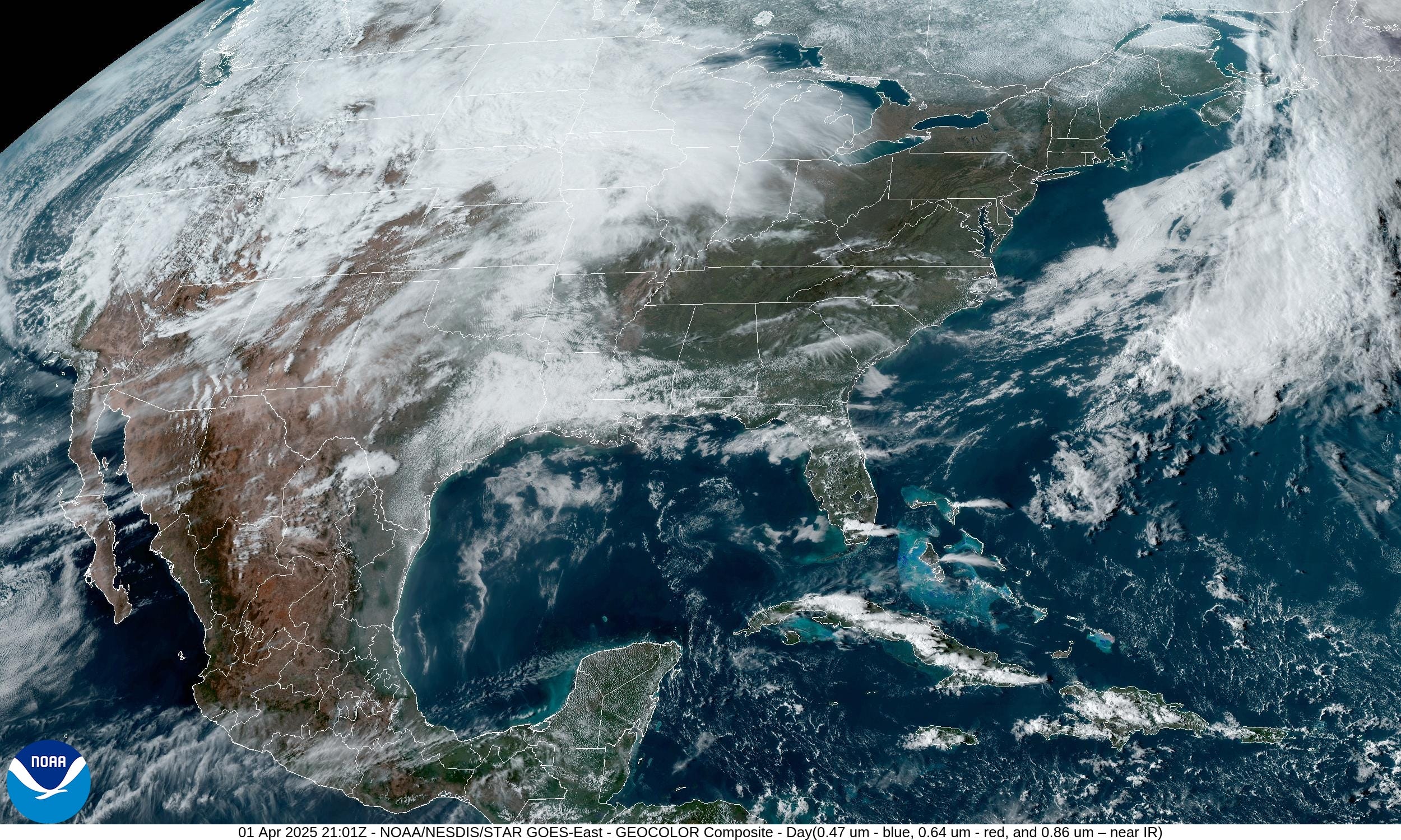
Today was a beautiful day across much of the eastern U.S. with mild temperatures with brilliant sunshine. Skies across the Southeast were cleared of pollen at least for a while.
Severe thunderstorms are possible in Oklahoma and Kansas this evening as the atmosphere’s cap is broken. Isolated supercells could spawn tornadoes.
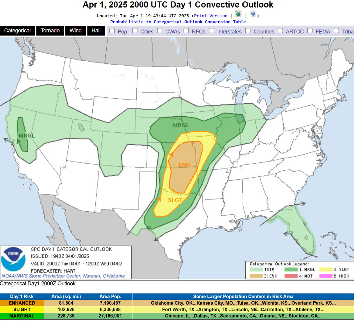
   Rapid, intense thunderstorm development should occur this evening
   over parts of the central/southern Plains. A few supercells with a
   risk for very large hail and strong tornadoes appear possible,
   particularly across central Oklahoma into eastern Kansas. A line of
   thunderstorms should also develop and pose a threat for
   severe/damaging winds across eastern Kansas into western Missouri
   tonight.
Tornado Watch 91 only has one lonely storm around Enid, Oklahoma.

Current radar through 6:20 PM ET

Integrated Vapor Transport Next 10-days
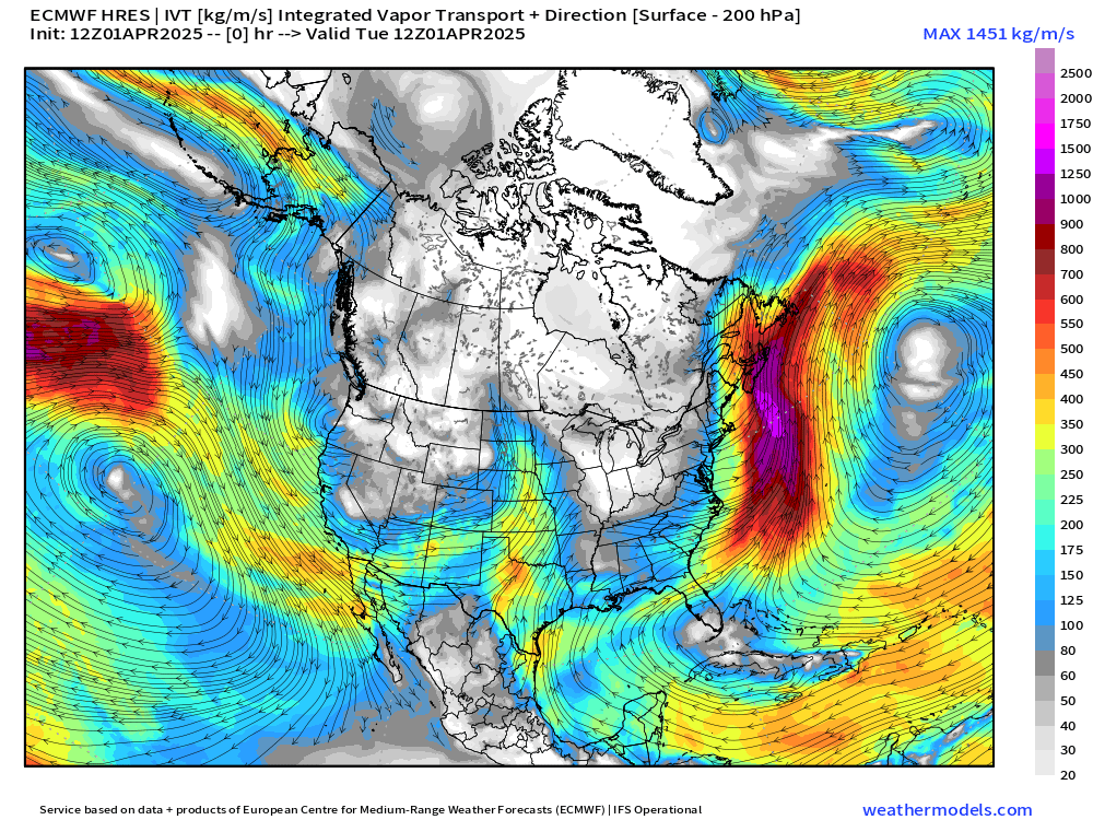
Not hard to see the massive plumes of moisture coming out of the Caribbean and Gulf of Mexico over the next several days. Then, we have a return to northwesterly flow with a strong early-April “polar vortex” event with persistent troughing in the Great Lakes.
Next 9-days High Temperatures

A mini-heat wave will build from Wednesday into Saturday across the Southeast with some places flirting with 90°F including Atlanta (earliest is April 23, 1980). Then, a strong trough/cold front blasts through the eastern U.S. from Canada cooling down dramatically — or back to reality of early Spring. Then, temperatures modify back to near-normal into later next week.
HRRR simulated radar next 18-hours | 21Z
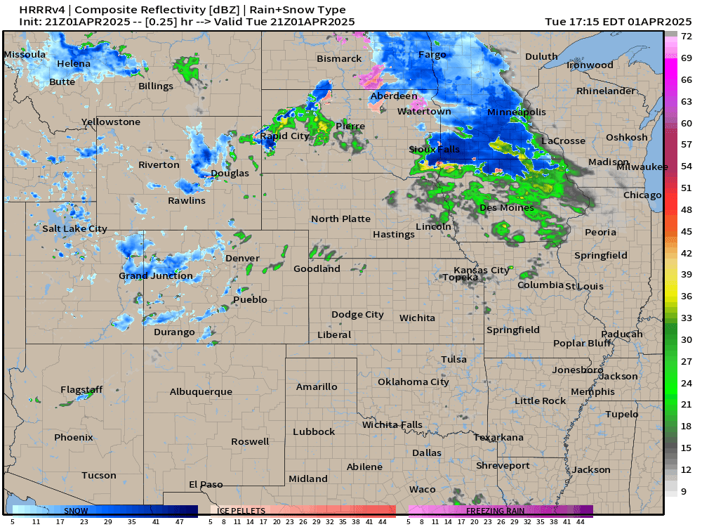
Could see quite a few supercells fire in OK and KS over the next few hours. They will push into Iowa and Missouri perhaps linearizing into a squall line.
Frontal boundaries this evening and weather into Wednesday morning

Temperature Analysis | 6:30 PM ET

Keep reading with a 7-day free trial
Subscribe to Weather Trader to keep reading this post and get 7 days of free access to the full post archives.