


April 1, 2024 Severe Weather Across Central U.S. with Tornado and Hail Threats
Winter returns to the Great Lakes and New England later in week with 2 strong storm systems

April begins with severe weather likely across the Central U.S. from Texas into the Plains and Ohio Valley with all threats on the table: wind, hail, and tornadoes, some could be strong.
An area of low pressure rapidly deepens over the Great Lakes on Wednesday with significant snowfall on the back side of the storm’s center. With the cold air from Canada dragged down, could be significant [but narrow] snowfall accumulation band centered upon Milwaukee.
Then, the energy is passed off the Northeast with yet another storm. The intensity has been decreased somewhat in recent model runs, but still impactful with heavy snowfall in interior New England — away from the coast — on Thursday.
Monday Morning Temperatures 7:30 AM ET

Very mild south of a warm/stationary front set up from St. Louis to Indianapolis this morning separating temperatures in the 40s and 60s. Morning with 70°F in Dallas, OKC, and Nashville.
Weather on April 1st Monday

Severe weather across a broad area including Dallas, OKC, St. Louis, and Indianapolis.
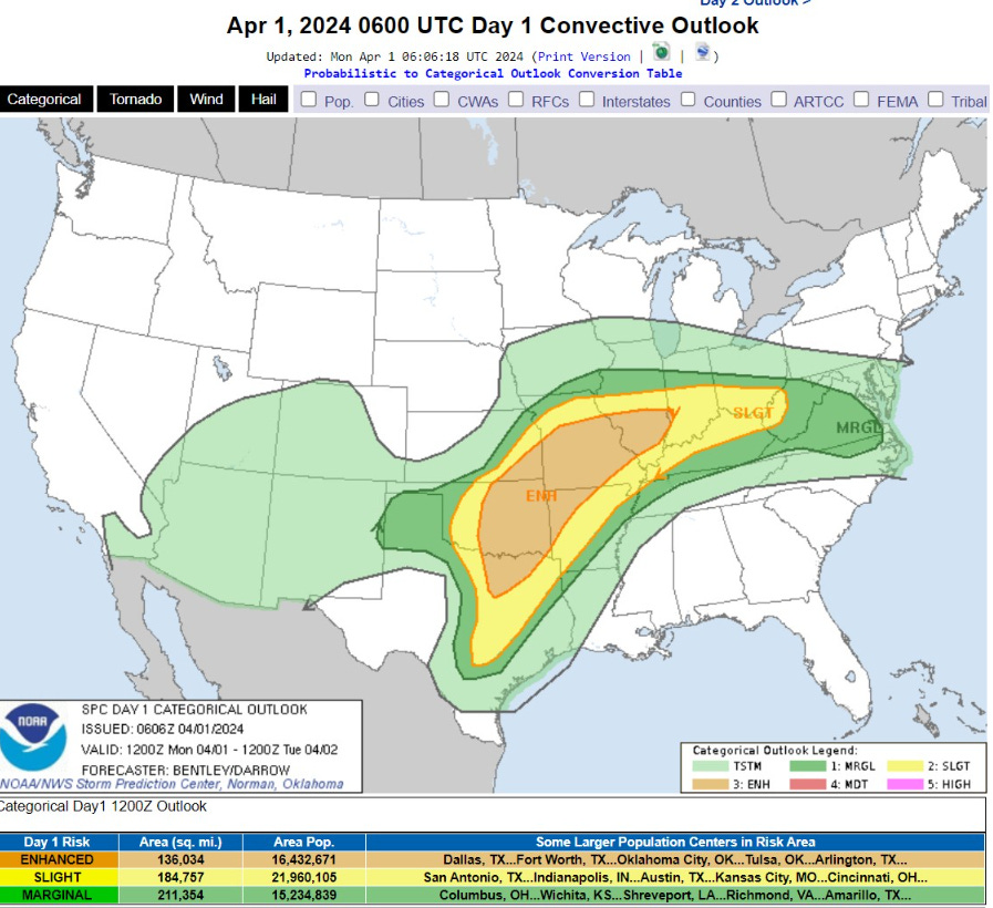
ENHANCED is the third category of risk severity with Moderate and High (4 and 5) worse.
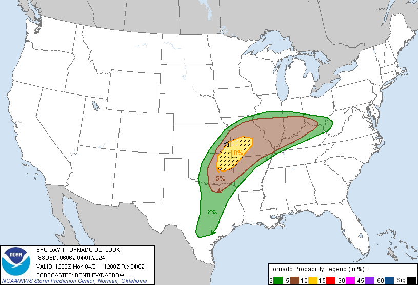
The highest risk of tornadoes — some of which could be strong — focused on corners of Kansas, Oklahoma, Missouri, and Arkansas including Tulsa and Springfield, MO.
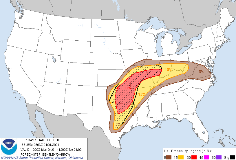
Large HAIL with supercells looks likely!
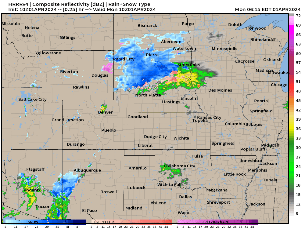
HRRR 18-hours from 10z shows organized squall lines developing in the late afternoon and early evening heading into the overnight hours.
Monday High Temperatures

70s and 80s will fuel the thunderstorm development along/south a warm front. Mid-80s in the Carolinas and Florida = HOT. 80 Million+ at/above 80°F
Next 8-Days Weather Systems
Keep reading with a 7-day free trial
Subscribe to Weather Trader to keep reading this post and get 7 days of free access to the full post archives.